Property Record
650 Bonham St, Paris, TX 75460


Property Detail
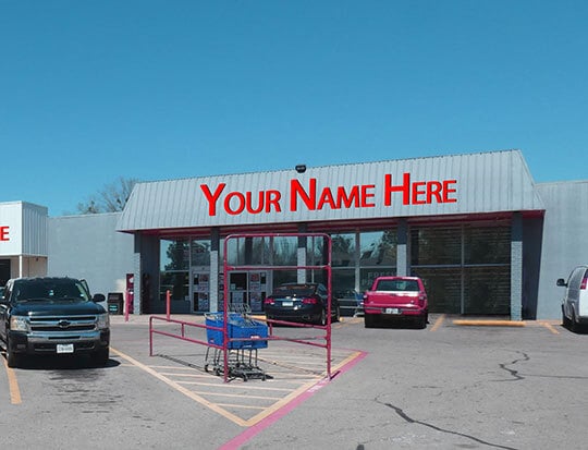
650 Bonham St
Paris, TX
CITY OF PARIS, BLOCK 44, LOT 2, 650 BONHAM, ACRES 2.724 650 BONHAM
14044
Lamar
Commercialnec
Texas
B and X Area of moderate flood hazard, usually the area between the limits of the 100-year and 500-year floods.
2
2024
2.72 AC
2025
Texas East Area
000600
Other Market Areas
40,480 SF
NEARBY LISTINGS FOR SALE OR LEASE
DEMOGRAPHICS near 650 Bonham St
1 mile
3 mile
5 mile
2025 Total Population
6,198
22,539
29,098
2030 Population
6,522
23,303
29,904
Pop Growth 2025-2030
+ 5.23%
+ 3.39%
+ 2.77%
Average Age
39
40
40
2025 Total Households
2,542
9,328
11,960
HH Growth 2025-2030
+ 5.23%
+ 3.38%
+ 2.75%
Median Household Inc
$30,646
$41,686
$47,677
Avg Household Size
2.30
2.30
2.30
2025 Avg HH Vehicles
1.00
2.00
2.00
Median Home Value
$100,209
$145,870
$174,433
Median Year Built
1971
1975
1978
Nearby Places
Map Layers
Map Styles
 Street
 Aerial
Transit
 Traffic
 Biking
Places
Listings with unknown addresses are not visible on the map
- Restaurants
- Banks
- Shops
- Fitness
- Groceries
SALE & LEASE HISTORY
LISTING DATE
SALE/LEASE

Oct 08, 2024
For Lease
Nov 13, 2019
For Lease
Dec 09, 2016
For Sale
Aug 26, 2019
For Sale
Apr 18, 2017
For Lease
Nearby Properties
Address
Land Use
TOTAL SIZE
Lot Size
Zoning
Address
Land Use
TOTAL SIZE
Lot Size
Zoning
1.52 AC
Address
Land Use
TOTAL SIZE
Lot Size
Zoning
54.04 AC
Address
Land Use
TOTAL SIZE
Lot Size
Zoning
Address
Land Use
TOTAL SIZE
Lot Size
Zoning
70,291 SF
27.90 AC
Address
Land Use
TOTAL SIZE
Lot Size
Zoning
60,700 SF
157.54 AC
Address
Land Use
TOTAL SIZE
Lot Size
Zoning
27,768 SF
56 AC
Address
Land Use
TOTAL SIZE
Lot Size
Zoning
33.27 AC
Address
Land Use
TOTAL SIZE
Lot Size
Zoning
315,171 SF
60.11 AC
Address
Land Use
TOTAL SIZE
Lot Size
Zoning
121,901 SF
25 AC
Address
Land Use
TOTAL SIZE
Lot Size
Zoning
11,582 SF
25.83 AC
Address
Land Use
TOTAL SIZE
Lot Size
Zoning
28,484 SF
15.25 AC
Address
Land Use
TOTAL SIZE
Lot Size
Zoning
100,721 SF
31 AC
Address
Land Use
TOTAL SIZE
Lot Size
Zoning
66,163 SF
3.87 AC
Address
Land Use
TOTAL SIZE
Lot Size
Zoning
40,503 SF
18.46 AC
Address
Land Use
TOTAL SIZE
Lot Size
Zoning
50,783 SF
3 AC
Address
Land Use
TOTAL SIZE
Lot Size
Zoning
5,472 SF
10.08 AC
Address
Land Use
TOTAL SIZE
Lot Size
Zoning
53,032 SF
35 AC
Address
Land Use
TOTAL SIZE
Lot Size
Zoning
57,468 SF
1.37 AC
Address
Land Use
TOTAL SIZE
Lot Size
Zoning
Address
Land Use
TOTAL SIZE
Lot Size
Zoning
70,510 SF
4.60 AC
Address
Land Use
TOTAL SIZE
Lot Size
Zoning
95,712 SF
6.96 AC
Address
Land Use
TOTAL SIZE
Lot Size
Zoning
2,368 SF
4.78 AC
Address
Land Use
TOTAL SIZE
Lot Size
Zoning
20,000 SF
6.27 AC
Address
Land Use
TOTAL SIZE
Lot Size
Zoning
132,419 SF
13.08 AC
Address
Land Use
TOTAL SIZE
Lot Size
Zoning
84,918 SF
23.25 AC
Address
Land Use
TOTAL SIZE
Lot Size
Zoning
5,376 SF
6.48 AC
Address
Land Use
TOTAL SIZE
Lot Size
Zoning
8,772 SF
4.50 AC
Address
Land Use
TOTAL SIZE
Lot Size
Zoning
84,680 SF
15 AC
Address
Land Use
TOTAL SIZE
Lot Size
Zoning
8,908 SF
6.78 AC
Address
Land Use
TOTAL SIZE
Lot Size
Zoning
41,352 SF
9.52 AC
The World's #1 Commercial Real Estate Marketplace
Connect with us
© 2026 CoStar Group
The information above has been obtained from sources believed reliable. While we do not doubt its accuracy we have not verified it and make no guarantee, warranty or representation about it. It is your responsibility to independently confirm its accuracy and completeness. Any projections, opinions, assumptions, or estimates used are for example only and do not represent the current or future performance of the property. The value of this transaction to you depends on tax and other factors which should be evaluated by your tax, financial, and legal advisors. You and your advisors should conduct a careful, independent investigation of the property to determine to your satisfaction the suitability of the property for your needs.