Property Record
6500 Chagall Dr, Moorpark, CA 93021
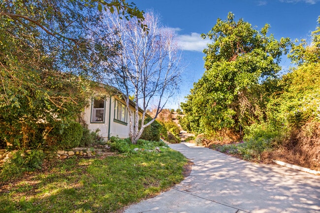


Property Detail
6500 Chagall Dr
Oxnard-Thousand Oaks-Ventura, CA
LOT: 41 REF: 16 PM 82
503-0-030-330
Ventura
Orchard
California
AE-40
41
B and X Area of moderate flood hazard, usually the area between the limits of the 100-year and 500-year floods.
20.10 AC
2024
Moorpark/Simi Valley
2025
Los Angeles
009300
NEARBY LISTINGS FOR SALE OR LEASE
DEMOGRAPHICS near 6500 Chagall Dr
1 mile
3 mile
5 mile
2024 Total Population
151
7,920
39,771
2029 Population
145
7,804
39,137
Pop Growth 2024-2029
(3.97%)
(1.46%)
(1.59%)
Average Age
42
41
41
2024 Total Households
43
2,423
12,508
HH Growth 2024-2029
(4.65%)
(1.69%)
(1.80%)
Median Household Inc
$187,499
$164,306
$154,728
Avg Household Size
3.20
3.20
3.10
2024 Avg HH Vehicles
3.00
3.00
3.00
Median Home Value
$1,108,000
$1,013,508
$965,486
Median Year Built
1983
1987
1985
Nearby Places
Map Layers
Map Styles
 Street
 Aerial
Transit
 Traffic
 Biking
Places
Listings with unknown addresses are not visible on the map
- Restaurants
- Banks
- Shops
- Fitness
- Groceries
PUBLIC TRANSPORTATION
COMMUTER RAIL
Moorpark (Ventura County Line - Southern California Regional Rail Authority (Metrolink))
Drive
Walk
Distance
Moorpark (Ventura County Line - Southern California Regional Rail Authority (Metrolink))
14 min
5.5 mi
Camarillo (Ventura County Line - Southern California Regional Rail Authority (Metrolink))
Drive
Walk
Distance
Camarillo (Ventura County Line - Southern California Regional Rail Authority (Metrolink))
20 min
9.8 mi
Freight Ports
The Port of Hueneme
Drive
Walk
Distance
The Port of Hueneme
40 min
21.6 mi
SALE & LEASE HISTORY
LISTING DATE
SALE/LEASE

Dec 24, 2021
For Sale
Nearby Properties
Address
Land Use
TOTAL SIZE
Lot Size
Zoning
Address
Land Use
TOTAL SIZE
Lot Size
Zoning
Address
Land Use
TOTAL SIZE
Lot Size
Zoning
52,547 SF
10.83 AC
Address
Land Use
TOTAL SIZE
Lot Size
Zoning
11,736 SF
4.08 AC
RPD5
Address
Land Use
TOTAL SIZE
Lot Size
Zoning
10.01 AC
Address
Land Use
TOTAL SIZE
Lot Size
Zoning
30 AC
AE
Address
Land Use
TOTAL SIZE
Lot Size
Zoning
109,206 SF
3.93 AC
M2
Address
Land Use
TOTAL SIZE
Lot Size
Zoning
105,132 SF
6.97 AC
CPD
Address
Land Use
TOTAL SIZE
Lot Size
Zoning
56,852 SF
2.55 AC
M2
Address
Land Use
TOTAL SIZE
Lot Size
Zoning
134.97 AC
A-E
Address
Land Use
TOTAL SIZE
Lot Size
Zoning
1,080 SF
0.86 AC
M2
Address
Land Use
TOTAL SIZE
Lot Size
Zoning
112,817 SF
3.07 AC
M2
Address
Land Use
TOTAL SIZE
Lot Size
Zoning
6.46 AC
Address
Land Use
TOTAL SIZE
Lot Size
Zoning
183.96 AC
AE
Address
Land Use
TOTAL SIZE
Lot Size
Zoning
1,828 SF
1.04 AC
M2
Address
Land Use
TOTAL SIZE
Lot Size
Zoning
28,166 SF
1.10 AC
M2
Address
Land Use
TOTAL SIZE
Lot Size
Zoning
16,880 SF
2.51 AC
RPD5
Address
Land Use
TOTAL SIZE
Lot Size
Zoning
23,444 SF
1.33 AC
M2
Address
Land Use
TOTAL SIZE
Lot Size
Zoning
497.22 AC
AEO-S-
Address
Land Use
TOTAL SIZE
Lot Size
Zoning
110.24 AC
AEO-S-
Address
Land Use
TOTAL SIZE
Lot Size
Zoning
92,795 SF
2.52 AC
M2
Address
Land Use
TOTAL SIZE
Lot Size
Zoning
46,567 SF
1.96 AC
M2
Address
Land Use
TOTAL SIZE
Lot Size
Zoning
5.23 AC
Address
Land Use
TOTAL SIZE
Lot Size
Zoning
19.52 AC
AE
Address
Land Use
TOTAL SIZE
Lot Size
Zoning
87.29 AC
AE
Address
Land Use
TOTAL SIZE
Lot Size
Zoning
222.29 AC
OS20AC
Address
Land Use
TOTAL SIZE
Lot Size
Zoning
30,897 SF
2.02 AC
M2
Address
Land Use
TOTAL SIZE
Lot Size
Zoning
27,840 SF
2.75 AC
M2
Address
Land Use
TOTAL SIZE
Lot Size
Zoning
13,146 SF
20.75 AC
AE
The World's #1 Commercial Real Estate Marketplace
Connect with us
© 2026 CoStar Group
The information above has been obtained from sources believed reliable. While we do not doubt its accuracy we have not verified it and make no guarantee, warranty or representation about it. It is your responsibility to independently confirm its accuracy and completeness. Any projections, opinions, assumptions, or estimates used are for example only and do not represent the current or future performance of the property. The value of this transaction to you depends on tax and other factors which should be evaluated by your tax, financial, and legal advisors. You and your advisors should conduct a careful, independent investigation of the property to determine to your satisfaction the suitability of the property for your needs.