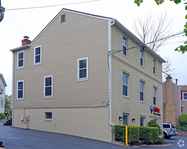
Property Record
6505 Democracy Blvd, Bethesda, MD 20817

NEARBY LISTINGS FOR SALE OR LEASE
Property Detail
6505 Democracy Blvd
Washington-Arlington-Alexandria, DC-VA-MD-WV
Georgetown Village
04-00049654
GEORGETOWN VILLAGE
Officebuilding
Montgomery
X
Maryland
51059C0075E
4
2024
0.14 AC
2025
North Bethesda/Potomac
701205
Washington, DC
2,252 SF
DEMOGRAPHICS near 6505 Democracy Blvd
1 Mile
3 Mile
5 Mile
2024 Total Population
12,056
126,851
343,322
2029 Population
11,986
125,864
340,093
Pop Growth 2024-2029
(0.58%)
(0.78%)
(0.94%)
Average Age
42
42
42
2024 Total Households
4,350
51,423
129,931
HH Growth 2024-2029
(0.78%)
(0.88%)
(0.88%)
Median Household Inc
$170,737
$143,657
$137,097
Avg Household Size
2.60
2.40
2.50
2024 Avg HH Vehicles
2.00
2.00
2.00
Median Home Value
$808,187
$816,985
$762,513
Median Year Built
1973
1975
1969
Nearby Places
Map Layers
Map Styles
 Street
 Aerial
- Restaurants
- Banks
- Shops
- Fitness
- Groceries
PUBLIC TRANSPORTATION
COMMUTER RAIL
Garrett Park (Brunswick Line - Maryland Area Regional Commuter Trains (The MARC))
DRIVE
WALK
Distance
Garrett Park (Brunswick Line - Maryland Area Regional Commuter Trains (The MARC))
9 min
3.6 mi
Kensington (Brunswick Line - Maryland Area Regional Commuter Trains (The MARC))
DRIVE
WALK
Distance
Kensington (Brunswick Line - Maryland Area Regional Commuter Trains (The MARC))
11 min
5.6 mi
AIRPORT
Ronald Reagan Washington Ntl
DRIVE
WALK
Distance
Ronald Reagan Washington Ntl
33 min
16.5 mi
Washington Dulles International
DRIVE
WALK
Distance
Washington Dulles International
36 min
23.0 mi
Baltimore/Washington International Thurgood Marshall
DRIVE
WALK
Distance
Baltimore/Washington International Thurgood Marshall
49 min
36.1 mi
Freight Ports
Port of Baltimore
DRIVE
WALK
Distance
Port of Baltimore
52 min
38.8 mi
SALE & LEASE HISTORY
LISTING DATE
SALE/LEASE

Sep 25, 2016
For Lease
Sep 23, 2016
For Sale
Sep 08, 2020
For Sale
May 13, 2021
For Lease
Jan 24, 2020
For Lease
Nearby Properties
Address
Land Use
TOTAL SIZE
Lot Size
Zoning
Address
Land Use
TOTAL SIZE
Lot Size
Zoning
4,400,000 SF
7.92 AC
R60
Address
Land Use
TOTAL SIZE
Lot Size
Zoning
769,580 SF
21.77 AC
GR1.5
Address
Land Use
TOTAL SIZE
Lot Size
Zoning
1,332,482 SF
3.79 AC
CR2.0
Address
Land Use
TOTAL SIZE
Lot Size
Zoning
737,500 SF
12.89 AC
R60
Address
Land Use
TOTAL SIZE
Lot Size
Zoning
1,119,608 SF
90.30 AC
R90
Address
Land Use
TOTAL SIZE
Lot Size
Zoning
178,124 SF
11 AC
R60
Address
Land Use
TOTAL SIZE
Lot Size
Zoning
451,948 SF
1.08 AC
CR5.0
Address
Land Use
TOTAL SIZE
Lot Size
Zoning
515,000 SF
5.23 AC
CR1.5
Address
Land Use
TOTAL SIZE
Lot Size
Zoning
115.87 AC
R60
Address
Land Use
TOTAL SIZE
Lot Size
Zoning
432,000 SF
1.77 AC
CR4.0
Address
Land Use
TOTAL SIZE
Lot Size
Zoning
379,100 SF
11.80 AC
CR4.0
Address
Land Use
TOTAL SIZE
Lot Size
Zoning
575,000 SF
110.35 AC
R60
Address
Land Use
TOTAL SIZE
Lot Size
Zoning
626,132 SF
7.28 AC
CR0.5
Address
Land Use
TOTAL SIZE
Lot Size
Zoning
380,452 SF
2.38 AC
CR3.0
Address
Land Use
TOTAL SIZE
Lot Size
Zoning
128,125 SF
6.82 AC
CR3.0
Address
Land Use
TOTAL SIZE
Lot Size
Zoning
414,000 SF
7.28 AC
MXCD
Address
Land Use
TOTAL SIZE
Lot Size
Zoning
393,977 SF
17.88 AC
MXCD
Address
Land Use
TOTAL SIZE
Lot Size
Zoning
412,122 SF
10.44 AC
CR1.5
Address
Land Use
TOTAL SIZE
Lot Size
Zoning
379,878 SF
2.13 AC
CR
Address
Land Use
TOTAL SIZE
Lot Size
Zoning
815,414 SF
3.27 AC
CR4.0
Address
Land Use
TOTAL SIZE
Lot Size
Zoning
674,400 SF
3.21 AC
CR3.0
Address
Land Use
TOTAL SIZE
Lot Size
Zoning
327,311 SF
1.83 AC
CR2.5
Address
Land Use
TOTAL SIZE
Lot Size
Zoning
366,915 SF
1.30 AC
CR5.0
Address
Land Use
TOTAL SIZE
Lot Size
Zoning
223,520 SF
2.77 AC
CR2.0
Address
Land Use
TOTAL SIZE
Lot Size
Zoning
559,515 SF
26.51 AC
EOF12
Address
Land Use
TOTAL SIZE
Lot Size
Zoning
362,353 SF
27.72 AC
R90
Address
Land Use
TOTAL SIZE
Lot Size
Zoning
291,194 SF
0.72 AC
CR4.0
Address
Land Use
TOTAL SIZE
Lot Size
Zoning
80,359 SF
11.61 AC
CRT1.
Address
Land Use
TOTAL SIZE
Lot Size
Zoning
330,650 SF
2.89 AC
MXTD
Address
Land Use
TOTAL SIZE
Lot Size
Zoning
454,275 SF
1.12 AC
CR7.2
The World's #1 Commercial Real Estate Marketplace
Connect with us
© 2025 CoStar Group
The information above has been obtained from sources believed reliable. While we do not doubt its accuracy we have not verified it and make no guarantee, warranty or representation about it. It is your responsibility to independently confirm its accuracy and completeness. Any projections, opinions, assumptions, or estimates used are for example only and do not represent the current or future performance of the property. The value of this transaction to you depends on tax and other factors which should be evaluated by your tax, financial, and legal advisors. You and your advisors should conduct a careful, independent investigation of the property to determine to your satisfaction the suitability of the property for your needs.