Property Record
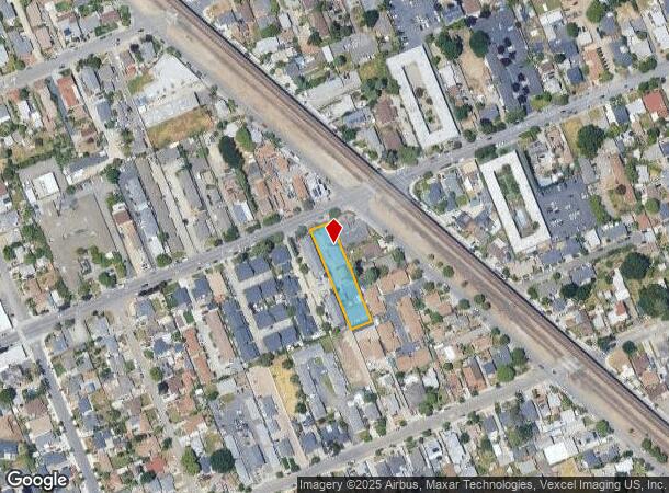
651 Blossom Way, Cherryland, CA 94541
NEARBY LISTINGS FOR SALE OR LEASE
Property Detail
651 Blossom Way
Oakland-Hayward-Berkeley, CA
Cherryland
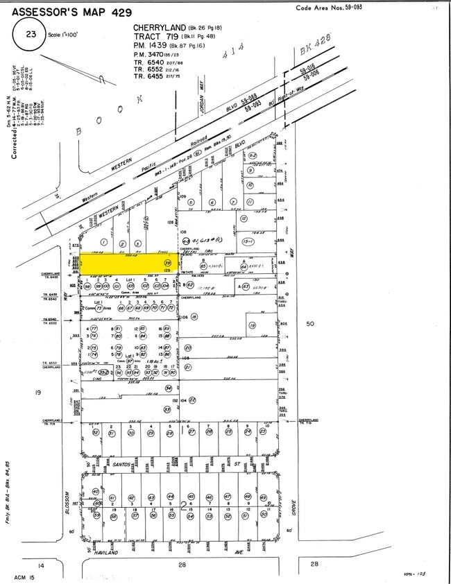
429-0023-039-00
LOT: 00039 BLK: AR: 0429 PAGE: 0023
Multifamilydwelling
Alameda
X
California
06001C0286G
129
2024
0.46 AC
2025
Cherryland
435601
East Bay/Oakland
4,345 SF
DEMOGRAPHICS near 651 Blossom Way
1 Mile
3 Mile
5 Mile
2024 Total Population
31,534
225,070
359,606
2029 Population
30,221
216,778
346,683
Pop Growth 2024-2029
(4.16%)
(3.68%)
(3.59%)
Average Age
39
40
41
2024 Total Households
10,074
73,689
117,138
HH Growth 2024-2029
(4.46%)
(3.94%)
(3.85%)
Median Household Inc
$80,306
$92,984
$97,241
Avg Household Size
3.00
2.90
2.90
2024 Avg HH Vehicles
2.00
2.00
2.00
Median Home Value
$710,199
$752,360
$768,421
Median Year Built
1964
1963
1966
Nearby Places
Map Layers
Map Styles
 Street
 Aerial
- Restaurants
- Banks
- Shops
- Fitness
- Groceries
PUBLIC TRANSPORTATION
COMMUTER RAIL
Hayward Amtrak (Capitol Corridor - Amtrak)
DRIVE
WALK
Distance
Hayward Amtrak (Capitol Corridor - Amtrak)
4 min
1.5 mi
Hayward (Capitol Corridor - Capitol Corridor Joint Powers Authority)
DRIVE
WALK
Distance
Hayward (Capitol Corridor - Capitol Corridor Joint Powers Authority)
4 min
1.5 mi
AIRPORT
Metro Oakland International
DRIVE
WALK
Distance
Metro Oakland International
15 min
9.6 mi
San Francisco International
DRIVE
WALK
Distance
San Francisco International
34 min
23.9 mi
Norman Y Mineta San Jose International
DRIVE
WALK
Distance
Norman Y Mineta San Jose International
38 min
28.5 mi
Freight Ports
Port of Oakland
DRIVE
WALK
Distance
Port of Oakland
20 min
14.2 mi
Nearby Properties
Address
Land Use
TOTAL SIZE
Lot Size
Zoning
Address
Land Use
TOTAL SIZE
Lot Size
Zoning
710,091 SF
50.34 AC
Address
Land Use
TOTAL SIZE
Lot Size
Zoning
4.90 AC
Address
Land Use
TOTAL SIZE
Lot Size
Zoning
500,913 SF
22.59 AC
Address
Land Use
TOTAL SIZE
Lot Size
Zoning
240,556 SF
11.63 AC
Address
Land Use
TOTAL SIZE
Lot Size
Zoning
437,104 SF
0.73 AC
Address
Land Use
TOTAL SIZE
Lot Size
Zoning
2.48 AC
Address
Land Use
TOTAL SIZE
Lot Size
Zoning
200,451 SF
11.22 AC
Address
Land Use
TOTAL SIZE
Lot Size
Zoning
236,976 SF
18.36 AC
Address
Land Use
TOTAL SIZE
Lot Size
Zoning
470,929 SF
31.62 AC
Address
Land Use
TOTAL SIZE
Lot Size
Zoning
1.50 AC
Address
Land Use
TOTAL SIZE
Lot Size
Zoning
150,856 SF
5.99 AC
Address
Land Use
TOTAL SIZE
Lot Size
Zoning
187,926 SF
1.19 AC
Address
Land Use
TOTAL SIZE
Lot Size
Zoning
294,146 SF
14.22 AC
Address
Land Use
TOTAL SIZE
Lot Size
Zoning
160,987 SF
7.20 AC
Address
Land Use
TOTAL SIZE
Lot Size
Zoning
241,382 SF
12.72 AC
Address
Land Use
TOTAL SIZE
Lot Size
Zoning
297,592 SF
11.65 AC
Address
Land Use
TOTAL SIZE
Lot Size
Zoning
310,072 SF
14.96 AC
Address
Land Use
TOTAL SIZE
Lot Size
Zoning
228,736 SF
5.95 AC
Address
Land Use
TOTAL SIZE
Lot Size
Zoning
169,371 SF
4.63 AC
Address
Land Use
TOTAL SIZE
Lot Size
Zoning
147,489 SF
9.90 AC
Address
Land Use
TOTAL SIZE
Lot Size
Zoning
625,101 SF
35.95 AC
Address
Land Use
TOTAL SIZE
Lot Size
Zoning
137,889 SF
18.44 AC
Address
Land Use
TOTAL SIZE
Lot Size
Zoning
116,750 SF
4.72 AC
Address
Land Use
TOTAL SIZE
Lot Size
Zoning
105,730 SF
5.32 AC
Address
Land Use
TOTAL SIZE
Lot Size
Zoning
143,154 SF
6.15 AC
Address
Land Use
TOTAL SIZE
Lot Size
Zoning
140,850 SF
9.98 AC
Address
Land Use
TOTAL SIZE
Lot Size
Zoning
89,968 SF
5 AC
Address
Land Use
TOTAL SIZE
Lot Size
Zoning
329,346 SF
29.36 AC
Address
Land Use
TOTAL SIZE
Lot Size
Zoning
59,012 SF
5.51 AC
Address
Land Use
TOTAL SIZE
Lot Size
Zoning
119,800 SF
5.72 AC
The World's #1 Commercial Real Estate Marketplace
Connect with us
© 2025 CoStar Group
The information above has been obtained from sources believed reliable. While we do not doubt its accuracy we have not verified it and make no guarantee, warranty or representation about it. It is your responsibility to independently confirm its accuracy and completeness. Any projections, opinions, assumptions, or estimates used are for example only and do not represent the current or future performance of the property. The value of this transaction to you depends on tax and other factors which should be evaluated by your tax, financial, and legal advisors. You and your advisors should conduct a careful, independent investigation of the property to determine to your satisfaction the suitability of the property for your needs.