Property Record
65Th St, Emeryville, CA 94608
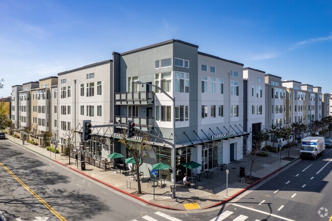


Property Detail
65Th St
049-1543-001-00
LOT: 00001 BLK: PM: 0272 PAGE: 0044
Multifamilydwelling
ALAMEDA
B and X Area of moderate flood hazard, usually the area between the limits of the 100-year and 500-year floods.
California
2024
5.03 AC
2025
Emeryville
425104
East Bay/Oakland
358,014 SF
Oakland-Fremont-Berkeley, CA
NEARBY LISTINGS FOR SALE OR LEASE
DEMOGRAPHICS near 65Th St
1 mile
3 mile
5 mile
2025 Total Population
23,535
239,903
421,686
2030 Population
23,622
241,352
424,218
Pop Growth 2025-2030
+ 0.37%
+ 0.60%
+ 0.60%
Average Age
40
39
41
2025 Total Households
11,168
99,755
176,547
HH Growth 2025-2030
+ 0.36%
+ 0.74%
+ 0.69%
Median Household Inc
$112,658
$102,218
$110,462
Avg Household Size
2.00
2.10
2.20
2025 Avg HH Vehicles
1.00
1.00
1.00
Median Home Value
$899,161
$1,056,394
$1,069,351
Median Year Built
1975
1956
1956
Nearby Places
Map Layers
Map Styles
 Street
 Aerial
Layers
 Traffic
 Biking
Places
Listings with unknown addresses are not visible on the map
- Restaurants
- Banks
- Shops
- Fitness
- Groceries
PUBLIC TRANSPORTATION
COMMUTER RAIL
Emeryville (Capitol Corridor - Capitol Corridor Joint Powers Authority)
Drive
Walk
Distance
Emeryville (Capitol Corridor - Capitol Corridor Joint Powers Authority)
2 min
10 min
0.5 mi
Berkeley Amtrak (Capitol Corridor - Amtrak)
Drive
Walk
Distance
Berkeley Amtrak (Capitol Corridor - Amtrak)
3 min
1.9 mi
AIRPORT
Metro Oakland International
Drive
Walk
Distance
Metro Oakland International
22 min
14.4 mi
San Francisco International
Drive
Walk
Distance
San Francisco International
34 min
22.0 mi
Freight Ports
Port of Oakland
Drive
Walk
Distance
Port of Oakland
10 min
5.7 mi
Nearby Properties
Address
Land Use
TOTAL SIZE
Lot Size
Zoning
Address
Land Use
TOTAL SIZE
Lot Size
Zoning
409,266 SF
1.76 AC
Address
Land Use
TOTAL SIZE
Lot Size
Zoning
1,028,501 SF
2.74 AC
Address
Land Use
TOTAL SIZE
Lot Size
Zoning
373,594 SF
16.16 AC
Address
Land Use
TOTAL SIZE
Lot Size
Zoning
488,781 SF
0.63 AC
Address
Land Use
TOTAL SIZE
Lot Size
Zoning
432,352 SF
Address
Land Use
TOTAL SIZE
Lot Size
Zoning
354,263 SF
4.06 AC
Address
Land Use
TOTAL SIZE
Lot Size
Zoning
423,577 SF
1.04 AC
Address
Land Use
TOTAL SIZE
Lot Size
Zoning
167,071 SF
0.70 AC
Address
Land Use
TOTAL SIZE
Lot Size
Zoning
540,434 SF
14.37 AC
Address
Land Use
TOTAL SIZE
Lot Size
Zoning
621,432 SF
1.31 AC
C
Address
Land Use
TOTAL SIZE
Lot Size
Zoning
395,549 SF
17.05 AC
Address
Land Use
TOTAL SIZE
Lot Size
Zoning
250,642 SF
17.05 AC
Address
Land Use
TOTAL SIZE
Lot Size
Zoning
0.73 AC
Address
Land Use
TOTAL SIZE
Lot Size
Zoning
703,758 SF
3.44 AC
Address
Land Use
TOTAL SIZE
Lot Size
Zoning
371,322 SF
1.62 AC
Address
Land Use
TOTAL SIZE
Lot Size
Zoning
240,633 SF
1.59 AC
Address
Land Use
TOTAL SIZE
Lot Size
Zoning
261,134 SF
2.23 AC
Address
Land Use
TOTAL SIZE
Lot Size
Zoning
350,741 SF
1.08 AC
Address
Land Use
TOTAL SIZE
Lot Size
Zoning
169,157 SF
10.20 AC
Address
Land Use
TOTAL SIZE
Lot Size
Zoning
224,160 SF
5.03 AC
Address
Land Use
TOTAL SIZE
Lot Size
Zoning
245,717 SF
0.65 AC
Address
Land Use
TOTAL SIZE
Lot Size
Zoning
303,063 SF
1.27 AC
Address
Land Use
TOTAL SIZE
Lot Size
Zoning
226,800 SF
4.63 AC
Address
Land Use
TOTAL SIZE
Lot Size
Zoning
370,806 SF
2.24 AC
Address
Land Use
TOTAL SIZE
Lot Size
Zoning
177,530 SF
0.46 AC
Address
Land Use
TOTAL SIZE
Lot Size
Zoning
4.77 AC
Address
Land Use
TOTAL SIZE
Lot Size
Zoning
280,484 SF
0.76 AC
Address
Land Use
TOTAL SIZE
Lot Size
Zoning
292,430 SF
2.09 AC
Address
Land Use
TOTAL SIZE
Lot Size
Zoning
397,378 SF
4.52 AC
The World's #1 Commercial Real Estate Marketplace
Connect with us
© 2026 CoStar Group
The information above has been obtained from sources believed reliable. While we do not doubt its accuracy we have not verified it and make no guarantee, warranty or representation about it. It is your responsibility to independently confirm its accuracy and completeness. Any projections, opinions, assumptions, or estimates used are for example only and do not represent the current or future performance of the property. The value of this transaction to you depends on tax and other factors which should be evaluated by your tax, financial, and legal advisors. You and your advisors should conduct a careful, independent investigation of the property to determine to your satisfaction the suitability of the property for your needs.