Property Record
660 E Fm 2410 Rd, Harker Heights, TX 76548


Save to a Folder
{{folder.Name}}
{{folder.ListingIds.length}} Properties
{{folder.ListingIds.length}} Property
Create a New Folder
Property Detail
660 E Fm 2410 Rd
Killeen-Temple, TX
FAMILY DOLLAR ADDITION 1ST AMENDMENT (L1 BA), BLOCK 00A, LOT 0001, ACRES 0.994
434575
BELL
Commercialnec
Texas
B and X Area of moderate flood hazard, usually the area between the limits of the 100-year and 500-year floods.
1
2025
0.99 AC
2025
Outlying Bell County
021905
Killeen/Temple/Fort Hood
8,000 SF
NEARBY LISTINGS FOR SALE OR LEASE
DEMOGRAPHICS near 660 E Fm 2410 Rd
1 mile
3 mile
5 mile
2025 Total Population
10,385
56,896
112,308
2030 Population
10,851
60,216
118,881
Pop Growth 2025-2030
+ 4.49%
+ 5.84%
+ 5.85%
Average Age
36
36
35
2025 Total Households
3,344
19,762
41,241
HH Growth 2025-2030
+ 4.61%
+ 5.97%
+ 5.96%
Median Household Inc
$122,788
$85,840
$71,425
Avg Household Size
3.10
2.80
2.70
2025 Avg HH Vehicles
2.00
2.00
2.00
Median Home Value
$339,554
$297,622
$266,200
Median Year Built
2003
2002
1998
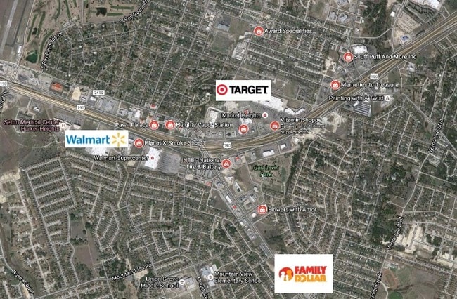
Nearby Places
Map Layers
Map Styles
 Street
 Aerial
Layers
 Traffic
 Biking
Places
Listings with unknown addresses are not visible on the map
- Restaurants
- Banks
- Shops
- Fitness
- Groceries
PUBLIC TRANSPORTATION
AIRPORT
Killeen Municipal
Drive
Walk
Distance
Killeen Municipal
6 min
2.7 mi
Robert Gray AAF
Drive
Walk
Distance
Robert Gray AAF
27 min
16.6 mi
Freight Ports
Port of Houston
Drive
Walk
Distance
Port of Houston
252 min
198.8 mi
SALE & LEASE HISTORY
LISTING DATE
SALE/LEASE

Sep 23, 2016
For Sale
Nearby Properties
Address
Land Use
TOTAL SIZE
Lot Size
Zoning
Address
Land Use
TOTAL SIZE
Lot Size
Zoning
194,952 SF
38.61 AC
Address
Land Use
TOTAL SIZE
Lot Size
Zoning
233,780 SF
45.21 AC
Address
Land Use
TOTAL SIZE
Lot Size
Zoning
233,807 SF
16.12 AC
Address
Land Use
TOTAL SIZE
Lot Size
Zoning
1 SF
18.38 AC
Address
Land Use
TOTAL SIZE
Lot Size
Zoning
152,304 SF
68.80 AC
Address
Land Use
TOTAL SIZE
Lot Size
Zoning
1 SF
30 AC
Address
Land Use
TOTAL SIZE
Lot Size
Zoning
146,182 SF
8.59 AC
Address
Land Use
TOTAL SIZE
Lot Size
Zoning
89,117 SF
5.31 AC
Address
Land Use
TOTAL SIZE
Lot Size
Zoning
62,226 SF
0.68 AC
Address
Land Use
TOTAL SIZE
Lot Size
Zoning
41,832 SF
4.30 AC
Address
Land Use
TOTAL SIZE
Lot Size
Zoning
210,437 SF
19.98 AC
Address
Land Use
TOTAL SIZE
Lot Size
Zoning
2,233 SF
29.99 AC
Address
Land Use
TOTAL SIZE
Lot Size
Zoning
72,368 SF
9.34 AC
Address
Land Use
TOTAL SIZE
Lot Size
Zoning
1 SF
24.80 AC
Address
Land Use
TOTAL SIZE
Lot Size
Zoning
112,176 SF
4.28 AC
Address
Land Use
TOTAL SIZE
Lot Size
Zoning
141,654 SF
31.81 AC
Address
Land Use
TOTAL SIZE
Lot Size
Zoning
26,950 SF
7.67 AC
B-5
Address
Land Use
TOTAL SIZE
Lot Size
Zoning
131,212 SF
17.48 AC
Address
Land Use
TOTAL SIZE
Lot Size
Zoning
137,820 SF
9.94 AC
Address
Land Use
TOTAL SIZE
Lot Size
Zoning
82,685 SF
13.07 AC
Address
Land Use
TOTAL SIZE
Lot Size
Zoning
89,000 SF
10.87 AC
Address
Land Use
TOTAL SIZE
Lot Size
Zoning
82,025 SF
9.82 AC
Address
Land Use
TOTAL SIZE
Lot Size
Zoning
74,819 SF
176.85 AC
Address
Land Use
TOTAL SIZE
Lot Size
Zoning
84,285 SF
4.51 AC
Address
Land Use
TOTAL SIZE
Lot Size
Zoning
105,867 SF
8.09 AC
Address
Land Use
TOTAL SIZE
Lot Size
Zoning
91,000 SF
4.85 AC
Address
Land Use
TOTAL SIZE
Lot Size
Zoning
81,815 SF
4.80 AC
Address
Land Use
TOTAL SIZE
Lot Size
Zoning
2,568 SF
48.88 AC
R-MH
Address
Land Use
TOTAL SIZE
Lot Size
Zoning
83,438 SF
13.41 AC
Address
Land Use
TOTAL SIZE
Lot Size
Zoning
77,680 SF
9.16 AC
The World's #1 Commercial Real Estate Marketplace
Connect with us
© 2026 CoStar Group
The information above has been obtained from sources believed reliable. While we do not doubt its accuracy we have not verified it and make no guarantee, warranty or representation about it. It is your responsibility to independently confirm its accuracy and completeness. Any projections, opinions, assumptions, or estimates used are for example only and do not represent the current or future performance of the property. The value of this transaction to you depends on tax and other factors which should be evaluated by your tax, financial, and legal advisors. You and your advisors should conduct a careful, independent investigation of the property to determine to your satisfaction the suitability of the property for your needs.