Property Record
6600 Us Highway 85, Commerce City, CO 80022


Property Detail
6600 Us Highway 85
1823-06-4-00-022
SECT,TWN,RNG:6-3-67 DESC: BEG AT NE COR W2 SE4 SEC 6 TH S 708/37 FT TO A PT ON NWLY ROW OF C B AND Q RR TH S 41D 46M W 150/98 FT TO TRUE POB TH CONT S 41D 46M W ALG SD ROW 1084/71 FT TH N 48D 17M W 545/03 FT TO PT ON E ROW LN U S HIWAY 85 TH N 489/65
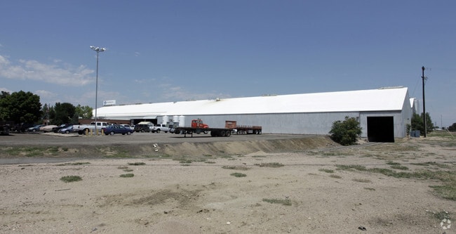
Warehouse
Adams
B and X Area of moderate flood hazard, usually the area between the limits of the 100-year and 500-year floods.
Colorado
2024
20.44 AC
2025
Commerce City
0087053016
Denver
151,800 SF
Denver-Aurora-Centennial, CO
NEARBY LISTINGS FOR SALE OR LEASE
DEMOGRAPHICS near 6600 Us Highway 85
1 mile
3 mile
5 mile
2024 Total Population
11,670
53,874
226,218
2029 Population
12,183
55,822
234,041
Pop Growth 2024-2029
+ 4.40%
+ 3.62%
+ 3.46%
Average Age
36
36
36
2024 Total Households
3,564
17,031
80,701
HH Growth 2024-2029
+ 4.71%
+ 3.95%
+ 3.66%
Median Household Inc
$65,701
$73,155
$94,585
Avg Household Size
3.10
3.00
2.70
2024 Avg HH Vehicles
2.00
2.00
2.00
Median Home Value
$346,272
$381,321
$490,358
Median Year Built
1960
1976
1977
Nearby Places
Map Layers
Map Styles
 Street
 Aerial
Transit
 Traffic
 Biking
Places
Listings with unknown addresses are not visible on the map
- Restaurants
- Banks
- Shops
- Fitness
- Groceries
PUBLIC TRANSPORTATION
COMMUTER RAIL
Commerce City - 72Nd Station Track 1 (Union Station to Eastlake & 124th Station - Regional Transportation District)
Drive
Walk
Distance
Commerce City - 72Nd Station Track 1 (Union Station to Eastlake & 124th Station - Regional Transportation District)
3 min
1.6 mi
40Th & Colorado Station Track 1 (Union Station to Denver Airport Station - Regional Transportation District)
Drive
Walk
Distance
40Th & Colorado Station Track 1 (Union Station to Denver Airport Station - Regional Transportation District)
6 min
4.0 mi
AIRPORT
Denver International
Drive
Walk
Distance
Denver International
28 min
21.9 mi
Freight Ports
Tulsa Port Of Catoosa
Drive
Walk
Distance
Tulsa Port Of Catoosa
725 min
707.4 mi
Nearby Properties
Address
Land Use
TOTAL SIZE
Lot Size
Zoning
Address
Land Use
TOTAL SIZE
Lot Size
Zoning
396,741 SF
8.12 AC
A1
Address
Land Use
TOTAL SIZE
Lot Size
Zoning
256,155 SF
3.84 AC
Address
Land Use
TOTAL SIZE
Lot Size
Zoning
106,680 SF
17.39 AC
Address
Land Use
TOTAL SIZE
Lot Size
Zoning
269,025 SF
18.86 AC
M-RX-5
Address
Land Use
TOTAL SIZE
Lot Size
Zoning
140,328 SF
6.54 AC
PUD
Address
Land Use
TOTAL SIZE
Lot Size
Zoning
17,063 SF
2.01 AC
Address
Land Use
TOTAL SIZE
Lot Size
Zoning
649,540 SF
33.65 AC
Address
Land Use
TOTAL SIZE
Lot Size
Zoning
3,573.99 AC
A3
Address
Land Use
TOTAL SIZE
Lot Size
Zoning
134,729 SF
5.57 AC
Address
Land Use
TOTAL SIZE
Lot Size
Zoning
551,915 SF
25.76 AC
Address
Land Use
TOTAL SIZE
Lot Size
Zoning
599,680 SF
43.94 AC
Address
Land Use
TOTAL SIZE
Lot Size
Zoning
74,106 SF
3.95 AC
PUD
Address
Land Use
TOTAL SIZE
Lot Size
Zoning
116,502 SF
4.08 AC
Address
Land Use
TOTAL SIZE
Lot Size
Zoning
296,000 SF
52.44 AC
A3
Address
Land Use
TOTAL SIZE
Lot Size
Zoning
94,213 SF
3.84 AC
A1
Address
Land Use
TOTAL SIZE
Lot Size
Zoning
419,745 SF
24.75 AC
Address
Land Use
TOTAL SIZE
Lot Size
Zoning
439,200 SF
25.09 AC
Address
Land Use
TOTAL SIZE
Lot Size
Zoning
90,760 SF
6.48 AC
Address
Land Use
TOTAL SIZE
Lot Size
Zoning
268,268 SF
29.99 AC
I-B
Address
Land Use
TOTAL SIZE
Lot Size
Zoning
6.69 AC
B-3
Address
Land Use
TOTAL SIZE
Lot Size
Zoning
1,048,207 SF
57.91 AC
I-B
Address
Land Use
TOTAL SIZE
Lot Size
Zoning
370,741 SF
19.53 AC
I3
Address
Land Use
TOTAL SIZE
Lot Size
Zoning
329,903 SF
21.97 AC
Address
Land Use
TOTAL SIZE
Lot Size
Zoning
277,869 SF
12.76 AC
Address
Land Use
TOTAL SIZE
Lot Size
Zoning
11,200 SF
36.45 AC
A1
Address
Land Use
TOTAL SIZE
Lot Size
Zoning
89,700 SF
2.50 AC
M-MX
Address
Land Use
TOTAL SIZE
Lot Size
Zoning
374,592 SF
15.23 AC
I-B
Address
Land Use
TOTAL SIZE
Lot Size
Zoning
97,626 SF
14.18 AC
Address
Land Use
TOTAL SIZE
Lot Size
Zoning
70,833 SF
2.40 AC
I-B
Address
Land Use
TOTAL SIZE
Lot Size
Zoning
99,969 SF
3.46 AC
The World's #1 Commercial Real Estate Marketplace
Connect with us
© 2026 CoStar Group
The information above has been obtained from sources believed reliable. While we do not doubt its accuracy we have not verified it and make no guarantee, warranty or representation about it. It is your responsibility to independently confirm its accuracy and completeness. Any projections, opinions, assumptions, or estimates used are for example only and do not represent the current or future performance of the property. The value of this transaction to you depends on tax and other factors which should be evaluated by your tax, financial, and legal advisors. You and your advisors should conduct a careful, independent investigation of the property to determine to your satisfaction the suitability of the property for your needs.