Property Record
6601 Decatur Rd, Fort Wayne, IN 46816
NEARBY LISTINGS FOR SALE OR LEASE
Property Detail
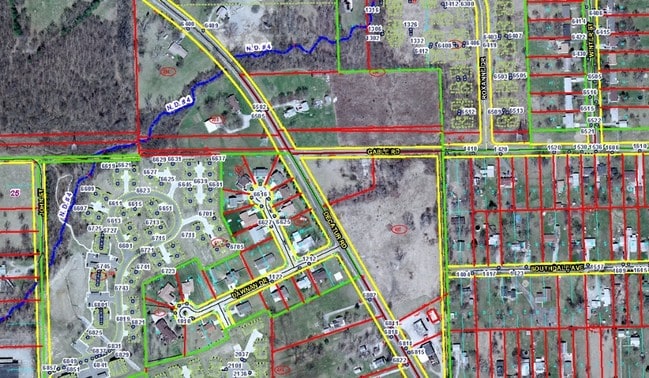
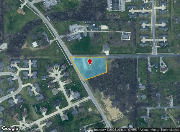
6601 Decatur Rd
02-12-25-403-001.000-074
1.39 A IRR TRACT NW 1/4 SE 1/4 SEC 25 LYING E OF DECATUR RD & S OF GABLE RD
Recreationalacreage
Allen
X
Indiana
18003C0315G
1.39 AC
2023
South Fort Wayne
2024
Fort Wayne
011304
Fort Wayne, IN
DEMOGRAPHICS near 6601 Decatur Rd
1 Mile
3 Mile
5 Mile
2024 Total Population
11,656
72,860
122,639
2029 Population
12,264
76,171
128,355
Pop Growth 2024-2029
+ 5.22%
+ 4.54%
+ 4.66%
Average Age
34
35
36
2024 Total Households
4,056
27,167
48,697
HH Growth 2024-2029
+ 5.05%
+ 4.49%
+ 4.71%
Median Household Inc
$31,875
$42,529
$42,767
Avg Household Size
2.80
2.60
2.40
2024 Avg HH Vehicles
2.00
2.00
2.00
Median Home Value
$89,895
$101,053
$107,532
Median Year Built
1964
1961
1957
Nearby Places
Map Layers
Map Styles
 Street
 Aerial
- Restaurants
- Banks
- Shops
- Fitness
- Groceries
PUBLIC TRANSPORTATION
AIRPORT
Fort Wayne International
DRIVE
WALK
Distance
Fort Wayne International
16 min
8.3 mi
Freight Ports
Port of Toledo
DRIVE
WALK
Distance
Port of Toledo
139 min
106.9 mi
SALE & LEASE HISTORY
LISTING DATE
SALE/LEASE

May 06, 2019
For Sale
Nearby Properties
Address
Land Use
TOTAL SIZE
Lot Size
Zoning
Address
Land Use
TOTAL SIZE
Lot Size
Zoning
385,470 SF
36.44 AC
Address
Land Use
TOTAL SIZE
Lot Size
Zoning
270,448 SF
41.83 AC
Address
Land Use
TOTAL SIZE
Lot Size
Zoning
300,402 SF
25.96 AC
Address
Land Use
TOTAL SIZE
Lot Size
Zoning
217,151 SF
20.72 AC
Address
Land Use
TOTAL SIZE
Lot Size
Zoning
97,125 SF
15.21 AC
Address
Land Use
TOTAL SIZE
Lot Size
Zoning
149,627 SF
6.53 AC
Address
Land Use
TOTAL SIZE
Lot Size
Zoning
167,836 SF
4.30 AC
Address
Land Use
TOTAL SIZE
Lot Size
Zoning
169,011 SF
17.14 AC
Address
Land Use
TOTAL SIZE
Lot Size
Zoning
243,087 SF
32.49 AC
Address
Land Use
TOTAL SIZE
Lot Size
Zoning
43,122 SF
11.44 AC
Address
Land Use
TOTAL SIZE
Lot Size
Zoning
187,552 SF
16.34 AC
Address
Land Use
TOTAL SIZE
Lot Size
Zoning
97,567 SF
38.69 AC
Address
Land Use
TOTAL SIZE
Lot Size
Zoning
39,902 SF
2.59 AC
Address
Land Use
TOTAL SIZE
Lot Size
Zoning
189,430 SF
19.38 AC
Address
Land Use
TOTAL SIZE
Lot Size
Zoning
172,656 SF
16.05 AC
Address
Land Use
TOTAL SIZE
Lot Size
Zoning
178,278 SF
10.59 AC
Address
Land Use
TOTAL SIZE
Lot Size
Zoning
398,376 SF
30.66 AC
Address
Land Use
TOTAL SIZE
Lot Size
Zoning
77,504 SF
5.92 AC
Address
Land Use
TOTAL SIZE
Lot Size
Zoning
57,892 SF
2.18 AC
Address
Land Use
TOTAL SIZE
Lot Size
Zoning
156,593 SF
12.15 AC
Address
Land Use
TOTAL SIZE
Lot Size
Zoning
174,206 SF
10.42 AC
Address
Land Use
TOTAL SIZE
Lot Size
Zoning
121,790 SF
9.44 AC
Address
Land Use
TOTAL SIZE
Lot Size
Zoning
101,294 SF
10.11 AC
Address
Land Use
TOTAL SIZE
Lot Size
Zoning
27,060 SF
19.83 AC
Address
Land Use
TOTAL SIZE
Lot Size
Zoning
186,975 SF
14.70 AC
Address
Land Use
TOTAL SIZE
Lot Size
Zoning
50,453 SF
0.87 AC
Address
Land Use
TOTAL SIZE
Lot Size
Zoning
113,012 SF
6.78 AC
Address
Land Use
TOTAL SIZE
Lot Size
Zoning
43,264 SF
3 AC
Address
Land Use
TOTAL SIZE
Lot Size
Zoning
155,867 SF
21.88 AC
Address
Land Use
TOTAL SIZE
Lot Size
Zoning
134,485 SF
11.71 AC
The World's #1 Commercial Real Estate Marketplace
Connect with us
© 2025 CoStar Group
The information above has been obtained from sources believed reliable. While we do not doubt its accuracy we have not verified it and make no guarantee, warranty or representation about it. It is your responsibility to independently confirm its accuracy and completeness. Any projections, opinions, assumptions, or estimates used are for example only and do not represent the current or future performance of the property. The value of this transaction to you depends on tax and other factors which should be evaluated by your tax, financial, and legal advisors. You and your advisors should conduct a careful, independent investigation of the property to determine to your satisfaction the suitability of the property for your needs.