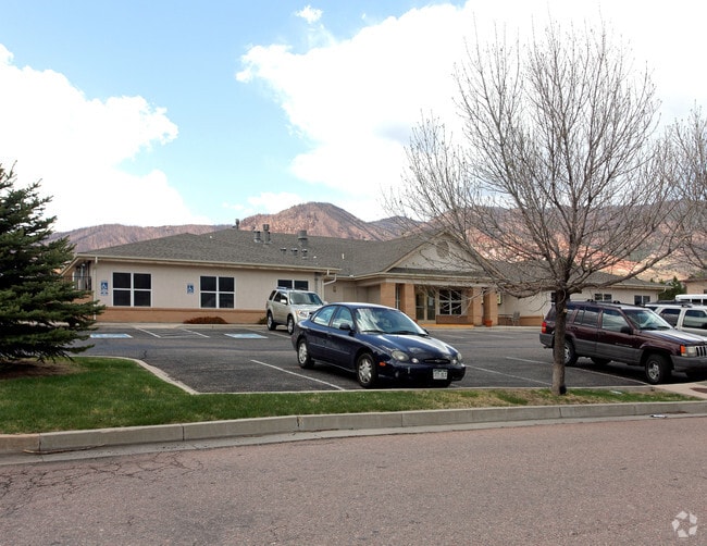
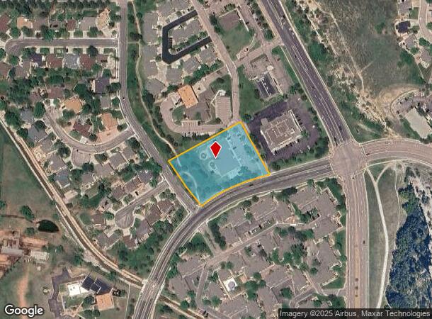
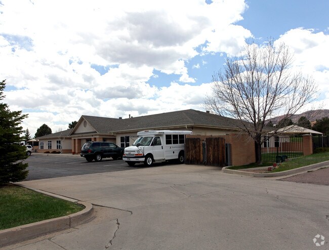
Property Record
6610 Flying W Ranch Rd, Colorado Springs, CO 80919

NEARBY LISTINGS FOR SALE OR LEASE
Property Detail
6610 Flying W Ranch Rd
Colorado Springs, CO
Kindercare Subdivision Filing No 1
73113-06-009
LOT 1 BLK 1 KINDERCARE SUB FIL NO 1
Commercialnec
El Paso
X
Colorado
08041C0511G
1
2024
1.83 AC
2025
Northwest
003707
Colorado Springs
9,882 SF
DEMOGRAPHICS near 6610 Flying W Ranch Rd
1 Mile
3 Mile
5 Mile
2024 Total Population
7,616
36,149
89,253
2029 Population
7,897
37,743
93,036
Pop Growth 2024-2029
+ 3.69%
+ 4.41%
+ 4.24%
Average Age
42
41
41
2024 Total Households
3,078
14,558
37,331
HH Growth 2024-2029
+ 3.90%
+ 4.64%
+ 4.48%
Median Household Inc
$108,934
$97,492
$76,562
Avg Household Size
2.50
2.40
2.30
2024 Avg HH Vehicles
2.00
2.00
2.00
Median Home Value
$496,558
$491,873
$440,308
Median Year Built
1990
1988
1984
Nearby Places
Map Layers
Map Styles
 Street
 Aerial
- Restaurants
- Banks
- Shops
- Fitness
- Groceries
PUBLIC TRANSPORTATION
AIRPORT
City of Colorado Springs Municipal
DRIVE
WALK
Distance
City of Colorado Springs Municipal
35 min
17.0 mi
Nearby Properties
Address
Land Use
TOTAL SIZE
Lot Size
Zoning
Address
Land Use
TOTAL SIZE
Lot Size
Zoning
625 SF
7.15 AC
RR-5
Address
Land Use
TOTAL SIZE
Lot Size
Zoning
662,208 SF
14.96 AC
BP
Address
Land Use
TOTAL SIZE
Lot Size
Zoning
62,201 SF
5.68 AC
MX-N
Address
Land Use
TOTAL SIZE
Lot Size
Zoning
117,227 SF
12.28 AC
PDZ HS
Address
Land Use
TOTAL SIZE
Lot Size
Zoning
747,294 SF
61.26 AC
BP HS
Address
Land Use
TOTAL SIZE
Lot Size
Zoning
139,621 SF
403.34 AC
A R-E HS
Address
Land Use
TOTAL SIZE
Lot Size
Zoning
77,655 SF
8.39 AC
MX-N MX-N/
Address
Land Use
TOTAL SIZE
Lot Size
Zoning
113,069 SF
44.99 AC
R-E HS
Address
Land Use
TOTAL SIZE
Lot Size
Zoning
93,939 SF
112.21 AC
PDZ
Address
Land Use
TOTAL SIZE
Lot Size
Zoning
131,696 SF
9.24 AC
MX-M
Address
Land Use
TOTAL SIZE
Lot Size
Zoning
100,930 SF
7.75 AC
BP CU
Address
Land Use
TOTAL SIZE
Lot Size
Zoning
30,757 SF
6.19 AC
MX-N CU HS
Address
Land Use
TOTAL SIZE
Lot Size
Zoning
158,502 SF
5.73 AC
MX-N HS
Address
Land Use
TOTAL SIZE
Lot Size
Zoning
41,015 SF
0.62 AC
BP
Address
Land Use
TOTAL SIZE
Lot Size
Zoning
301,559 SF
46.67 AC
BP/CR CU H
Address
Land Use
TOTAL SIZE
Lot Size
Zoning
88.37 AC
BP/CR HS C
Address
Land Use
TOTAL SIZE
Lot Size
Zoning
249,958 SF
21.03 AC
BP/CR HS C
Address
Land Use
TOTAL SIZE
Lot Size
Zoning
554,579 SF
97.22 AC
BP
Address
Land Use
TOTAL SIZE
Lot Size
Zoning
39,120 SF
2.16 AC
LI/CR CU
Address
Land Use
TOTAL SIZE
Lot Size
Zoning
70,999 SF
2.82 AC
C6
Address
Land Use
TOTAL SIZE
Lot Size
Zoning
39,807 SF
12.94 AC
MX-N CU UV
Address
Land Use
TOTAL SIZE
Lot Size
Zoning
26,040 SF
0.94 AC
R-5
Address
Land Use
TOTAL SIZE
Lot Size
Zoning
437,714 SF
24.97 AC
BP PDZ UV
Address
Land Use
TOTAL SIZE
Lot Size
Zoning
199,901 SF
9.77 AC
MX-M/CR HS
Address
Land Use
TOTAL SIZE
Lot Size
Zoning
150,075 SF
10.78 AC
BP HS CU S
Address
Land Use
TOTAL SIZE
Lot Size
Zoning
30,874 SF
5 AC
C-2 RR-0.5
Address
Land Use
TOTAL SIZE
Lot Size
Zoning
15,543 SF
3.27 AC
BP/CR CU
Address
Land Use
TOTAL SIZE
Lot Size
Zoning
45,716 SF
Address
Land Use
TOTAL SIZE
Lot Size
Zoning
106,190 SF
8 AC
BP CU HS
Address
Land Use
TOTAL SIZE
Lot Size
Zoning
369,144 SF
11.19 AC
MX-M CU HS
The World's #1 Commercial Real Estate Marketplace
Connect with us
© 2026 CoStar Group
The information above has been obtained from sources believed reliable. While we do not doubt its accuracy we have not verified it and make no guarantee, warranty or representation about it. It is your responsibility to independently confirm its accuracy and completeness. Any projections, opinions, assumptions, or estimates used are for example only and do not represent the current or future performance of the property. The value of this transaction to you depends on tax and other factors which should be evaluated by your tax, financial, and legal advisors. You and your advisors should conduct a careful, independent investigation of the property to determine to your satisfaction the suitability of the property for your needs.