Property Record
6645 Wadsworth Blvd, Arvada, CO 80003
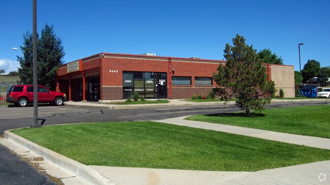

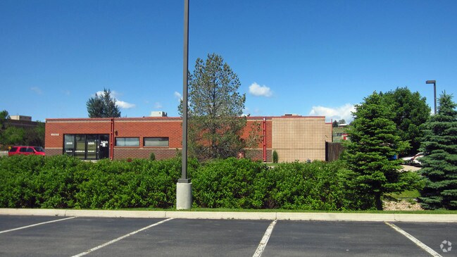
Property Detail
6645 Wadsworth Blvd
Denver-Aurora-Centennial, CO
SECTION 02 TOWNSHIP 03 RANGE 69 QTR SW SUBDIVISIONCD 790400 SUBDIVISIONNAME WADSWORTH PLACE FLG 4 BLOCK 001 LOT 0002 SIZE: 23348 TRACT VALUE: .536
39-023-06-009
JEFFERSON
Commercialnec
Colorado
B and X Area of moderate flood hazard, usually the area between the limits of the 100-year and 500-year floods.
2
2025
0.54 AC
2025
Northwest
010211
Denver
3,083 SF
NEARBY LISTINGS FOR SALE OR LEASE
DEMOGRAPHICS near 6645 Wadsworth Blvd
1 mile
3 mile
5 mile
2025 Total Population
14,896
125,289
316,694
2030 Population
14,767
125,433
319,581
Pop Growth 2025-2030
(0.87%)
+ 0.11%
+ 0.91%
Average Age
42
41
40
2025 Total Households
5,918
51,490
129,062
HH Growth 2025-2030
(0.93%)
+ 0.07%
+ 0.86%
Median Household Inc
$95,019
$90,569
$97,845
Avg Household Size
2.40
2.40
2.40
2025 Avg HH Vehicles
2.00
2.00
2.00
Median Home Value
$659,460
$609,756
$639,274
Median Year Built
1969
1974
1974
Nearby Places
Map Layers
Map Styles
 Street
 Aerial
Layers
 Traffic
 Biking
Places
Listings with unknown addresses are not visible on the map
- Restaurants
- Banks
- Shops
- Fitness
- Groceries
PUBLIC TRANSPORTATION
COMMUTER RAIL
Drive
Walk
Distance
3 min
1.5 mi
Drive
Walk
Distance
4 min
1.9 mi
AIRPORT
Denver International
Drive
Walk
Distance
Denver International
40 min
29.7 mi
Nearby Properties
Address
Land Use
TOTAL SIZE
Lot Size
Zoning
Address
Land Use
TOTAL SIZE
Lot Size
Zoning
559,786 SF
26.52 AC
Address
Land Use
TOTAL SIZE
Lot Size
Zoning
208,500 SF
8.42 AC
Address
Land Use
TOTAL SIZE
Lot Size
Zoning
138,770 SF
4.64 AC
Address
Land Use
TOTAL SIZE
Lot Size
Zoning
117,774 SF
8.60 AC
Address
Land Use
TOTAL SIZE
Lot Size
Zoning
80,030 SF
2.25 AC
Address
Land Use
TOTAL SIZE
Lot Size
Zoning
103,174 SF
1.23 AC
Address
Land Use
TOTAL SIZE
Lot Size
Zoning
81,065 SF
4.51 AC
Address
Land Use
TOTAL SIZE
Lot Size
Zoning
93,699 SF
1.89 AC
Address
Land Use
TOTAL SIZE
Lot Size
Zoning
97,944 SF
6.34 AC
Address
Land Use
TOTAL SIZE
Lot Size
Zoning
398,180 SF
33.31 AC
R1C
Address
Land Use
TOTAL SIZE
Lot Size
Zoning
56,854 SF
1.83 AC
Address
Land Use
TOTAL SIZE
Lot Size
Zoning
52,194 SF
5.33 AC
Address
Land Use
TOTAL SIZE
Lot Size
Zoning
72,252 SF
4.20 AC
Address
Land Use
TOTAL SIZE
Lot Size
Zoning
51,612 SF
1.76 AC
Address
Land Use
TOTAL SIZE
Lot Size
Zoning
50,490 SF
1.58 AC
Address
Land Use
TOTAL SIZE
Lot Size
Zoning
298,366 SF
24.21 AC
Address
Land Use
TOTAL SIZE
Lot Size
Zoning
59,824 SF
0.96 AC
Address
Land Use
TOTAL SIZE
Lot Size
Zoning
37,368 SF
0.87 AC
Address
Land Use
TOTAL SIZE
Lot Size
Zoning
42,474 SF
1.16 AC
Address
Land Use
TOTAL SIZE
Lot Size
Zoning
269,013 SF
31.89 AC
Address
Land Use
TOTAL SIZE
Lot Size
Zoning
48,252 SF
1.83 AC
Address
Land Use
TOTAL SIZE
Lot Size
Zoning
36,937 SF
0.88 AC
Address
Land Use
TOTAL SIZE
Lot Size
Zoning
69,537 SF
4.49 AC
Address
Land Use
TOTAL SIZE
Lot Size
Zoning
75,062 SF
5.28 AC
A1
Address
Land Use
TOTAL SIZE
Lot Size
Zoning
6,731 SF
80.77 AC
Address
Land Use
TOTAL SIZE
Lot Size
Zoning
54,566 SF
1.39 AC
Address
Land Use
TOTAL SIZE
Lot Size
Zoning
71,682 SF
4.14 AC
Address
Land Use
TOTAL SIZE
Lot Size
Zoning
62,025 SF
2.49 AC
R4
Address
Land Use
TOTAL SIZE
Lot Size
Zoning
25,016 SF
3.10 AC
Address
Land Use
TOTAL SIZE
Lot Size
Zoning
436,238 SF
13.94 AC
The World's #1 Commercial Real Estate Marketplace
Connect with us
© 2026 CoStar Group
The information above has been obtained from sources believed reliable. While we do not doubt its accuracy we have not verified it and make no guarantee, warranty or representation about it. It is your responsibility to independently confirm its accuracy and completeness. Any projections, opinions, assumptions, or estimates used are for example only and do not represent the current or future performance of the property. The value of this transaction to you depends on tax and other factors which should be evaluated by your tax, financial, and legal advisors. You and your advisors should conduct a careful, independent investigation of the property to determine to your satisfaction the suitability of the property for your needs.