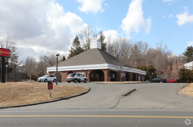
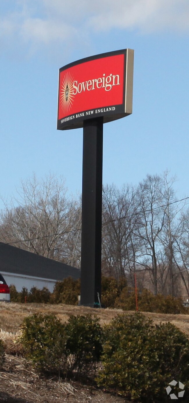
Property Record
669 Wolcott Rd, Wolcott, CT 06716

Property Detail
669 Wolcott Rd
WOLC-000114-000001-000189A
Naugatuck Vly
Commercialbuilding
Connecticut
GC
189a
B and X Area of moderate flood hazard, usually the area between the limits of the 100-year and 500-year floods.
1 AC
2025
Waterbury
2025
Westchester/So Connecticut
361200
New Haven, CT
4,487 SF
NEARBY LISTINGS FOR SALE OR LEASE
DEMOGRAPHICS near 669 Wolcott Rd
1 mile
3 mile
5 mile
2025 Total Population
4,575
32,796
134,806
2030 Population
4,684
33,607
137,875
Pop Growth 2025-2030
+ 2.38%
+ 2.47%
+ 2.28%
Average Age
44
41
39
2025 Total Households
1,851
12,704
52,150
HH Growth 2025-2030
+ 2.32%
+ 2.46%
+ 2.32%
Median Household Inc
$114,467
$78,683
$62,537
Avg Household Size
2.40
2.50
2.50
2025 Avg HH Vehicles
2.00
2.00
2.00
Median Home Value
$296,323
$276,261
$267,274
Median Year Built
1972
1971
1962
Nearby Places
Map Layers
Map Styles
 Street
 Aerial
Layers
 Traffic
 Biking
Places
Listings with unknown addresses are not visible on the map
- Restaurants
- Banks
- Shops
- Fitness
- Groceries
PUBLIC TRANSPORTATION
COMMUTER RAIL
Waterbury Station (New Haven Line - Metro-North Commuter Railroad Company (Metro-North))
Drive
Walk
Distance
Waterbury Station (New Haven Line - Metro-North Commuter Railroad Company (Metro-North))
11 min
5.6 mi
Naugatuck Station (New Haven Line - Metro-North Commuter Railroad Company (Metro-North))
Drive
Walk
Distance
Naugatuck Station (New Haven Line - Metro-North Commuter Railroad Company (Metro-North))
16 min
9.8 mi
AIRPORT
Tweed/New Haven
Drive
Walk
Distance
Tweed/New Haven
50 min
29.8 mi
Bradley International
Drive
Walk
Distance
Bradley International
60 min
39.0 mi
Freight Ports
Port of New Haven
Drive
Walk
Distance
Port of New Haven
45 min
27.2 mi
Nearby Properties
Address
Land Use
TOTAL SIZE
Lot Size
Zoning
Address
Land Use
TOTAL SIZE
Lot Size
Zoning
306,366 SF
84 AC
RS-12
Address
Land Use
TOTAL SIZE
Lot Size
Zoning
5.13 AC
RM
Address
Land Use
TOTAL SIZE
Lot Size
Zoning
39 AC
RM
Address
Land Use
TOTAL SIZE
Lot Size
Zoning
50 AC
R-40
Address
Land Use
TOTAL SIZE
Lot Size
Zoning
24.49 AC
CA
Address
Land Use
TOTAL SIZE
Lot Size
Zoning
31.75 AC
CA
Address
Land Use
TOTAL SIZE
Lot Size
Zoning
18.01 AC
CA
Address
Land Use
TOTAL SIZE
Lot Size
Zoning
10.51 AC
RL
Address
Land Use
TOTAL SIZE
Lot Size
Zoning
15.39 AC
RM
Address
Land Use
TOTAL SIZE
Lot Size
Zoning
10 AC
RS-12
Address
Land Use
TOTAL SIZE
Lot Size
Zoning
125,520 SF
9 AC
CA
Address
Land Use
TOTAL SIZE
Lot Size
Zoning
154,629 SF
18.76 AC
CA
Address
Land Use
TOTAL SIZE
Lot Size
Zoning
10 AC
R-40
Address
Land Use
TOTAL SIZE
Lot Size
Zoning
124,890 SF
12.10 AC
CA
Address
Land Use
TOTAL SIZE
Lot Size
Zoning
5.11 AC
CA
Address
Land Use
TOTAL SIZE
Lot Size
Zoning
85,155 SF
29.20 AC
R-30
Address
Land Use
TOTAL SIZE
Lot Size
Zoning
4.78 AC
CA
Address
Land Use
TOTAL SIZE
Lot Size
Zoning
52,542 SF
6.82 AC
R-30
Address
Land Use
TOTAL SIZE
Lot Size
Zoning
14.73 AC
RL
Address
Land Use
TOTAL SIZE
Lot Size
Zoning
10.67 AC
CA
Address
Land Use
TOTAL SIZE
Lot Size
Zoning
10.34 AC
RM
Address
Land Use
TOTAL SIZE
Lot Size
Zoning
59,658 SF
1.04 AC
RM
Address
Land Use
TOTAL SIZE
Lot Size
Zoning
29,068 SF
5.25 AC
RM
Address
Land Use
TOTAL SIZE
Lot Size
Zoning
26,224 SF
8.64 AC
RL
Address
Land Use
TOTAL SIZE
Lot Size
Zoning
10,210 SF
1.18 AC
CA
Address
Land Use
TOTAL SIZE
Lot Size
Zoning
8.72 AC
CA
Address
Land Use
TOTAL SIZE
Lot Size
Zoning
177,077 SF
10.42 AC
IL
Address
Land Use
TOTAL SIZE
Lot Size
Zoning
50,300 SF
1.06 AC
CA
Address
Land Use
TOTAL SIZE
Lot Size
Zoning
Address
Land Use
TOTAL SIZE
Lot Size
Zoning
17.44 AC
GC
The World's #1 Commercial Real Estate Marketplace
Connect with us
© 2026 CoStar Group
The information above has been obtained from sources believed reliable. While we do not doubt its accuracy we have not verified it and make no guarantee, warranty or representation about it. It is your responsibility to independently confirm its accuracy and completeness. Any projections, opinions, assumptions, or estimates used are for example only and do not represent the current or future performance of the property. The value of this transaction to you depends on tax and other factors which should be evaluated by your tax, financial, and legal advisors. You and your advisors should conduct a careful, independent investigation of the property to determine to your satisfaction the suitability of the property for your needs.