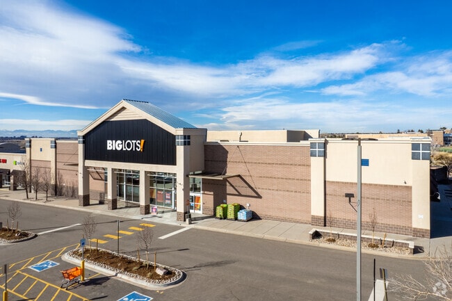
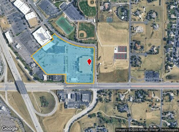
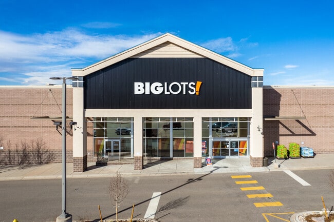
Property Record
6696 S Parker Rd, Aurora, CO 80016

NEARBY LISTINGS FOR SALE OR LEASE
Property Detail
6696 S Parker Rd
Denver
Arapahoe Crossings Subdivision Flg No 3
Denver-Aurora-Lakewood, CO
TOWNSHIP T5S MAPPLATB 566 MAPPLATP 1 SUBDIVISIONCD 001706 SUBDIVISIONNAME ARAPAHOE CROSSINGS SUBDIVISION FLG NO 3 BLOCK 001 LOT 001 LOT 1 BLK 1 ARAPAHOE CROSSINGS SUB FLG NO 3
2073-20-4-12-001
Arapahoe
Storebuilding
Colorado
2024
1
2025
19.37 AC
085000
Southeast
166,431 SF
DEMOGRAPHICS near 6696 S Parker Rd
1 Mile
3 Mile
5 Mile
2024 Total Population
7,904
74,911
241,504
2029 Population
7,935
75,426
247,368
Pop Growth 2024-2029
+ 0.39%
+ 0.69%
+ 2.43%
Average Age
37
39
39
2024 Total Households
2,951
26,842
89,498
HH Growth 2024-2029
+ 0.34%
+ 0.78%
+ 2.69%
Median Household Inc
$100,184
$111,841
$103,797
Avg Household Size
2.60
2.70
2.60
2024 Avg HH Vehicles
2.00
2.00
2.00
Median Home Value
$711,743
$530,064
$493,435
Median Year Built
2004
1993
1994
Nearby Places
Map Layers
Map Styles
 Street
 Aerial
- Restaurants
- Banks
- Shops
- Fitness
- Groceries
PUBLIC TRANSPORTATION
AIRPORT
Denver International
DRIVE
WALK
Distance
Denver International
34 min
26.9 mi
Freight Ports
Tulsa Port Of Catoosa
DRIVE
WALK
Distance
Tulsa Port Of Catoosa
728 min
707.9 mi
SALE & LEASE HISTORY
LISTING DATE
SALE/LEASE

Apr 24, 2017
For Lease
Nearby Properties
Address
Land Use
TOTAL SIZE
Lot Size
Zoning
Address
Land Use
TOTAL SIZE
Lot Size
Zoning
234,214 SF
5.23 AC
Address
Land Use
TOTAL SIZE
Lot Size
Zoning
280,586 SF
60.97 AC
RPD
Address
Land Use
TOTAL SIZE
Lot Size
Zoning
284,862 SF
23.37 AC
PUD
Address
Land Use
TOTAL SIZE
Lot Size
Zoning
525,600 SF
57.90 AC
Address
Land Use
TOTAL SIZE
Lot Size
Zoning
346,890 SF
38.99 AC
AA1
Address
Land Use
TOTAL SIZE
Lot Size
Zoning
246,768 SF
12.37 AC
PUD
Address
Land Use
TOTAL SIZE
Lot Size
Zoning
134,316 SF
26.52 AC
Address
Land Use
TOTAL SIZE
Lot Size
Zoning
103,811 SF
6.36 AC
RPD
Address
Land Use
TOTAL SIZE
Lot Size
Zoning
304,620 SF
23.95 AC
AMU
Address
Land Use
TOTAL SIZE
Lot Size
Zoning
107,760 SF
5.41 AC
AMU
Address
Land Use
TOTAL SIZE
Lot Size
Zoning
253,296 SF
16.41 AC
Address
Land Use
TOTAL SIZE
Lot Size
Zoning
217,273 SF
18.28 AC
Address
Land Use
TOTAL SIZE
Lot Size
Zoning
171,600 SF
10.32 AC
AA2
Address
Land Use
TOTAL SIZE
Lot Size
Zoning
195,390 SF
14.78 AC
AI1
Address
Land Use
TOTAL SIZE
Lot Size
Zoning
281,429 SF
22.55 AC
PUD
Address
Land Use
TOTAL SIZE
Lot Size
Zoning
494,489 SF
22.16 AC
Address
Land Use
TOTAL SIZE
Lot Size
Zoning
150,920 SF
12.18 AC
AA1
Address
Land Use
TOTAL SIZE
Lot Size
Zoning
337,765 SF
23.46 AC
Address
Land Use
TOTAL SIZE
Lot Size
Zoning
140,080 SF
15.05 AC
Address
Land Use
TOTAL SIZE
Lot Size
Zoning
91.37 AC
Address
Land Use
TOTAL SIZE
Lot Size
Zoning
196,252 SF
17.14 AC
PDU
Address
Land Use
TOTAL SIZE
Lot Size
Zoning
149,928 SF
10.73 AC
Address
Land Use
TOTAL SIZE
Lot Size
Zoning
202,392 SF
21.13 AC
Address
Land Use
TOTAL SIZE
Lot Size
Zoning
122,965 SF
12.30 AC
RPD
Address
Land Use
TOTAL SIZE
Lot Size
Zoning
12,726 SF
17.94 AC
Address
Land Use
TOTAL SIZE
Lot Size
Zoning
132,300 SF
11.09 AC
AMU
Address
Land Use
TOTAL SIZE
Lot Size
Zoning
288,737 SF
26.40 AC
AMU
Address
Land Use
TOTAL SIZE
Lot Size
Zoning
150,000 SF
10.83 AC
AA2
Address
Land Use
TOTAL SIZE
Lot Size
Zoning
106,000 SF
27.41 AC
The World's #1 Commercial Real Estate Marketplace
Connect with us
© 2025 CoStar Group
The information above has been obtained from sources believed reliable. While we do not doubt its accuracy we have not verified it and make no guarantee, warranty or representation about it. It is your responsibility to independently confirm its accuracy and completeness. Any projections, opinions, assumptions, or estimates used are for example only and do not represent the current or future performance of the property. The value of this transaction to you depends on tax and other factors which should be evaluated by your tax, financial, and legal advisors. You and your advisors should conduct a careful, independent investigation of the property to determine to your satisfaction the suitability of the property for your needs.