Property Record
66Th North Dr, Belleville, IL 62226
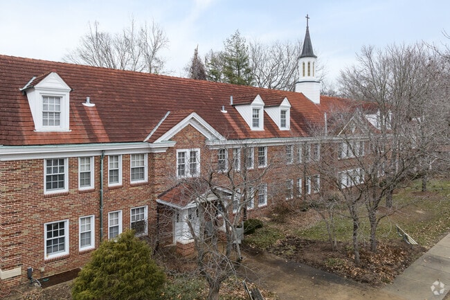


This Property Is For Sale
Property Detail
66Th North Dr
St. Louis
ST CLAIR TWP SEC 6 LOT 8B PT SW & PT LOT 9A BK A01581415 EX A02003449
St. Louis, MO-IL
ST. CLAIR
08-06.0-300-057
Illinois
Taxexempt
8b,9a
0
38.27 AC
2024
Illinois
503301
NEARBY LISTINGS FOR SALE OR LEASE
DEMOGRAPHICS near 66Th North Dr
1 mile
3 mile
5 mile
2025 Total Population
4,622
39,887
93,190
2030 Population
4,530
38,867
91,373
Pop Growth 2025-2030
(1.99%)
(2.56%)
(1.95%)
Average Age
43
43
42
2025 Total Households
1,947
17,456
39,476
HH Growth 2025-2030
(2.00%)
(2.56%)
(1.99%)
Median Household Inc
$69,635
$60,977
$63,435
Avg Household Size
2.30
2.20
2.30
2025 Avg HH Vehicles
2.00
2.00
2.00
Median Home Value
$163,223
$162,972
$158,817
Median Year Built
1959
1966
1969
Nearby Places
Map Layers
Map Styles
 Street
 Aerial
Layers
 Traffic
 Biking
Places
Listings with unknown addresses are not visible on the map
- Restaurants
- Banks
- Shops
- Fitness
- Groceries
PUBLIC TRANSPORTATION
COMMUTER RAIL
Memorial Hospital (Lambert Airport Shiloh-Scott - St. Louis MetroLink (MetroLink))
Drive
Walk
Distance
Memorial Hospital (Lambert Airport Shiloh-Scott - St. Louis MetroLink (MetroLink))
4 min
2.0 mi
Fairview Heights (Lambert Airport Shiloh-Scott - St. Louis MetroLink (MetroLink), Shrewsbury-Lansdowne I-44 Emerson Park - St. Louis MetroLink (MetroLink))
Drive
Walk
Distance
Fairview Heights (Lambert Airport Shiloh-Scott - St. Louis MetroLink (MetroLink), Shrewsbury-Lansdowne I-44 Emerson Park - St. Louis MetroLink (MetroLink))
7 min
3.0 mi
AIRPORT
Scott AFB/Midamerica St Louis
Drive
Walk
Distance
Scott AFB/Midamerica St Louis
30 min
15.6 mi
St Louis Lambert International
Drive
Walk
Distance
St Louis Lambert International
40 min
26.2 mi
Freight Ports
Port Milwaukee
Drive
Walk
Distance
Port Milwaukee
419 min
367.5 mi
Nearby Properties
Address
Land Use
TOTAL SIZE
Lot Size
Zoning
Address
Land Use
TOTAL SIZE
Lot Size
Zoning
2,484 SF
16.76 AC
Address
Land Use
TOTAL SIZE
Lot Size
Zoning
Address
Land Use
TOTAL SIZE
Lot Size
Zoning
41,366 SF
12.07 AC
Address
Land Use
TOTAL SIZE
Lot Size
Zoning
127,251 SF
12.15 AC
Address
Land Use
TOTAL SIZE
Lot Size
Zoning
127,590 SF
10.53 AC
Address
Land Use
TOTAL SIZE
Lot Size
Zoning
18,734 SF
10.48 AC
Address
Land Use
TOTAL SIZE
Lot Size
Zoning
104,230 SF
11.08 AC
Address
Land Use
TOTAL SIZE
Lot Size
Zoning
147,888 SF
52.30 AC
Address
Land Use
TOTAL SIZE
Lot Size
Zoning
10,014 SF
3.18 AC
Address
Land Use
TOTAL SIZE
Lot Size
Zoning
82,500 SF
14.61 AC
Address
Land Use
TOTAL SIZE
Lot Size
Zoning
49,248 SF
2 AC
Address
Land Use
TOTAL SIZE
Lot Size
Zoning
5,656 SF
8.65 AC
Address
Land Use
TOTAL SIZE
Lot Size
Zoning
46,610 SF
5.22 AC
Address
Land Use
TOTAL SIZE
Lot Size
Zoning
10,505 SF
20.08 AC
Address
Land Use
TOTAL SIZE
Lot Size
Zoning
6,800 SF
4.33 AC
Address
Land Use
TOTAL SIZE
Lot Size
Zoning
130,254 SF
11.44 AC
Address
Land Use
TOTAL SIZE
Lot Size
Zoning
3,416 SF
7.30 AC
Address
Land Use
TOTAL SIZE
Lot Size
Zoning
13,546 SF
11.19 AC
Address
Land Use
TOTAL SIZE
Lot Size
Zoning
4,420 SF
3.82 AC
Address
Land Use
TOTAL SIZE
Lot Size
Zoning
7,344 SF
3.50 AC
Address
Land Use
TOTAL SIZE
Lot Size
Zoning
90,945 SF
5.93 AC
Address
Land Use
TOTAL SIZE
Lot Size
Zoning
16,549 SF
5.44 AC
Address
Land Use
TOTAL SIZE
Lot Size
Zoning
54,179 SF
9.26 AC
Address
Land Use
TOTAL SIZE
Lot Size
Zoning
18.43 AC
Address
Land Use
TOTAL SIZE
Lot Size
Zoning
26.26 AC
C2
Address
Land Use
TOTAL SIZE
Lot Size
Zoning
18,837 SF
134.15 AC
Address
Land Use
TOTAL SIZE
Lot Size
Zoning
8,376 SF
3.11 AC
Address
Land Use
TOTAL SIZE
Lot Size
Zoning
4.70 AC
Address
Land Use
TOTAL SIZE
Lot Size
Zoning
15,480 SF
1.35 AC
Address
Land Use
TOTAL SIZE
Lot Size
Zoning
24,580 SF
19.55 AC
The World's #1 Commercial Real Estate Marketplace
Connect with us
© 2026 CoStar Group
The information above has been obtained from sources believed reliable. While we do not doubt its accuracy we have not verified it and make no guarantee, warranty or representation about it. It is your responsibility to independently confirm its accuracy and completeness. Any projections, opinions, assumptions, or estimates used are for example only and do not represent the current or future performance of the property. The value of this transaction to you depends on tax and other factors which should be evaluated by your tax, financial, and legal advisors. You and your advisors should conduct a careful, independent investigation of the property to determine to your satisfaction the suitability of the property for your needs.