Property Record
67 Jefferson Ave, Springfield, MA 01107
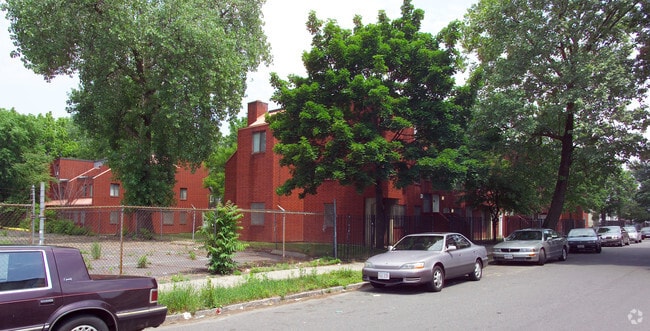

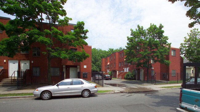
Property Detail
67 Jefferson Ave
SPRI-007075-000000-000043
HAMPDEN
Taxexempt
Massachusetts
SR3B1
1.02 AC
0
Memorial Square
2025
Hartford
800600
Springfield, MA
16,200 SF
NEARBY LISTINGS FOR SALE OR LEASE
DEMOGRAPHICS near 67 Jefferson Ave
1 mile
3 mile
5 mile
2025 Total Population
18,014
117,211
219,642
2030 Population
17,869
116,708
218,881
Pop Growth 2025-2030
(0.80%)
(0.43%)
(0.35%)
Average Age
37
38
40
2025 Total Households
7,129
45,839
86,268
HH Growth 2025-2030
(0.69%)
(0.45%)
(0.38%)
Median Household Inc
$24,007
$45,066
$56,712
Avg Household Size
2.40
2.40
2.40
2025 Avg HH Vehicles
1.00
1.00
1.00
Median Home Value
$256,152
$268,165
$277,630
Median Year Built
1948
1948
1952
Nearby Places
Map Layers
Map Styles
 Street
 Aerial
Transit
 Traffic
 Biking
Places
Listings with unknown addresses are not visible on the map
- Restaurants
- Banks
- Shops
- Fitness
- Groceries
PUBLIC TRANSPORTATION
COMMUTER RAIL
Drive
Walk
Distance
2 min
20 min
1.0 mi
Drive
Walk
Distance
11 min
6.8 mi
AIRPORT
Bradley International
Drive
Walk
Distance
Bradley International
30 min
14.0 mi
The World's #1 Commercial Real Estate Marketplace
Connect with us
© 2026 CoStar Group
The information above has been obtained from sources believed reliable. While we do not doubt its accuracy we have not verified it and make no guarantee, warranty or representation about it. It is your responsibility to independently confirm its accuracy and completeness. Any projections, opinions, assumptions, or estimates used are for example only and do not represent the current or future performance of the property. The value of this transaction to you depends on tax and other factors which should be evaluated by your tax, financial, and legal advisors. You and your advisors should conduct a careful, independent investigation of the property to determine to your satisfaction the suitability of the property for your needs.