Property Record
6731 Nw Cache Rd, Lawton, OK 73505

Save to a Folder
{{folder.Name}}
{{folder.ListingIds.length}} Properties
{{folder.ListingIds.length}} Property
Create a New Folder
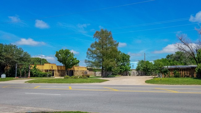
Property Detail
6731 Nw Cache Rd
0041666
20-2N-12W C T A TR OF LAND BEG 458.10' W OF SE/C SEC 20 & 50' N OF CEN LNE OF HWY 62 TH N 208.6', W 208.6', S 208.6', E 208.6
Restaurantdrivein
Comanche
B and X Area of moderate flood hazard, usually the area between the limits of the 100-year and 500-year floods.
Oklahoma
2025
29
2025
1.08 AC
000402
Other Market Areas
3,084 SF
Lawton, OK
NEARBY LISTINGS FOR SALE OR LEASE
DEMOGRAPHICS near 6731 Nw Cache Rd
1 mile
3 mile
5 mile
2025 Total Population
11,322
38,098
69,041
2030 Population
11,168
37,759
69,164
Pop Growth 2025-2030
(1.36%)
(0.89%)
+ 0.18%
Average Age
39
38
37
2025 Total Households
4,736
15,569
27,702
HH Growth 2025-2030
(1.58%)
(1.09%)
+ 0.13%
Median Household Inc
$61,524
$57,290
$51,196
Avg Household Size
2.30
2.40
2.30
2025 Avg HH Vehicles
2.00
2.00
2.00
Median Home Value
$167,328
$165,666
$144,286
Median Year Built
1979
1975
1972
Nearby Places
Map Layers
Map Styles
 Street
 Aerial
Layers
 Traffic
 Biking
Places
Listings with unknown addresses are not visible on the map
- Restaurants
- Banks
- Shops
- Fitness
- Groceries
PUBLIC TRANSPORTATION
AIRPORT
Lawton-Fort Sill Regional
Drive
Walk
Distance
Lawton-Fort Sill Regional
17 min
7.5 mi
Freight Ports
Tulsa Port Of Catoosa
Drive
Walk
Distance
Tulsa Port Of Catoosa
229 min
213.2 mi
SALE & LEASE HISTORY
LISTING DATE
SALE/LEASE

Sep 23, 2016
For Sale
Apr 20, 2017
For Sale
Apr 14, 2017
For Lease
Apr 14, 2017
For Sale
Nearby Properties
Address
Land Use
TOTAL SIZE
Lot Size
Zoning
Address
Land Use
TOTAL SIZE
Lot Size
Zoning
44,900 SF
484.43 AC
Address
Land Use
TOTAL SIZE
Lot Size
Zoning
36,063 SF
6.35 AC
Address
Land Use
TOTAL SIZE
Lot Size
Zoning
55,256 SF
6.30 AC
Address
Land Use
TOTAL SIZE
Lot Size
Zoning
9,000 SF
25.39 AC
Address
Land Use
TOTAL SIZE
Lot Size
Zoning
30,000 SF
17.22 AC
Address
Land Use
TOTAL SIZE
Lot Size
Zoning
40,284 SF
7.61 AC
Address
Land Use
TOTAL SIZE
Lot Size
Zoning
25,930 SF
5.47 AC
Address
Land Use
TOTAL SIZE
Lot Size
Zoning
8,800 SF
30.05 AC
Address
Land Use
TOTAL SIZE
Lot Size
Zoning
9,240 SF
6.43 AC
Address
Land Use
TOTAL SIZE
Lot Size
Zoning
1,488 SF
19.48 AC
Address
Land Use
TOTAL SIZE
Lot Size
Zoning
13,326 SF
8.47 AC
Address
Land Use
TOTAL SIZE
Lot Size
Zoning
906 SF
5.51 AC
Address
Land Use
TOTAL SIZE
Lot Size
Zoning
39,546 SF
10.62 AC
Address
Land Use
TOTAL SIZE
Lot Size
Zoning
2,330 SF
19.42 AC
Address
Land Use
TOTAL SIZE
Lot Size
Zoning
16,996 SF
12.16 AC
Address
Land Use
TOTAL SIZE
Lot Size
Zoning
131,736 SF
10.24 AC
Address
Land Use
TOTAL SIZE
Lot Size
Zoning
39,791 SF
20.50 AC
Address
Land Use
TOTAL SIZE
Lot Size
Zoning
83,945 SF
46.98 AC
Address
Land Use
TOTAL SIZE
Lot Size
Zoning
25,800 SF
3.82 AC
Address
Land Use
TOTAL SIZE
Lot Size
Zoning
68,844 SF
10.43 AC
Address
Land Use
TOTAL SIZE
Lot Size
Zoning
2,376 SF
8.64 AC
Address
Land Use
TOTAL SIZE
Lot Size
Zoning
3,470 SF
10.11 AC
Address
Land Use
TOTAL SIZE
Lot Size
Zoning
3,860 SF
7.41 AC
Address
Land Use
TOTAL SIZE
Lot Size
Zoning
117,301 SF
13.84 AC
Address
Land Use
TOTAL SIZE
Lot Size
Zoning
65,320 SF
4.81 AC
Address
Land Use
TOTAL SIZE
Lot Size
Zoning
29,498 SF
8.02 AC
Address
Land Use
TOTAL SIZE
Lot Size
Zoning
63,224 SF
2.66 AC
Address
Land Use
TOTAL SIZE
Lot Size
Zoning
82,509 SF
6.29 AC
Address
Land Use
TOTAL SIZE
Lot Size
Zoning
24,756 SF
2.39 AC
Address
Land Use
TOTAL SIZE
Lot Size
Zoning
50,002 SF
7.66 AC
The World's #1 Commercial Real Estate Marketplace
Connect with us
© 2026 CoStar Group
The information above has been obtained from sources believed reliable. While we do not doubt its accuracy we have not verified it and make no guarantee, warranty or representation about it. It is your responsibility to independently confirm its accuracy and completeness. Any projections, opinions, assumptions, or estimates used are for example only and do not represent the current or future performance of the property. The value of this transaction to you depends on tax and other factors which should be evaluated by your tax, financial, and legal advisors. You and your advisors should conduct a careful, independent investigation of the property to determine to your satisfaction the suitability of the property for your needs.