Property Record
674 E White Mountain Blvd, Pinetop, AZ 85935
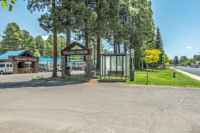

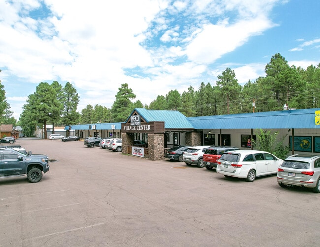

This Property Is For Sale
Property Detail
674 E White Mountain Blvd
311-28-031A
PINETOP HILLS #2 LOTS C-21 & C-22 LESS SELY 65 OF LOT C-21 (393- 007)
Regionalshoppingcenterormallwithanchorstore
NAVAJO
MUNICIPAL
Arizona
B and X Area of moderate flood hazard, usually the area between the limits of the 100-year and 500-year floods.
c
2025
1.82 AC
2027
Arizona Northeast & Holbrook Area
964901
Other Market Areas
19,933 SF
Show Low, AZ
NEARBY LISTINGS FOR SALE OR LEASE
DEMOGRAPHICS near 674 E White Mountain Blvd
1 mile
3 mile
5 mile
2025 Total Population
1,347
9,411
15,318
2030 Population
1,439
9,994
16,220
Pop Growth 2025-2030
+ 6.83%
+ 6.19%
+ 5.89%
Average Age
45
44
45
2025 Total Households
557
3,729
6,031
HH Growth 2025-2030
+ 5.92%
+ 6.01%
+ 5.90%
Median Household Inc
$56,733
$58,342
$59,080
Avg Household Size
2.40
2.50
2.50
2025 Avg HH Vehicles
2.00
2.00
2.00
Median Home Value
$356,896
$355,716
$350,567
Median Year Built
1983
1986
1987
Nearby Places
Map Layers
Map Styles
 Street
 Aerial
Layers
 Traffic
 Biking
Places
Listings with unknown addresses are not visible on the map
- Restaurants
- Banks
- Shops
- Fitness
- Groceries
Nearby Properties
Address
Land Use
TOTAL SIZE
Lot Size
Zoning
Address
Land Use
TOTAL SIZE
Lot Size
Zoning
4,308 SF
73.88 AC
MUNICIPAL
Address
Land Use
TOTAL SIZE
Lot Size
Zoning
99,979 SF
10.70 AC
MUNICIPAL
Address
Land Use
TOTAL SIZE
Lot Size
Zoning
320 AC
Address
Land Use
TOTAL SIZE
Lot Size
Zoning
38,549 SF
2.40 AC
MUNICIPAL
Address
Land Use
TOTAL SIZE
Lot Size
Zoning
20,555 SF
19.27 AC
MUNICIPAL
Address
Land Use
TOTAL SIZE
Lot Size
Zoning
27,602 SF
1.53 AC
MUNICIPAL
Address
Land Use
TOTAL SIZE
Lot Size
Zoning
20,088 SF
2 AC
R-2
Address
Land Use
TOTAL SIZE
Lot Size
Zoning
21,761 SF
0.92 AC
MUNICIPAL
Address
Land Use
TOTAL SIZE
Lot Size
Zoning
39,350 SF
4.24 AC
MUNICIPAL
Address
Land Use
TOTAL SIZE
Lot Size
Zoning
46,480 SF
4.35 AC
C-R
Address
Land Use
TOTAL SIZE
Lot Size
Zoning
22,389 SF
3.16 AC
MUNICIPAL
Address
Land Use
TOTAL SIZE
Lot Size
Zoning
25,081 SF
3.17 AC
MUNICIPAL
Address
Land Use
TOTAL SIZE
Lot Size
Zoning
107.88 AC
Address
Land Use
TOTAL SIZE
Lot Size
Zoning
25,882 SF
21.67 AC
MUNICIPAL
Address
Land Use
TOTAL SIZE
Lot Size
Zoning
21,538 SF
1.30 AC
MUNICIPAL
Address
Land Use
TOTAL SIZE
Lot Size
Zoning
9,514 SF
2.40 AC
MUNICIPAL
Address
Land Use
TOTAL SIZE
Lot Size
Zoning
16,458 SF
3.20 AC
MUNICIPAL
Address
Land Use
TOTAL SIZE
Lot Size
Zoning
17,843 SF
0.92 AC
MUNICIPAL
Address
Land Use
TOTAL SIZE
Lot Size
Zoning
30,166 SF
1.56 AC
MUNICIPAL
Address
Land Use
TOTAL SIZE
Lot Size
Zoning
14,770 SF
1.30 AC
MUNICIPAL
Address
Land Use
TOTAL SIZE
Lot Size
Zoning
17,168 SF
0.60 AC
MUNICIPAL
Address
Land Use
TOTAL SIZE
Lot Size
Zoning
28,050 SF
2.38 AC
MUNICIPAL
Address
Land Use
TOTAL SIZE
Lot Size
Zoning
10,933 SF
1 AC
R-3
Address
Land Use
TOTAL SIZE
Lot Size
Zoning
17,168 SF
0.46 AC
MUNICIPAL
Address
Land Use
TOTAL SIZE
Lot Size
Zoning
5,636 SF
3.78 AC
Address
Land Use
TOTAL SIZE
Lot Size
Zoning
12,387 SF
1.47 AC
MUNICIPAL
Address
Land Use
TOTAL SIZE
Lot Size
Zoning
28,195 SF
6.62 AC
R1-10
Address
Land Use
TOTAL SIZE
Lot Size
Zoning
12,343 SF
3.61 AC
MUNICIPAL
Address
Land Use
TOTAL SIZE
Lot Size
Zoning
12,042 SF
0.92 AC
MUNICIPAL
The World's #1 Commercial Real Estate Marketplace
Connect with us
© 2026 CoStar Group
The information above has been obtained from sources believed reliable. While we do not doubt its accuracy we have not verified it and make no guarantee, warranty or representation about it. It is your responsibility to independently confirm its accuracy and completeness. Any projections, opinions, assumptions, or estimates used are for example only and do not represent the current or future performance of the property. The value of this transaction to you depends on tax and other factors which should be evaluated by your tax, financial, and legal advisors. You and your advisors should conduct a careful, independent investigation of the property to determine to your satisfaction the suitability of the property for your needs.