Property Record
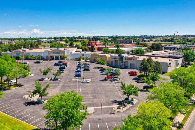
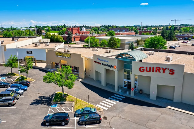
6755 W 88Th Ave, Westminster, CO 80031

Property Detail
6755 W 88Th Ave
29-234-04-010
SECTION 23 TOWNSHIP 02 RANGE 69 QTR SE SUBDIVISIONCD 822900 SUBDIVISIONNAME WESTGLENN FLG # 4 BLOCK 00A LOT SIZE: 96224 TRACT 00B VALUE: 2.209
Commercialnec
JEFFERSON
B and X Area of moderate flood hazard, usually the area between the limits of the 100-year and 500-year floods.
Colorado
2025
2.21 AC
2025
Northwest
009831
Denver
55,797 SF
Denver-Aurora-Centennial, CO
NEARBY LISTINGS FOR SALE OR LEASE
DEMOGRAPHICS near 6755 W 88Th Ave
1 mile
3 mile
5 mile
2025 Total Population
15,312
118,757
309,636
2030 Population
15,240
119,561
314,369
Pop Growth 2025-2030
(0.47%)
+ 0.68%
+ 1.53%
Average Age
39
40
39
2025 Total Households
6,674
46,593
120,741
HH Growth 2025-2030
(0.34%)
+ 0.71%
+ 1.62%
Median Household Inc
$87,374
$97,011
$94,183
Avg Household Size
2.30
2.50
2.50
2025 Avg HH Vehicles
2.00
2.00
2.00
Median Home Value
$484,224
$564,131
$563,188
Median Year Built
1980
1978
1979
Nearby Places
Map Layers
Map Styles
 Street
 Aerial
Layers
 Traffic
 Biking
Places
Listings with unknown addresses are not visible on the map
- Restaurants
- Banks
- Shops
- Fitness
- Groceries
PUBLIC TRANSPORTATION
COMMUTER RAIL
Drive
Walk
Distance
11 min
4.7 mi
Drive
Walk
Distance
9 min
4.8 mi
AIRPORT
Denver International
Drive
Walk
Distance
Denver International
39 min
29.3 mi
SALE & LEASE HISTORY
LISTING DATE
SALE/LEASE

Sep 24, 2016
For Lease
Sep 10, 2019
For Sale
Jul 17, 2017
For Sale
Nearby Properties
Address
Land Use
TOTAL SIZE
Lot Size
Zoning
Address
Land Use
TOTAL SIZE
Lot Size
Zoning
21,306 SF
2.43 AC
Address
Land Use
TOTAL SIZE
Lot Size
Zoning
559,786 SF
26.52 AC
Address
Land Use
TOTAL SIZE
Lot Size
Zoning
248,096 SF
19.67 AC
Address
Land Use
TOTAL SIZE
Lot Size
Zoning
224,600 SF
6.22 AC
Address
Land Use
TOTAL SIZE
Lot Size
Zoning
216,285 SF
6 AC
Address
Land Use
TOTAL SIZE
Lot Size
Zoning
208,500 SF
8.42 AC
Address
Land Use
TOTAL SIZE
Lot Size
Zoning
176,583 SF
Address
Land Use
TOTAL SIZE
Lot Size
Zoning
117,774 SF
8.60 AC
Address
Land Use
TOTAL SIZE
Lot Size
Zoning
138,912 SF
8.71 AC
Address
Land Use
TOTAL SIZE
Lot Size
Zoning
81,065 SF
4.51 AC
Address
Land Use
TOTAL SIZE
Lot Size
Zoning
113,385 SF
6.77 AC
Address
Land Use
TOTAL SIZE
Lot Size
Zoning
398,180 SF
33.31 AC
R1C
Address
Land Use
TOTAL SIZE
Lot Size
Zoning
58,750 SF
1.52 AC
Address
Land Use
TOTAL SIZE
Lot Size
Zoning
305,110 SF
16.87 AC
Address
Land Use
TOTAL SIZE
Lot Size
Zoning
52,194 SF
5.33 AC
Address
Land Use
TOTAL SIZE
Lot Size
Zoning
209,009 SF
22.30 AC
Address
Land Use
TOTAL SIZE
Lot Size
Zoning
64,106 SF
4.10 AC
Address
Land Use
TOTAL SIZE
Lot Size
Zoning
46,922 SF
2.35 AC
Address
Land Use
TOTAL SIZE
Lot Size
Zoning
69,537 SF
4.49 AC
Address
Land Use
TOTAL SIZE
Lot Size
Zoning
29,986 SF
2.88 AC
Address
Land Use
TOTAL SIZE
Lot Size
Zoning
75,062 SF
5.28 AC
A1
Address
Land Use
TOTAL SIZE
Lot Size
Zoning
674,481 SF
21.06 AC
Address
Land Use
TOTAL SIZE
Lot Size
Zoning
159,724 SF
8.11 AC
Address
Land Use
TOTAL SIZE
Lot Size
Zoning
250,701 SF
14.14 AC
Address
Land Use
TOTAL SIZE
Lot Size
Zoning
25,016 SF
3.10 AC
Address
Land Use
TOTAL SIZE
Lot Size
Zoning
127,434 SF
7.53 AC
Address
Land Use
TOTAL SIZE
Lot Size
Zoning
310,000 SF
26.51 AC
Address
Land Use
TOTAL SIZE
Lot Size
Zoning
121,639 SF
25.99 AC
Address
Land Use
TOTAL SIZE
Lot Size
Zoning
155,081 SF
7.42 AC
Address
Land Use
TOTAL SIZE
Lot Size
Zoning
361,013 SF
2.88 AC
The World's #1 Commercial Real Estate Marketplace
Connect with us
© 2026 CoStar Group
The information above has been obtained from sources believed reliable. While we do not doubt its accuracy we have not verified it and make no guarantee, warranty or representation about it. It is your responsibility to independently confirm its accuracy and completeness. Any projections, opinions, assumptions, or estimates used are for example only and do not represent the current or future performance of the property. The value of this transaction to you depends on tax and other factors which should be evaluated by your tax, financial, and legal advisors. You and your advisors should conduct a careful, independent investigation of the property to determine to your satisfaction the suitability of the property for your needs.