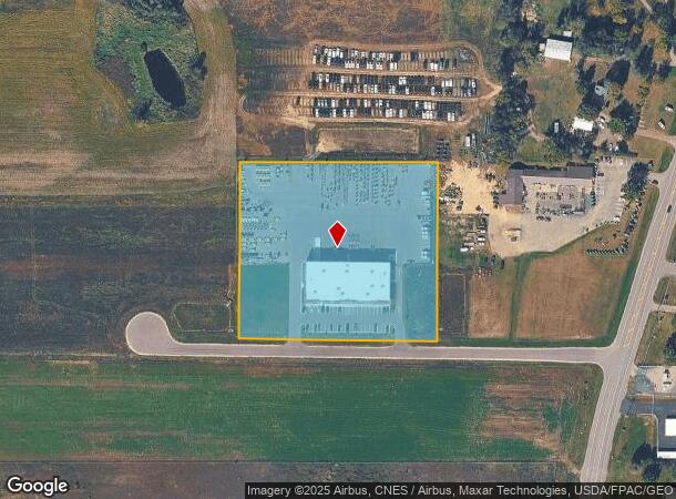
Property Record
6811 137Th Ave Ne, Forest Lake, MN 55025

NEARBY LISTINGS FOR SALE OR LEASE
Property Detail
6811 137Th Ave Ne
Minneapolis-St. Paul-Bloomington, MN-WI
Waldoch Add
33-32-22-24-0015
LOT 3 BLK 1 WALDOCH ADDITION
Commercialnec
Anoka
2024
Minnesota
2025
3
070103
North Central
21,000 SF
Minneapolis/St Paul
DEMOGRAPHICS near 6811 137Th Ave Ne
1 Mile
3 Mile
5 Mile
2024 Total Population
425
6,584
37,157
2029 Population
434
6,816
39,037
Pop Growth 2024-2029
+ 2.12%
+ 3.52%
+ 5.06%
Average Age
44
40
38
2024 Total Households
163
2,304
12,288
HH Growth 2024-2029
+ 1.84%
+ 3.47%
+ 5.07%
Median Household Inc
$96,323
$110,558
$114,264
Avg Household Size
2.60
2.80
2.90
2024 Avg HH Vehicles
3.00
2.00
2.00
Median Home Value
$350,980
$348,002
$387,770
Median Year Built
1980
1988
1998
Nearby Places
Map Layers
Map Styles
 Street
 Aerial
- Restaurants
- Banks
- Shops
- Fitness
- Groceries
PUBLIC TRANSPORTATION
AIRPORT
Minneapolis-St Paul International/Wold-Chamberlain
DRIVE
WALK
Distance
Minneapolis-St Paul International/Wold-Chamberlain
43 min
29.9 mi
Freight Ports
Port Milwaukee
DRIVE
WALK
Distance
Port Milwaukee
387 min
347.8 mi
Nearby Properties
Address
Land Use
TOTAL SIZE
Lot Size
Zoning
Address
Land Use
TOTAL SIZE
Lot Size
Zoning
180,712 SF
15.95 AC
Address
Land Use
TOTAL SIZE
Lot Size
Zoning
Address
Land Use
TOTAL SIZE
Lot Size
Zoning
79,827 SF
2.81 AC
Address
Land Use
TOTAL SIZE
Lot Size
Zoning
51,860 SF
78.12 AC
Address
Land Use
TOTAL SIZE
Lot Size
Zoning
1,144 SF
39 AC
Address
Land Use
TOTAL SIZE
Lot Size
Zoning
95,852 SF
10.10 AC
Address
Land Use
TOTAL SIZE
Lot Size
Zoning
3,600 SF
67.80 AC
Address
Land Use
TOTAL SIZE
Lot Size
Zoning
71,284 SF
2.07 AC
Address
Land Use
TOTAL SIZE
Lot Size
Zoning
78,587 SF
20 AC
Address
Land Use
TOTAL SIZE
Lot Size
Zoning
32,342 SF
5.17 AC
Address
Land Use
TOTAL SIZE
Lot Size
Zoning
9,140 SF
27 AC
Address
Land Use
TOTAL SIZE
Lot Size
Zoning
93,001 SF
11 AC
Address
Land Use
TOTAL SIZE
Lot Size
Zoning
21,748 SF
27.40 AC
Address
Land Use
TOTAL SIZE
Lot Size
Zoning
14,898 SF
Address
Land Use
TOTAL SIZE
Lot Size
Zoning
18,358 SF
2.13 AC
Address
Land Use
TOTAL SIZE
Lot Size
Zoning
21,188 SF
1.88 AC
Address
Land Use
TOTAL SIZE
Lot Size
Zoning
25,296 SF
9 AC
Address
Land Use
TOTAL SIZE
Lot Size
Zoning
19,080 SF
7.94 AC
Address
Land Use
TOTAL SIZE
Lot Size
Zoning
886 SF
26 AC
Address
Land Use
TOTAL SIZE
Lot Size
Zoning
14,160 SF
2.32 AC
Address
Land Use
TOTAL SIZE
Lot Size
Zoning
2,316 SF
1.32 AC
Address
Land Use
TOTAL SIZE
Lot Size
Zoning
14,944 SF
13.95 AC
Address
Land Use
TOTAL SIZE
Lot Size
Zoning
31,360 SF
4.40 AC
Address
Land Use
TOTAL SIZE
Lot Size
Zoning
32,584 SF
0.74 AC
Address
Land Use
TOTAL SIZE
Lot Size
Zoning
8,250 SF
2.22 AC
Address
Land Use
TOTAL SIZE
Lot Size
Zoning
2,104 SF
24.20 AC
Address
Land Use
TOTAL SIZE
Lot Size
Zoning
19,200 SF
2.20 AC
Address
Land Use
TOTAL SIZE
Lot Size
Zoning
10,684 SF
1.13 AC
The World's #1 Commercial Real Estate Marketplace
Connect with us
© 2026 CoStar Group
The information above has been obtained from sources believed reliable. While we do not doubt its accuracy we have not verified it and make no guarantee, warranty or representation about it. It is your responsibility to independently confirm its accuracy and completeness. Any projections, opinions, assumptions, or estimates used are for example only and do not represent the current or future performance of the property. The value of this transaction to you depends on tax and other factors which should be evaluated by your tax, financial, and legal advisors. You and your advisors should conduct a careful, independent investigation of the property to determine to your satisfaction the suitability of the property for your needs.