Property Record
6838 Forney Hill Rd, Denver, NC 28037

Property Detail
6838 Forney Hill Rd
Charlotte-Concord-Gastonia, NC-SC
#11 LT CREEK RUN RECOMB
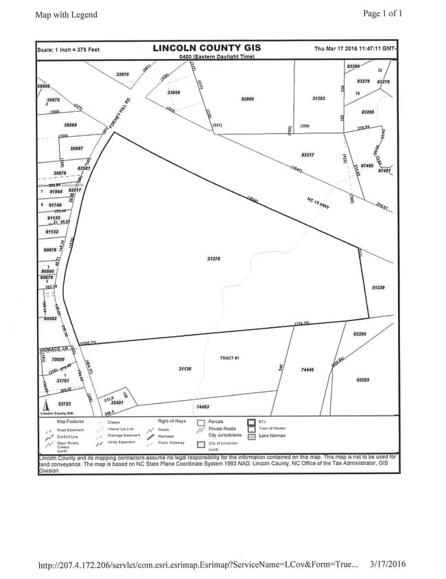
31378
LINCOLN
Residentialacreage
North Carolina
R-T
11
2025
39.13 AC
2025
Lincoln County
071101
Charlotte
NEARBY LISTINGS FOR SALE OR LEASE
DEMOGRAPHICS near 6838 Forney Hill Rd
1 mile
3 mile
5 mile
2025 Total Population
989
12,428
36,156
2030 Population
1,102
13,696
39,749
Pop Growth 2025-2030
+ 11.43%
+ 10.20%
+ 9.94%
Average Age
43
42
43
2025 Total Households
406
4,773
14,158
HH Growth 2025-2030
+ 11.33%
+ 10.25%
+ 9.95%
Median Household Inc
$87,500
$95,897
$98,047
Avg Household Size
2.40
2.60
2.50
2025 Avg HH Vehicles
2.00
2.00
2.00
Median Home Value
$394,936
$445,983
$450,000
Median Year Built
1998
1999
2000
Nearby Places
Map Layers
Map Styles
 Street
 Aerial
Layers
 Traffic
 Biking
Places
Listings with unknown addresses are not visible on the map
- Restaurants
- Banks
- Shops
- Fitness
- Groceries
PUBLIC TRANSPORTATION
AIRPORT
Charlotte/Douglas International
Drive
Walk
Distance
Charlotte/Douglas International
41 min
26.0 mi
Concord-Padgett Regional
Drive
Walk
Distance
Concord-Padgett Regional
40 min
31.4 mi
Freight Ports
North Charleston Terminal
Drive
Walk
Distance
North Charleston Terminal
251 min
221.9 mi
SALE & LEASE HISTORY
LISTING DATE
SALE/LEASE

Jul 31, 2017
For Sale
Nearby Properties
Address
Land Use
TOTAL SIZE
Lot Size
Zoning
Address
Land Use
TOTAL SIZE
Lot Size
Zoning
91,753 SF
19.94 AC
R-T
Address
Land Use
TOTAL SIZE
Lot Size
Zoning
6,264 SF
24.64 AC
ELDD B-G
Address
Land Use
TOTAL SIZE
Lot Size
Zoning
66,136 SF
18.10 AC
ELDD B-N &
Address
Land Use
TOTAL SIZE
Lot Size
Zoning
251,009 SF
20.46 AC
ELDD I-G
Address
Land Use
TOTAL SIZE
Lot Size
Zoning
42,185 SF
5.26 AC
B-G
Address
Land Use
TOTAL SIZE
Lot Size
Zoning
12,948 SF
28.37 AC
R-SF
Address
Land Use
TOTAL SIZE
Lot Size
Zoning
32,163 SF
48.72 AC
ELDD R-T
Address
Land Use
TOTAL SIZE
Lot Size
Zoning
81,228 SF
26.89 AC
ELDD B-N C
Address
Land Use
TOTAL SIZE
Lot Size
Zoning
17,978 SF
39.55 AC
R-T
Address
Land Use
TOTAL SIZE
Lot Size
Zoning
601.08 AC
R-T
Address
Land Use
TOTAL SIZE
Lot Size
Zoning
8,100 SF
275.67 AC
PD-R CU
Address
Land Use
TOTAL SIZE
Lot Size
Zoning
20,923 SF
2.83 AC
R-S CU
Address
Land Use
TOTAL SIZE
Lot Size
Zoning
45,326 SF
4.45 AC
ELDD B-G
Address
Land Use
TOTAL SIZE
Lot Size
Zoning
12,000 SF
7.87 AC
ELDD B-G C
Address
Land Use
TOTAL SIZE
Lot Size
Zoning
14,736 SF
1.44 AC
HC
Address
Land Use
TOTAL SIZE
Lot Size
Zoning
12,500 SF
2.53 AC
ELDD B-G
Address
Land Use
TOTAL SIZE
Lot Size
Zoning
19,952 SF
2.24 AC
ELDD B-N
Address
Land Use
TOTAL SIZE
Lot Size
Zoning
9,657 SF
6.29 AC
R-T
Address
Land Use
TOTAL SIZE
Lot Size
Zoning
10,768 SF
2.20 AC
HC
Address
Land Use
TOTAL SIZE
Lot Size
Zoning
24,548 SF
11.40 AC
ELDD B-G
Address
Land Use
TOTAL SIZE
Lot Size
Zoning
20,000 SF
2.60 AC
ELDD I-G
Address
Land Use
TOTAL SIZE
Lot Size
Zoning
60,000 SF
28.03 AC
ELDD I-G
Address
Land Use
TOTAL SIZE
Lot Size
Zoning
16,000 SF
3.12 AC
ELDD B-G
Address
Land Use
TOTAL SIZE
Lot Size
Zoning
23,940 SF
3.63 AC
I-G
Address
Land Use
TOTAL SIZE
Lot Size
Zoning
13,512 SF
2.23 AC
ELDD B-G C
Address
Land Use
TOTAL SIZE
Lot Size
Zoning
30,048 SF
2 AC
I-G
Address
Land Use
TOTAL SIZE
Lot Size
Zoning
41,606 SF
4.69 AC
PD
Address
Land Use
TOTAL SIZE
Lot Size
Zoning
8,600 SF
28.44 AC
R-T
Address
Land Use
TOTAL SIZE
Lot Size
Zoning
25,224 SF
10.99 AC
ELDD I-L
Address
Land Use
TOTAL SIZE
Lot Size
Zoning
33,442 SF
4.59 AC
HC
The World's #1 Commercial Real Estate Marketplace
Connect with us
© 2026 CoStar Group
The information above has been obtained from sources believed reliable. While we do not doubt its accuracy we have not verified it and make no guarantee, warranty or representation about it. It is your responsibility to independently confirm its accuracy and completeness. Any projections, opinions, assumptions, or estimates used are for example only and do not represent the current or future performance of the property. The value of this transaction to you depends on tax and other factors which should be evaluated by your tax, financial, and legal advisors. You and your advisors should conduct a careful, independent investigation of the property to determine to your satisfaction the suitability of the property for your needs.