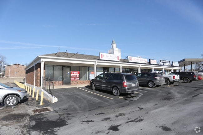
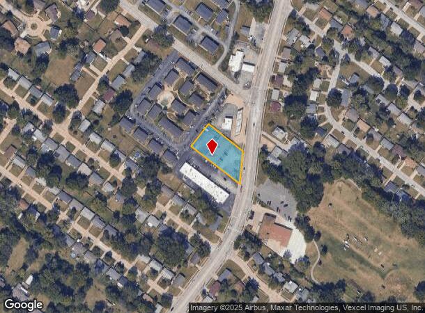
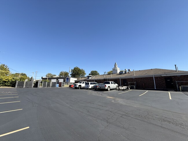
Property Record
6841 Howdershell Rd, Hazelwood, MO 63042
NEARBY LISTINGS FOR SALE OR LEASE
Property Detail
6841 Howdershell Rd
St. Louis, MO-IL
Chez Orleans Sub
08L-21-1139
CHEZ ORLEANS SUB 5 17 84 LOT 2
Storebuilding
St. Louis
X
Missouri
29183C0295G
2
2024
0.66 AC
2025
Northwest County
211401
St. Louis
5,750 SF
DEMOGRAPHICS near 6841 Howdershell Rd
1 mile
3 mile
5 mile
2024 Total Population
9,202
49,046
143,448
2029 Population
8,994
47,948
140,940
Pop Growth 2024-2029
(2.26%)
(2.24%)
(1.75%)
Average Age
40
39
39
2024 Total Households
3,826
20,524
58,263
HH Growth 2024-2029
(2.33%)
(2.28%)
(1.81%)
Median Household Inc
$66,134
$57,130
$56,325
Avg Household Size
2.30
2.30
2.40
2024 Avg HH Vehicles
2.00
2.00
2.00
Median Home Value
$164,071
$142,592
$141,378
Median Year Built
1967
1965
1964
Nearby Places
Map Layers
Map Styles
 Street
 Aerial
Transit
 Traffic
 Biking
Places
Listings with unknown addresses are not visible on the map
- Restaurants
- Banks
- Shops
- Fitness
- Groceries
PUBLIC TRANSPORTATION
COMMUTER RAIL
Lambert Airport East Terminal (Lambert Airport Shiloh-Scott - St. Louis MetroLink (MetroLink))
Drive
Walk
Distance
Lambert Airport East Terminal (Lambert Airport Shiloh-Scott - St. Louis MetroLink (MetroLink))
12 min
7.0 mi
Lambert Airport Main Terminal (Lambert Airport Shiloh-Scott - St. Louis MetroLink (MetroLink))
Drive
Walk
Distance
Lambert Airport Main Terminal (Lambert Airport Shiloh-Scott - St. Louis MetroLink (MetroLink))
14 min
7.6 mi
AIRPORT
St Louis Lambert International
Drive
Walk
Distance
St Louis Lambert International
9 min
4.7 mi
Freight Ports
Port Milwaukee
Drive
Walk
Distance
Port Milwaukee
428 min
376.5 mi
SALE & LEASE HISTORY
LISTING DATE
SALE/LEASE

Feb 14, 2018
For Lease
Nearby Properties
Address
Land Use
TOTAL SIZE
Lot Size
Zoning
Address
Land Use
TOTAL SIZE
Lot Size
Zoning
1,817,830 SF
75.99 AC
M1
Address
Land Use
TOTAL SIZE
Lot Size
Zoning
4,416 SF
54.81 AC
80B
Address
Land Use
TOTAL SIZE
Lot Size
Zoning
893,188 SF
71.88 AC
G
Address
Land Use
TOTAL SIZE
Lot Size
Zoning
815,658 SF
28.70 AC
M1
Address
Land Use
TOTAL SIZE
Lot Size
Zoning
816,783 SF
37.97 AC
7M-1
Address
Land Use
TOTAL SIZE
Lot Size
Zoning
528,000 SF
21.10 AC
80I
Address
Land Use
TOTAL SIZE
Lot Size
Zoning
491,800 SF
18.69 AC
80AG
Address
Land Use
TOTAL SIZE
Lot Size
Zoning
406,000 SF
18.82 AC
80CA
Address
Land Use
TOTAL SIZE
Lot Size
Zoning
445,715 SF
28.16 AC
80I
Address
Land Use
TOTAL SIZE
Lot Size
Zoning
343,900 SF
19.62 AC
80AG
Address
Land Use
TOTAL SIZE
Lot Size
Zoning
335,294 SF
33.83 AC
24MFD
Address
Land Use
TOTAL SIZE
Lot Size
Zoning
6.88 AC
H
Address
Land Use
TOTAL SIZE
Lot Size
Zoning
293,622 SF
28.06 AC
H
Address
Land Use
TOTAL SIZE
Lot Size
Zoning
659,138 SF
1,142.84 AC
M1
Address
Land Use
TOTAL SIZE
Lot Size
Zoning
262,938 SF
11.32 AC
80H
Address
Land Use
TOTAL SIZE
Lot Size
Zoning
161,536 SF
7.91 AC
R5
Address
Land Use
TOTAL SIZE
Lot Size
Zoning
269,258 SF
89.80 AC
80F
Address
Land Use
TOTAL SIZE
Lot Size
Zoning
216,000 SF
16.42 AC
80AG
Address
Land Use
TOTAL SIZE
Lot Size
Zoning
135,721 SF
5.40 AC
80F
Address
Land Use
TOTAL SIZE
Lot Size
Zoning
387,158 SF
34.19 AC
R6
Address
Land Use
TOTAL SIZE
Lot Size
Zoning
780,115 SF
17.91 AC
PD
Address
Land Use
TOTAL SIZE
Lot Size
Zoning
196,819 SF
9.83 AC
7M-1
Address
Land Use
TOTAL SIZE
Lot Size
Zoning
36.40 AC
80I
Address
Land Use
TOTAL SIZE
Lot Size
Zoning
203,240 SF
8.50 AC
80H
Address
Land Use
TOTAL SIZE
Lot Size
Zoning
213,100 SF
11.28 AC
80AG
Address
Land Use
TOTAL SIZE
Lot Size
Zoning
382,000 SF
28.06 AC
80I
Address
Land Use
TOTAL SIZE
Lot Size
Zoning
123,173 SF
1,142.68 AC
NU
Address
Land Use
TOTAL SIZE
Lot Size
Zoning
76.67 AC
80I
Address
Land Use
TOTAL SIZE
Lot Size
Zoning
999 SF
21.20 AC
R
Address
Land Use
TOTAL SIZE
Lot Size
Zoning
305,740 SF
15.77 AC
7M-1
The World's #1 Commercial Real Estate Marketplace
Connect with us
© 2026 CoStar Group
The information above has been obtained from sources believed reliable. While we do not doubt its accuracy we have not verified it and make no guarantee, warranty or representation about it. It is your responsibility to independently confirm its accuracy and completeness. Any projections, opinions, assumptions, or estimates used are for example only and do not represent the current or future performance of the property. The value of this transaction to you depends on tax and other factors which should be evaluated by your tax, financial, and legal advisors. You and your advisors should conduct a careful, independent investigation of the property to determine to your satisfaction the suitability of the property for your needs.