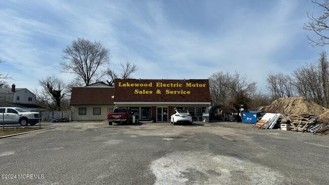
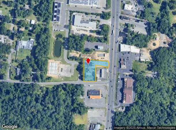
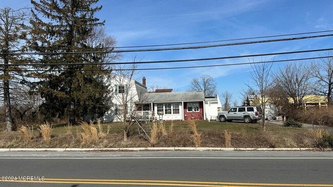
Property Record
6850 6854 Us Highway 9, Howell, NJ 07731
Current Lease Availabilities
NEARBY LISTINGS FOR SALE OR LEASE
Property Detail
6850 6854 Us Highway 9
21-00071-0000-00003
Monmouth
Vehiclerentalsvehiclesales
New Jersey
X
3
34025C0430F
0.84 AC
2024
Western Monmouth
2025
Northern New Jersey
811402
New York-Jersey City-White Plains, NY-NJ
5,852 SF
DEMOGRAPHICS near 6850 6854 Us Highway 9
1 Mile
3 Mile
5 Mile
2024 Total Population
13,522
105,594
194,305
2029 Population
13,508
105,547
196,226
Pop Growth 2024-2029
(0.10%)
(0.04%)
+ 0.99%
Average Age
26
26
31
2024 Total Households
2,958
22,760
51,451
HH Growth 2024-2029
(1.56%)
(1.89%)
(0.16%)
Median Household Inc
$51,021
$68,829
$75,767
Avg Household Size
3.90
4.10
3.40
2024 Avg HH Vehicles
2.00
2.00
2.00
Median Home Value
$491,944
$419,262
$378,725
Median Year Built
1974
1984
1986
Nearby Places
- Restaurants
- Banks
- Shops
- Fitness
- Groceries
PUBLIC TRANSPORTATION
AIRPORT
Trenton Mercer
DRIVE
WALK
Distance
Trenton Mercer
56 min
41.0 mi
Freight Ports
New York Container Terminal
DRIVE
WALK
Distance
New York Container Terminal
58 min
43.4 mi
Nearby Properties
Address
Land Use
TOTAL SIZE
Lot Size
Zoning
Address
Land Use
TOTAL SIZE
Lot Size
Zoning
113.02 AC
R12
Address
Land Use
TOTAL SIZE
Lot Size
Zoning
12.43 AC
HD7
Address
Land Use
TOTAL SIZE
Lot Size
Zoning
155.11 AC
PFE/
Address
Land Use
TOTAL SIZE
Lot Size
Zoning
24.15 AC
MF
Address
Land Use
TOTAL SIZE
Lot Size
Zoning
338.52 AC
OSP
Address
Land Use
TOTAL SIZE
Lot Size
Zoning
105.04 AC
SED
Address
Land Use
TOTAL SIZE
Lot Size
Zoning
2,382 SF
341 AC
OSP
Address
Land Use
TOTAL SIZE
Lot Size
Zoning
161,340 SF
35.35 AC
HD-1
Address
Land Use
TOTAL SIZE
Lot Size
Zoning
237,479 SF
21 AC
LC
Address
Land Use
TOTAL SIZE
Lot Size
Zoning
21,876 SF
22.26 AC
B3
Address
Land Use
TOTAL SIZE
Lot Size
Zoning
1,032 SF
12.50 AC
HC
Address
Land Use
TOTAL SIZE
Lot Size
Zoning
36.25 AC
R12
Address
Land Use
TOTAL SIZE
Lot Size
Zoning
50,125 SF
19.18 AC
M1
Address
Land Use
TOTAL SIZE
Lot Size
Zoning
17,676 SF
7.25 AC
R15
Address
Land Use
TOTAL SIZE
Lot Size
Zoning
15.17 AC
M1
Address
Land Use
TOTAL SIZE
Lot Size
Zoning
28.99 AC
HD-1
Address
Land Use
TOTAL SIZE
Lot Size
Zoning
94,380 SF
8.71 AC
B4
Address
Land Use
TOTAL SIZE
Lot Size
Zoning
14.73 AC
R-5
Address
Land Use
TOTAL SIZE
Lot Size
Zoning
37,202 SF
14.79 AC
B3
Address
Land Use
TOTAL SIZE
Lot Size
Zoning
85,995 SF
7.60 AC
M1
Address
Land Use
TOTAL SIZE
Lot Size
Zoning
39.28 AC
R12
Address
Land Use
TOTAL SIZE
Lot Size
Zoning
93,712 SF
15.17 AC
M1
Address
Land Use
TOTAL SIZE
Lot Size
Zoning
8,784 SF
16.16 AC
R-LM
Address
Land Use
TOTAL SIZE
Lot Size
Zoning
1,825 SF
49.38 AC
OSP
Address
Land Use
TOTAL SIZE
Lot Size
Zoning
19.11 AC
M1
Address
Land Use
TOTAL SIZE
Lot Size
Zoning
8.43 AC
MF
Address
Land Use
TOTAL SIZE
Lot Size
Zoning
17.08 AC
R15
Address
Land Use
TOTAL SIZE
Lot Size
Zoning
1,270 SF
3.65 AC
R12
Address
Land Use
TOTAL SIZE
Lot Size
Zoning
360,400 SF
35.98 AC
SED
Address
Land Use
TOTAL SIZE
Lot Size
Zoning
112 SF
20.47 AC
HCMF
The World's #1 Commercial Real Estate Marketplace
Connect with us
© 2025 CoStar Group
The information above has been obtained from sources believed reliable. While we do not doubt its accuracy we have not verified it and make no guarantee, warranty or representation about it. It is your responsibility to independently confirm its accuracy and completeness. Any projections, opinions, assumptions, or estimates used are for example only and do not represent the current or future performance of the property. The value of this transaction to you depends on tax and other factors which should be evaluated by your tax, financial, and legal advisors. You and your advisors should conduct a careful, independent investigation of the property to determine to your satisfaction the suitability of the property for your needs.