Property Record
6866 W Indian School Rd, Phoenix, AZ 85033
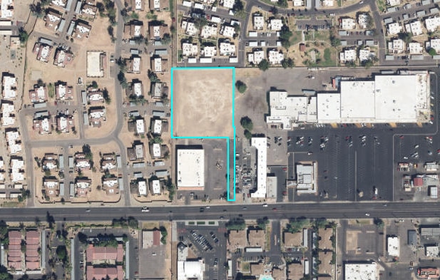


This Property Is For Sale
Property Detail
6866 W Indian School Rd
Phoenix-Mesa-Chandler, AZ
SUNSET SQUARE MCR 855-32
144-40-474A
MARICOPA
Commercialacreage
Arizona
C-C
1
C and X Area of minimal flood hazard, usually depicted on FIRMs as above the 500-year flood level.
2.26 AC
2025
Glendale
2025
Phoenix
109602
NEARBY LISTINGS FOR SALE OR LEASE
-
-
-
-
NWC Of 77th And Indian School Rd @ W Indian School Rd
Phoenix, AZ 85033
$1,689,715
2.36 AC Lots
Land
-
-
-
-
-
-
-
View all Phoenix listings for sale on LoopNet.com
DEMOGRAPHICS near 6866 W Indian School Rd
1 mile
3 mile
5 mile
2025 Total Population
30,095
222,709
442,916
2030 Population
30,879
229,152
457,991
Pop Growth 2025-2030
+ 2.61%
+ 2.89%
+ 3.40%
Average Age
32
33
34
2025 Total Households
8,187
62,238
130,230
HH Growth 2025-2030
+ 2.72%
+ 2.99%
+ 3.62%
Median Household Inc
$61,244
$62,967
$62,407
Avg Household Size
3.50
3.40
3.20
2025 Avg HH Vehicles
2.00
2.00
2.00
Median Home Value
$299,582
$310,655
$324,498
Median Year Built
1978
1978
1980
Nearby Places
Map Layers
Map Styles
 Street
 Aerial
Layers
 Traffic
 Biking
Places
Listings with unknown addresses are not visible on the map
- Restaurants
- Banks
- Shops
- Fitness
- Groceries
PUBLIC TRANSPORTATION
AIRPORT
Phoenix Sky Harbor International
Drive
Walk
Distance
Phoenix Sky Harbor International
26 min
16.3 mi
Freight Ports
Port of San Diego
Drive
Walk
Distance
Port of San Diego
391 min
349.6 mi
Nearby Properties
Address
Land Use
TOTAL SIZE
Lot Size
Zoning
Address
Land Use
TOTAL SIZE
Lot Size
Zoning
Address
Land Use
TOTAL SIZE
Lot Size
Zoning
1,267,497 SF
70.43 AC
A1
Address
Land Use
TOTAL SIZE
Lot Size
Zoning
281,038 SF
7.71 AC
Address
Land Use
TOTAL SIZE
Lot Size
Zoning
285,815 SF
37.17 AC
R-6
Address
Land Use
TOTAL SIZE
Lot Size
Zoning
348,753 SF
19.36 AC
R-6
Address
Land Use
TOTAL SIZE
Lot Size
Zoning
587,843 SF
20.49 AC
PAD
Address
Land Use
TOTAL SIZE
Lot Size
Zoning
629,928 SF
41.37 AC
Address
Land Use
TOTAL SIZE
Lot Size
Zoning
351,903 SF
29.13 AC
A1
Address
Land Use
TOTAL SIZE
Lot Size
Zoning
436,817 SF
23.21 AC
I-P
Address
Land Use
TOTAL SIZE
Lot Size
Zoning
316,386 SF
45.04 AC
R16
Address
Land Use
TOTAL SIZE
Lot Size
Zoning
25.91 AC
A1
Address
Land Use
TOTAL SIZE
Lot Size
Zoning
350,874 SF
28.66 AC
C-C
Address
Land Use
TOTAL SIZE
Lot Size
Zoning
660,807 SF
31.44 AC
PAD-14
Address
Land Use
TOTAL SIZE
Lot Size
Zoning
498,064 SF
12.92 AC
C-N
Address
Land Use
TOTAL SIZE
Lot Size
Zoning
1.05 AC
Address
Land Use
TOTAL SIZE
Lot Size
Zoning
587,158 SF
36.23 AC
I-P
Address
Land Use
TOTAL SIZE
Lot Size
Zoning
132,597 SF
59.45 AC
C-2
Address
Land Use
TOTAL SIZE
Lot Size
Zoning
92,600 SF
20 AC
C-C
Address
Land Use
TOTAL SIZE
Lot Size
Zoning
367,133 SF
17.88 AC
IND.PK.
Address
Land Use
TOTAL SIZE
Lot Size
Zoning
108,128 SF
18.55 AC
R-43AG
Address
Land Use
TOTAL SIZE
Lot Size
Zoning
95,080 SF
17.39 AC
C2
Address
Land Use
TOTAL SIZE
Lot Size
Zoning
706,747 SF
13.54 AC
R-5
Address
Land Use
TOTAL SIZE
Lot Size
Zoning
405,621 SF
19.58 AC
M-M
Address
Land Use
TOTAL SIZE
Lot Size
Zoning
206,709 SF
11.76 AC
Address
Land Use
TOTAL SIZE
Lot Size
Zoning
95,025 SF
13.59 AC
R1-6
Address
Land Use
TOTAL SIZE
Lot Size
Zoning
404,407 SF
20.94 AC
M-H
Address
Land Use
TOTAL SIZE
Lot Size
Zoning
219,960 SF
12.10 AC
I-P
Address
Land Use
TOTAL SIZE
Lot Size
Zoning
120,680 SF
19.15 AC
A-1
Address
Land Use
TOTAL SIZE
Lot Size
Zoning
134,215 SF
17.75 AC
R-6
Address
Land Use
TOTAL SIZE
Lot Size
Zoning
116,276 SF
11.58 AC
R-6
The World's #1 Commercial Real Estate Marketplace
Connect with us
© 2026 CoStar Group
The information above has been obtained from sources believed reliable. While we do not doubt its accuracy we have not verified it and make no guarantee, warranty or representation about it. It is your responsibility to independently confirm its accuracy and completeness. Any projections, opinions, assumptions, or estimates used are for example only and do not represent the current or future performance of the property. The value of this transaction to you depends on tax and other factors which should be evaluated by your tax, financial, and legal advisors. You and your advisors should conduct a careful, independent investigation of the property to determine to your satisfaction the suitability of the property for your needs.