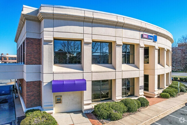
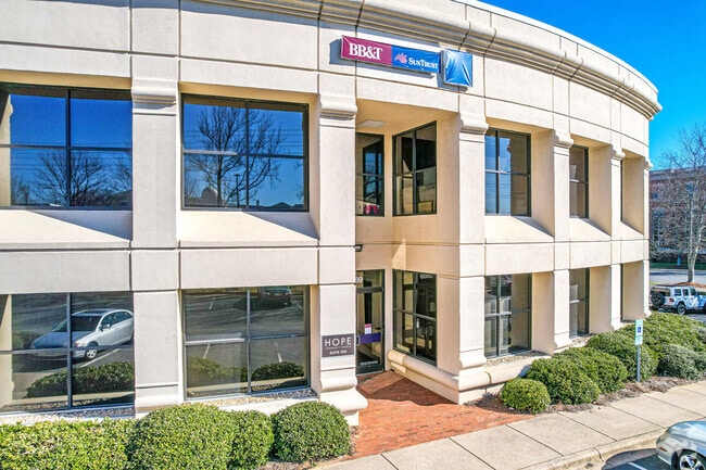
Property Record
6869 Fairview Rd, Charlotte, NC 28210
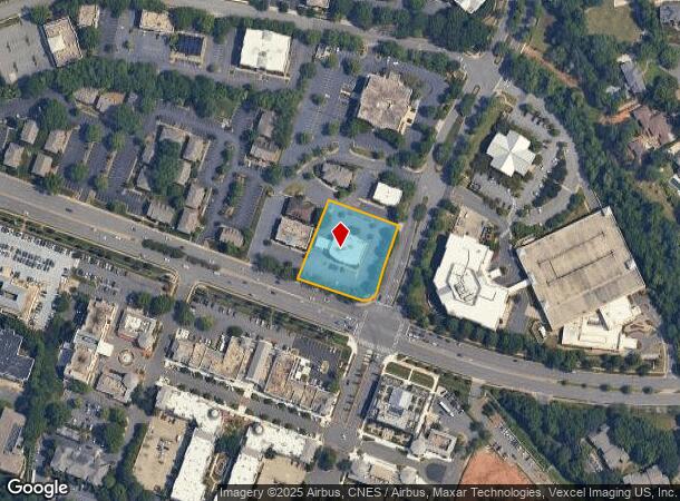
NEARBY LISTINGS FOR SALE OR LEASE
Property Detail
6869 Fairview Rd
183-134-95
Graham Heights West
Officebuilding
Mecklenburg
X
North Carolina
3710455100K
95
2024
1.15 AC
2025
SouthPark
002903
Charlotte
11,800 SF
Charlotte-Concord-Gastonia, NC-SC
DEMOGRAPHICS near 6869 Fairview Rd
1 mile
3 mile
5 mile
2024 Total Population
11,548
89,070
255,427
2029 Population
12,222
93,994
269,704
Pop Growth 2024-2029
+ 5.84%
+ 5.53%
+ 5.59%
Average Age
42
40
38
2024 Total Households
5,763
38,835
113,211
HH Growth 2024-2029
+ 5.87%
+ 5.65%
+ 5.65%
Median Household Inc
$111,408
$112,476
$86,328
Avg Household Size
2.00
2.20
2.20
2024 Avg HH Vehicles
2.00
2.00
2.00
Median Home Value
$717,046
$615,211
$482,921
Median Year Built
1994
1980
1985
Nearby Places
Map Layers
Map Styles
 Street
 Aerial
Transit
 Traffic
 Biking
Places
Listings with unknown addresses are not visible on the map
- Restaurants
- Banks
- Shops
- Fitness
- Groceries
PUBLIC TRANSPORTATION
COMMUTER RAIL
Drive
Walk
Distance
15 min
8.1 mi
AIRPORT
Charlotte/Douglas International
Drive
Walk
Distance
Charlotte/Douglas International
21 min
10.4 mi
Concord-Padgett Regional
Drive
Walk
Distance
Concord-Padgett Regional
35 min
21.4 mi
SALE & LEASE HISTORY
LISTING DATE
SALE/LEASE

Aug 13, 2018
For Lease
Nearby Properties
Address
Land Use
TOTAL SIZE
Lot Size
Zoning
Address
Land Use
TOTAL SIZE
Lot Size
Zoning
875,672 SF
41.66 AC
CC
Address
Land Use
TOTAL SIZE
Lot Size
Zoning
965,867 SF
5.81 AC
O1
Address
Land Use
TOTAL SIZE
Lot Size
Zoning
709,410 SF
22.24 AC
INSTCD
Address
Land Use
TOTAL SIZE
Lot Size
Zoning
692,098 SF
7.83 AC
MUDDO
Address
Land Use
TOTAL SIZE
Lot Size
Zoning
711,907 SF
4.84 AC
Address
Land Use
TOTAL SIZE
Lot Size
Zoning
573,667 SF
5.81 AC
MUDDO
Address
Land Use
TOTAL SIZE
Lot Size
Zoning
831,732 SF
24.50 AC
R3
Address
Land Use
TOTAL SIZE
Lot Size
Zoning
546,111 SF
4.85 AC
MUDDCD
Address
Land Use
TOTAL SIZE
Lot Size
Zoning
653,339 SF
6.20 AC
Address
Land Use
TOTAL SIZE
Lot Size
Zoning
572,979 SF
5.60 AC
O3
Address
Land Use
TOTAL SIZE
Lot Size
Zoning
528,907 SF
18.13 AC
CC
Address
Land Use
TOTAL SIZE
Lot Size
Zoning
460,937 SF
2.67 AC
O1
Address
Land Use
TOTAL SIZE
Lot Size
Zoning
544,973 SF
3.42 AC
Address
Land Use
TOTAL SIZE
Lot Size
Zoning
501,350 SF
6.82 AC
Address
Land Use
TOTAL SIZE
Lot Size
Zoning
586,989 SF
6.50 AC
Address
Land Use
TOTAL SIZE
Lot Size
Zoning
356,838 SF
27.63 AC
B1
Address
Land Use
TOTAL SIZE
Lot Size
Zoning
427,305 SF
3.21 AC
O2CD
Address
Land Use
TOTAL SIZE
Lot Size
Zoning
422,653 SF
58.70 AC
R3
Address
Land Use
TOTAL SIZE
Lot Size
Zoning
328,090 SF
70.27 AC
R3
Address
Land Use
TOTAL SIZE
Lot Size
Zoning
471,303 SF
4.30 AC
O3
Address
Land Use
TOTAL SIZE
Lot Size
Zoning
518,503 SF
5.34 AC
O1
Address
Land Use
TOTAL SIZE
Lot Size
Zoning
430,000 SF
7.25 AC
MUDDO
Address
Land Use
TOTAL SIZE
Lot Size
Zoning
287,182 SF
21.73 AC
CC
Address
Land Use
TOTAL SIZE
Lot Size
Zoning
424,279 SF
4.20 AC
R43MF
Address
Land Use
TOTAL SIZE
Lot Size
Zoning
476,244 SF
2.78 AC
Address
Land Use
TOTAL SIZE
Lot Size
Zoning
287,611 SF
12.73 AC
R3
Address
Land Use
TOTAL SIZE
Lot Size
Zoning
231,502 SF
2.22 AC
MUDDO
Address
Land Use
TOTAL SIZE
Lot Size
Zoning
471,547 SF
10.68 AC
Address
Land Use
TOTAL SIZE
Lot Size
Zoning
402,998 SF
23.82 AC
RI
Address
Land Use
TOTAL SIZE
Lot Size
Zoning
289,095 SF
8.38 AC
R43MFCD
The World's #1 Commercial Real Estate Marketplace
Connect with us
© 2026 CoStar Group
The information above has been obtained from sources believed reliable. While we do not doubt its accuracy we have not verified it and make no guarantee, warranty or representation about it. It is your responsibility to independently confirm its accuracy and completeness. Any projections, opinions, assumptions, or estimates used are for example only and do not represent the current or future performance of the property. The value of this transaction to you depends on tax and other factors which should be evaluated by your tax, financial, and legal advisors. You and your advisors should conduct a careful, independent investigation of the property to determine to your satisfaction the suitability of the property for your needs.