Property Record
6875 E 54Th Pl, Commerce City, CO 80022


Property Detail
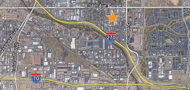
6875 E 54Th Pl
1823-17-1-01-025
SUB:KEMP SUBD DESC: PLOT 16 AND 17
Warehouse
Adams
I2
Colorado
B and X Area of moderate flood hazard, usually the area between the limits of the 100-year and 500-year floods.
1.69 AC
2024
East I-70/270
2025
Denver
008709
Denver-Aurora-Centennial, CO
11,520 SF
NEARBY LISTINGS FOR SALE OR LEASE
DEMOGRAPHICS near 6875 E 54Th Pl
1 mile
3 mile
5 mile
2024 Total Population
6,476
69,276
260,896
2029 Population
6,605
71,094
268,004
Pop Growth 2024-2029
+ 1.99%
+ 2.62%
+ 2.72%
Average Age
35
36
36
2024 Total Households
2,036
23,764
98,768
HH Growth 2024-2029
+ 2.31%
+ 2.60%
+ 2.85%
Median Household Inc
$80,389
$96,339
$92,385
Avg Household Size
3.00
2.80
2.50
2024 Avg HH Vehicles
2.00
2.00
2.00
Median Home Value
$461,538
$571,236
$584,004
Median Year Built
1996
1979
1971
Nearby Places
Map Layers
Map Styles
 Street
 Aerial
Transit
 Traffic
 Biking
Places
Listings with unknown addresses are not visible on the map
- Restaurants
- Banks
- Shops
- Fitness
- Groceries
PUBLIC TRANSPORTATION
AIRPORT
Denver International
Drive
Walk
Distance
Denver International
26 min
16.3 mi
SALE & LEASE HISTORY
LISTING DATE
SALE/LEASE

Nov 12, 2024
For Sale
Jul 16, 2024
For Lease
Nearby Properties
Address
Land Use
TOTAL SIZE
Lot Size
Zoning
Address
Land Use
TOTAL SIZE
Lot Size
Zoning
396,741 SF
8.12 AC
A1
Address
Land Use
TOTAL SIZE
Lot Size
Zoning
677,018 SF
5.05 AC
C-MX
Address
Land Use
TOTAL SIZE
Lot Size
Zoning
719,357 SF
21.47 AC
M-MX-5
Address
Land Use
TOTAL SIZE
Lot Size
Zoning
343,997 SF
6.36 AC
S-MX-5
Address
Land Use
TOTAL SIZE
Lot Size
Zoning
256,155 SF
3.84 AC
Address
Land Use
TOTAL SIZE
Lot Size
Zoning
169,941 SF
4.08 AC
I-B
Address
Land Use
TOTAL SIZE
Lot Size
Zoning
723,053 SF
32.44 AC
M-IMX-12
Address
Land Use
TOTAL SIZE
Lot Size
Zoning
269,025 SF
18.86 AC
M-RX-5
Address
Land Use
TOTAL SIZE
Lot Size
Zoning
17,063 SF
2.01 AC
Address
Land Use
TOTAL SIZE
Lot Size
Zoning
45,803 SF
1.96 AC
M-IMX-5
Address
Land Use
TOTAL SIZE
Lot Size
Zoning
254,509 SF
16.29 AC
E-SU-DX
Address
Land Use
TOTAL SIZE
Lot Size
Zoning
97,306 SF
4.25 AC
C-MX
Address
Land Use
TOTAL SIZE
Lot Size
Zoning
3,573.99 AC
A3
Address
Land Use
TOTAL SIZE
Lot Size
Zoning
134,729 SF
5.57 AC
Address
Land Use
TOTAL SIZE
Lot Size
Zoning
109,982 SF
2.92 AC
M-IMX-12
Address
Land Use
TOTAL SIZE
Lot Size
Zoning
88,214 SF
3.40 AC
C-MX
Address
Land Use
TOTAL SIZE
Lot Size
Zoning
599,680 SF
43.94 AC
Address
Land Use
TOTAL SIZE
Lot Size
Zoning
6.97 AC
C-MU-20
Address
Land Use
TOTAL SIZE
Lot Size
Zoning
651,423 SF
82.50 AC
I-2
Address
Land Use
TOTAL SIZE
Lot Size
Zoning
116,502 SF
4.08 AC
Address
Land Use
TOTAL SIZE
Lot Size
Zoning
296,000 SF
52.44 AC
A3
Address
Land Use
TOTAL SIZE
Lot Size
Zoning
646,975 SF
32.60 AC
M-IMX-8
Address
Land Use
TOTAL SIZE
Lot Size
Zoning
185,207 SF
9.94 AC
C-MU-20
Address
Land Use
TOTAL SIZE
Lot Size
Zoning
94,213 SF
3.84 AC
A1
Address
Land Use
TOTAL SIZE
Lot Size
Zoning
138,799 SF
16.28 AC
I-A
Address
Land Use
TOTAL SIZE
Lot Size
Zoning
90,760 SF
6.48 AC
Address
Land Use
TOTAL SIZE
Lot Size
Zoning
124,526 SF
10 AC
M-RH-3
Address
Land Use
TOTAL SIZE
Lot Size
Zoning
268,268 SF
29.99 AC
I-B
Address
Land Use
TOTAL SIZE
Lot Size
Zoning
466,055 SF
24.82 AC
M-IMX-5
Address
Land Use
TOTAL SIZE
Lot Size
Zoning
1,048,207 SF
57.91 AC
I-B
The World's #1 Commercial Real Estate Marketplace
Connect with us
© 2026 CoStar Group
The information above has been obtained from sources believed reliable. While we do not doubt its accuracy we have not verified it and make no guarantee, warranty or representation about it. It is your responsibility to independently confirm its accuracy and completeness. Any projections, opinions, assumptions, or estimates used are for example only and do not represent the current or future performance of the property. The value of this transaction to you depends on tax and other factors which should be evaluated by your tax, financial, and legal advisors. You and your advisors should conduct a careful, independent investigation of the property to determine to your satisfaction the suitability of the property for your needs.