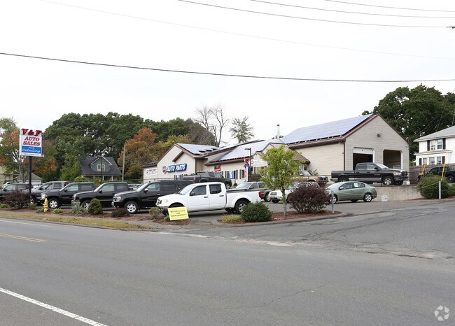
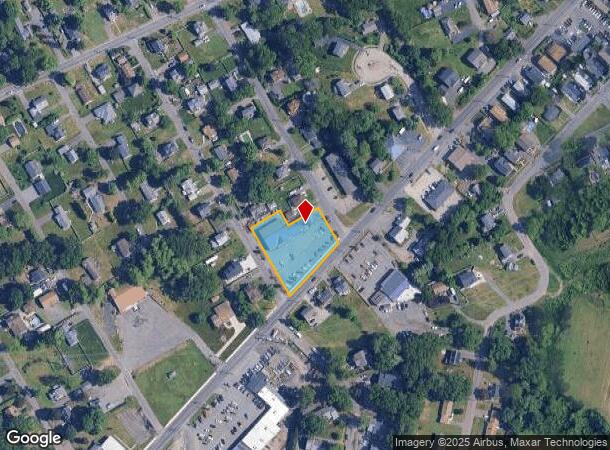
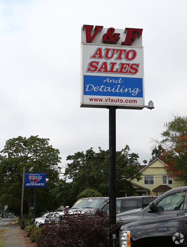
Property Record
7 Harding St, Agawam, MA 01001
NEARBY LISTINGS FOR SALE OR LEASE
Property Detail
7 Harding St
AGAW-000014H-000012-000001
Hampden
Autorepair
Massachusetts
X
1
25013C0384E
0.80 AC
2025
Hampden County
2025
Hartford
813207
Springfield, MA
6,067 SF
DEMOGRAPHICS near 7 Harding St
1 Mile
3 Mile
5 Mile
2024 Total Population
6,176
50,893
158,800
2029 Population
6,086
49,861
155,645
Pop Growth 2024-2029
(1.46%)
(2.03%)
(1.99%)
Average Age
41
41
39
2024 Total Households
2,604
20,786
61,750
HH Growth 2024-2029
(1.54%)
(2.11%)
(2.03%)
Median Household Inc
$73,960
$66,935
$52,819
Avg Household Size
2.40
2.40
2.40
2024 Avg HH Vehicles
2.00
2.00
1.00
Median Home Value
$262,804
$268,815
$266,215
Median Year Built
1958
1960
1952
Nearby Places
Map Layers
Map Styles
 Street
 Aerial
- Restaurants
- Banks
- Shops
- Fitness
- Groceries
PUBLIC TRANSPORTATION
COMMUTER RAIL
Springfield (Amtrak Hartford Line - Amtrak, Hartford Line - Amtrak, Lake Shore Limited - Amtrak, Northeast Regional - Amtrak, Valley Flyer - Amtrak, Vermonter - Amtrak)
DRIVE
WALK
Distance
Springfield (Amtrak Hartford Line - Amtrak, Hartford Line - Amtrak, Lake Shore Limited - Amtrak, Northeast Regional - Amtrak, Valley Flyer - Amtrak, Vermonter - Amtrak)
6 min
3.7 mi
AIRPORT
Bradley International
DRIVE
WALK
Distance
Bradley International
29 min
12.0 mi
Freight Ports
Port of New Haven
DRIVE
WALK
Distance
Port of New Haven
87 min
67.3 mi
Nearby Properties
Address
Land Use
TOTAL SIZE
Lot Size
Zoning
Address
Land Use
TOTAL SIZE
Lot Size
Zoning
257,525 SF
64.03 AC
Address
Land Use
TOTAL SIZE
Lot Size
Zoning
36.53 AC
IB
Address
Land Use
TOTAL SIZE
Lot Size
Zoning
200,000 SF
13.91 AC
R3
Address
Land Use
TOTAL SIZE
Lot Size
Zoning
236,032 SF
41.65 AC
RA2
Address
Land Use
TOTAL SIZE
Lot Size
Zoning
201,800 SF
6.27 AC
R5
Address
Land Use
TOTAL SIZE
Lot Size
Zoning
186,700 SF
11.17 AC
SR3R5
Address
Land Use
TOTAL SIZE
Lot Size
Zoning
137,450 SF
16 AC
Address
Land Use
TOTAL SIZE
Lot Size
Zoning
128,877 SF
28.75 AC
Address
Land Use
TOTAL SIZE
Lot Size
Zoning
133,822 SF
40.51 AC
RA2
Address
Land Use
TOTAL SIZE
Lot Size
Zoning
2,022 SF
33.70 AC
AG
Address
Land Use
TOTAL SIZE
Lot Size
Zoning
171,105 SF
14.21 AC
Address
Land Use
TOTAL SIZE
Lot Size
Zoning
32,084 SF
0.48 AC
Address
Land Use
TOTAL SIZE
Lot Size
Zoning
18.51 AC
BA
Address
Land Use
TOTAL SIZE
Lot Size
Zoning
125,510 SF
0.96 AC
B3
Address
Land Use
TOTAL SIZE
Lot Size
Zoning
51,555 SF
4.11 AC
Address
Land Use
TOTAL SIZE
Lot Size
Zoning
15,696 SF
0.47 AC
Address
Land Use
TOTAL SIZE
Lot Size
Zoning
Address
Land Use
TOTAL SIZE
Lot Size
Zoning
54,198 SF
1.76 AC
R1
Address
Land Use
TOTAL SIZE
Lot Size
Zoning
91,224 SF
4.54 AC
Address
Land Use
TOTAL SIZE
Lot Size
Zoning
811.20 AC
RA2
Address
Land Use
TOTAL SIZE
Lot Size
Zoning
63,770 SF
18.22 AC
Address
Land Use
TOTAL SIZE
Lot Size
Zoning
241,663 SF
13.59 AC
IA
Address
Land Use
TOTAL SIZE
Lot Size
Zoning
63,891 SF
3.50 AC
RA2
Address
Land Use
TOTAL SIZE
Lot Size
Zoning
37,660 SF
R2
Address
Land Use
TOTAL SIZE
Lot Size
Zoning
36,890 SF
158.16 AC
Address
Land Use
TOTAL SIZE
Lot Size
Zoning
148,820 SF
15.17 AC
Address
Land Use
TOTAL SIZE
Lot Size
Zoning
63,580 SF
4.90 AC
Address
Land Use
TOTAL SIZE
Lot Size
Zoning
2.60 AC
Address
Land Use
TOTAL SIZE
Lot Size
Zoning
78,732 SF
16.72 AC
BA
Address
Land Use
TOTAL SIZE
Lot Size
Zoning
468 SF
0.71 AC
The World's #1 Commercial Real Estate Marketplace
Connect with us
© 2025 CoStar Group
The information above has been obtained from sources believed reliable. While we do not doubt its accuracy we have not verified it and make no guarantee, warranty or representation about it. It is your responsibility to independently confirm its accuracy and completeness. Any projections, opinions, assumptions, or estimates used are for example only and do not represent the current or future performance of the property. The value of this transaction to you depends on tax and other factors which should be evaluated by your tax, financial, and legal advisors. You and your advisors should conduct a careful, independent investigation of the property to determine to your satisfaction the suitability of the property for your needs.