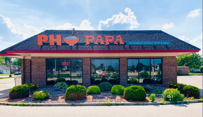
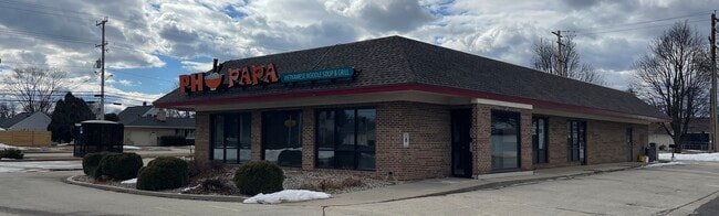
Property Record
700 E Maes Ave, Kimberly, WI 54136

Current Lease Availabilities
Property Detail
700 E Maes Ave
Appleton, WI
PRT GOV LOTS 6&7 & LOT 8 HEWITTS SUBD SEC26 T21N R18E COM N/L MAES AV & E/L WILSON ST N87D E10FT TO POB N174.93FT E25.93FT S37.50FT E182FT S12.97FT N87D W2.83FT S79.84FT S87D W2.45FT S18D W23.44FT S81D W176.29FT S87D W21.16FT TO BEG LESS HY .59AC M/L
25-0-0892-05
Outagamie
Commercialnec
Wisconsin
B and X Area of moderate flood hazard, usually the area between the limits of the 100-year and 500-year floods.
6&7
2024
0.59 AC
2024
Outagamie County
011700
Green Bay
3,834 SF
NEARBY LISTINGS FOR SALE OR LEASE
DEMOGRAPHICS near 700 E Maes Ave
1 mile
3 mile
5 mile
2024 Total Population
8,532
60,849
137,510
2029 Population
8,775
62,362
140,732
Pop Growth 2024-2029
+ 2.85%
+ 2.49%
+ 2.34%
Average Age
41
40
40
2024 Total Households
3,605
24,497
55,166
HH Growth 2024-2029
+ 2.94%
+ 2.45%
+ 2.44%
Median Household Inc
$68,557
$83,395
$84,012
Avg Household Size
2.30
2.40
2.40
2024 Avg HH Vehicles
2.00
2.00
2.00
Median Home Value
$199,064
$259,054
$261,392
Median Year Built
1970
1983
1979
Nearby Places
Map Layers
Map Styles
 Street
 Aerial
Transit
 Traffic
 Biking
Places
Listings with unknown addresses are not visible on the map
- Restaurants
- Banks
- Shops
- Fitness
- Groceries
PUBLIC TRANSPORTATION
AIRPORT
Appleton International
Drive
Walk
Distance
Appleton International
23 min
11.4 mi
Green Bay/Austin Straubel International
Drive
Walk
Distance
Green Bay/Austin Straubel International
30 min
22.3 mi
Freight Ports
Port Milwaukee
Drive
Walk
Distance
Port Milwaukee
133 min
113.5 mi
Nearby Properties
Address
Land Use
TOTAL SIZE
Lot Size
Zoning
Address
Land Use
TOTAL SIZE
Lot Size
Zoning
154,889 SF
1 AC
C2
Address
Land Use
TOTAL SIZE
Lot Size
Zoning
30.30 AC
Address
Land Use
TOTAL SIZE
Lot Size
Zoning
18.75 AC
Address
Land Use
TOTAL SIZE
Lot Size
Zoning
33.54 AC
Address
Land Use
TOTAL SIZE
Lot Size
Zoning
84,620 SF
92.18 AC
C2
Address
Land Use
TOTAL SIZE
Lot Size
Zoning
20.37 AC
PDC2
Address
Land Use
TOTAL SIZE
Lot Size
Zoning
31.46 AC
Address
Land Use
TOTAL SIZE
Lot Size
Zoning
100,105 SF
12.62 AC
C2
Address
Land Use
TOTAL SIZE
Lot Size
Zoning
70,136 SF
6.34 AC
C2
Address
Land Use
TOTAL SIZE
Lot Size
Zoning
65,818 SF
8.01 AC
C2
Address
Land Use
TOTAL SIZE
Lot Size
Zoning
16.63 AC
Address
Land Use
TOTAL SIZE
Lot Size
Zoning
6.59 AC
M1
Address
Land Use
TOTAL SIZE
Lot Size
Zoning
13.05 AC
Address
Land Use
TOTAL SIZE
Lot Size
Zoning
6.02 AC
Address
Land Use
TOTAL SIZE
Lot Size
Zoning
Address
Land Use
TOTAL SIZE
Lot Size
Zoning
37,430 SF
7.32 AC
M1
Address
Land Use
TOTAL SIZE
Lot Size
Zoning
Address
Land Use
TOTAL SIZE
Lot Size
Zoning
13.11 AC
Address
Land Use
TOTAL SIZE
Lot Size
Zoning
66,504 SF
5.25 AC
C2
Address
Land Use
TOTAL SIZE
Lot Size
Zoning
Address
Land Use
TOTAL SIZE
Lot Size
Zoning
14,024 SF
9.34 AC
PDR3
Address
Land Use
TOTAL SIZE
Lot Size
Zoning
59,010 SF
13.09 AC
Address
Land Use
TOTAL SIZE
Lot Size
Zoning
5.10 AC
Address
Land Use
TOTAL SIZE
Lot Size
Zoning
32.39 AC
Address
Land Use
TOTAL SIZE
Lot Size
Zoning
45.88 AC
Address
Land Use
TOTAL SIZE
Lot Size
Zoning
20.22 AC
M1
Address
Land Use
TOTAL SIZE
Lot Size
Zoning
16,664 SF
8.48 AC
PDR3
Address
Land Use
TOTAL SIZE
Lot Size
Zoning
Address
Land Use
TOTAL SIZE
Lot Size
Zoning
13,994 SF
8.13 AC
R3
Address
Land Use
TOTAL SIZE
Lot Size
Zoning
62,673 SF
3.19 AC
PDC2
The World's #1 Commercial Real Estate Marketplace
Connect with us
© 2026 CoStar Group
The information above has been obtained from sources believed reliable. While we do not doubt its accuracy we have not verified it and make no guarantee, warranty or representation about it. It is your responsibility to independently confirm its accuracy and completeness. Any projections, opinions, assumptions, or estimates used are for example only and do not represent the current or future performance of the property. The value of this transaction to you depends on tax and other factors which should be evaluated by your tax, financial, and legal advisors. You and your advisors should conduct a careful, independent investigation of the property to determine to your satisfaction the suitability of the property for your needs.