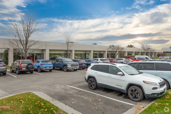
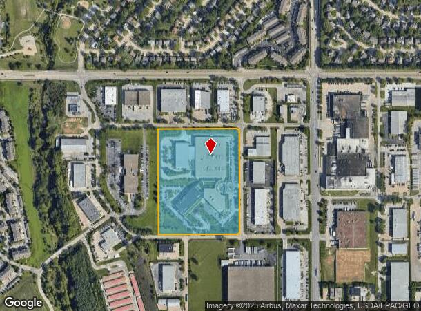
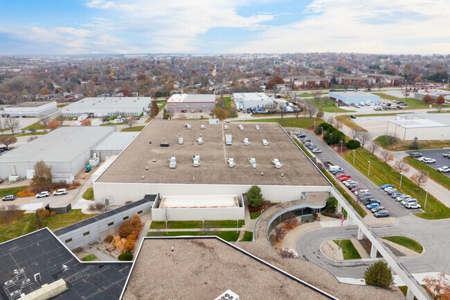
Property Record
7002 S 109Th St, La Vista, NE 68128
NEARBY LISTINGS FOR SALE OR LEASE
Property Detail
7002 S 109Th St
Omaha-Council Bluffs, NE-IA
Brook Valley Business Park
011587782
LOT 16 BROOK VALLEY BUSINESS PARK REPLAT OF LOTS 16, 17, 18B, 21B, 22 AND 23
Industrialgeneral
Sarpy
X
Nebraska
31153C0055H
16
2024
14.34 AC
2025
Sarpy West
010629
Omaha/Council Bluffs
23,890 SF
DEMOGRAPHICS near 7002 S 109Th St
1 Mile
3 Mile
5 Mile
2024 Total Population
9,668
76,789
190,381
2029 Population
10,059
79,956
197,253
Pop Growth 2024-2029
+ 4.04%
+ 4.12%
+ 3.61%
Average Age
39
39
39
2024 Total Households
3,903
31,968
76,254
HH Growth 2024-2029
+ 4.33%
+ 4.10%
+ 3.58%
Median Household Inc
$82,271
$69,607
$79,448
Avg Household Size
2.40
2.30
2.40
2024 Avg HH Vehicles
2.00
2.00
2.00
Median Home Value
$256,858
$217,001
$240,909
Median Year Built
1995
1980
1981
Nearby Places
Map Layers
Map Styles
 Street
 Aerial
- Restaurants
- Banks
- Shops
- Fitness
- Groceries
PUBLIC TRANSPORTATION
AIRPORT
Eppley Airfield
DRIVE
WALK
Distance
Eppley Airfield
28 min
16.0 mi
Freight Ports
Tulsa Port Of Catoosa
DRIVE
WALK
Distance
Tulsa Port Of Catoosa
469 min
420.4 mi
Nearby Properties
Address
Land Use
TOTAL SIZE
Lot Size
Zoning
Address
Land Use
TOTAL SIZE
Lot Size
Zoning
3,654 SF
39.62 AC
Address
Land Use
TOTAL SIZE
Lot Size
Zoning
28,820 SF
16.81 AC
Address
Land Use
TOTAL SIZE
Lot Size
Zoning
370,890 SF
11.20 AC
CC
Address
Land Use
TOTAL SIZE
Lot Size
Zoning
503,886 SF
25.40 AC
Address
Land Use
TOTAL SIZE
Lot Size
Zoning
599,779 SF
46.87 AC
I1
Address
Land Use
TOTAL SIZE
Lot Size
Zoning
56,174 SF
8.65 AC
Address
Land Use
TOTAL SIZE
Lot Size
Zoning
252,985 SF
6.53 AC
Address
Land Use
TOTAL SIZE
Lot Size
Zoning
317,277 SF
20.12 AC
Address
Land Use
TOTAL SIZE
Lot Size
Zoning
8.10 AC
Address
Land Use
TOTAL SIZE
Lot Size
Zoning
46,886 SF
19.29 AC
Address
Land Use
TOTAL SIZE
Lot Size
Zoning
23.99 AC
Address
Land Use
TOTAL SIZE
Lot Size
Zoning
28,913 SF
2.04 AC
Address
Land Use
TOTAL SIZE
Lot Size
Zoning
22.05 AC
Address
Land Use
TOTAL SIZE
Lot Size
Zoning
85,632 SF
5.69 AC
Address
Land Use
TOTAL SIZE
Lot Size
Zoning
897,738 SF
52.16 AC
Address
Land Use
TOTAL SIZE
Lot Size
Zoning
354,299 SF
22.85 AC
R6
Address
Land Use
TOTAL SIZE
Lot Size
Zoning
423,905 SF
21.96 AC
GI
Address
Land Use
TOTAL SIZE
Lot Size
Zoning
294,672 SF
15.06 AC
Address
Land Use
TOTAL SIZE
Lot Size
Zoning
56,150 SF
28.48 AC
Address
Land Use
TOTAL SIZE
Lot Size
Zoning
13,930 SF
1.04 AC
Address
Land Use
TOTAL SIZE
Lot Size
Zoning
199,152 SF
13.44 AC
R6
Address
Land Use
TOTAL SIZE
Lot Size
Zoning
271,344 SF
9.78 AC
Address
Land Use
TOTAL SIZE
Lot Size
Zoning
210,585 SF
142.28 AC
I2
Address
Land Use
TOTAL SIZE
Lot Size
Zoning
271,404 SF
17.51 AC
Address
Land Use
TOTAL SIZE
Lot Size
Zoning
309,162 SF
15.54 AC
Address
Land Use
TOTAL SIZE
Lot Size
Zoning
258,637 SF
24.30 AC
Address
Land Use
TOTAL SIZE
Lot Size
Zoning
6,210 SF
8.28 AC
Address
Land Use
TOTAL SIZE
Lot Size
Zoning
124,820 SF
9.69 AC
MU
Address
Land Use
TOTAL SIZE
Lot Size
Zoning
2,610 SF
9.96 AC
The World's #1 Commercial Real Estate Marketplace
Connect with us
© 2026 CoStar Group
The information above has been obtained from sources believed reliable. While we do not doubt its accuracy we have not verified it and make no guarantee, warranty or representation about it. It is your responsibility to independently confirm its accuracy and completeness. Any projections, opinions, assumptions, or estimates used are for example only and do not represent the current or future performance of the property. The value of this transaction to you depends on tax and other factors which should be evaluated by your tax, financial, and legal advisors. You and your advisors should conduct a careful, independent investigation of the property to determine to your satisfaction the suitability of the property for your needs.