Property Record
701 Griffith Rd, Charlotte, NC 28217


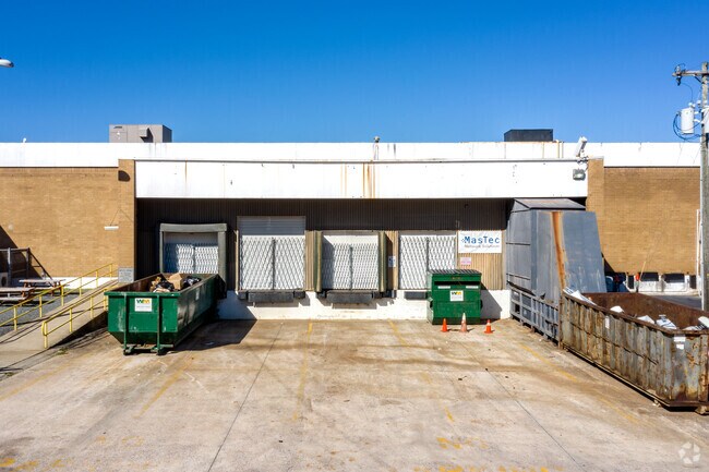

Property Detail
701 Griffith Rd
169-101-06
L37 &P14 &15 M4-123
Industrialgeneral
Mecklenburg
I-2
North Carolina
B and X Area of moderate flood hazard, usually the area between the limits of the 100-year and 500-year floods.
37
2024
13.21 AC
2025
Tyvola Rd
003807
Charlotte
217,060 SF
Charlotte-Concord-Gastonia, NC-SC
NEARBY LISTINGS FOR SALE OR LEASE
DEMOGRAPHICS near 701 Griffith Rd
1 mile
3 mile
5 mile
2025 Total Population
11,461
98,911
226,176
2030 Population
12,398
107,876
246,927
Pop Growth 2025-2030
+ 8.18%
+ 9.06%
+ 9.17%
Average Age
35
36
37
2025 Total Households
4,629
44,153
103,418
HH Growth 2025-2030
+ 8.21%
+ 9.13%
+ 9.30%
Median Household Inc
$69,397
$84,836
$95,396
Avg Household Size
2.40
2.20
2.10
2025 Avg HH Vehicles
2.00
2.00
2.00
Median Home Value
$432,048
$527,999
$655,597
Median Year Built
1977
1989
1993
Nearby Places
Map Layers
Map Styles
 Street
 Aerial
Transit
 Traffic
 Biking
Places
Listings with unknown addresses are not visible on the map
- Restaurants
- Banks
- Shops
- Fitness
- Groceries
PUBLIC TRANSPORTATION
TRANSIT/SUBWAY
Tyvola (LYNX Blue Line - Charlotte Area Transit System (CATS))
Drive
Walk
Distance
Tyvola (LYNX Blue Line - Charlotte Area Transit System (CATS))
1 min
7 min
0.4 mi
Archdale (LYNX Blue Line - Charlotte Area Transit System (CATS))
Drive
Walk
Distance
Archdale (LYNX Blue Line - Charlotte Area Transit System (CATS))
3 min
16 min
0.8 mi
COMMUTER RAIL
Charlotte Amtrak Station (Carolinian - Amtrak, Crescent - Amtrak, Piedmont - Amtrak)
Drive
Walk
Distance
Charlotte Amtrak Station (Carolinian - Amtrak, Crescent - Amtrak, Piedmont - Amtrak)
15 min
7.1 mi
AIRPORT
Charlotte/Douglas International
Drive
Walk
Distance
Charlotte/Douglas International
16 min
6.3 mi
Concord-Padgett Regional
Drive
Walk
Distance
Concord-Padgett Regional
34 min
22.3 mi
Freight Ports
North Charleston Terminal
Drive
Walk
Distance
North Charleston Terminal
222 min
194.5 mi
SALE & LEASE HISTORY
LISTING DATE
SALE/LEASE

Sep 25, 2016
For Lease
Mar 27, 2019
For Lease
Nearby Properties
Address
Land Use
TOTAL SIZE
Lot Size
Zoning
Address
Land Use
TOTAL SIZE
Lot Size
Zoning
875,672 SF
41.66 AC
CC
Address
Land Use
TOTAL SIZE
Lot Size
Zoning
965,867 SF
5.81 AC
O1
Address
Land Use
TOTAL SIZE
Lot Size
Zoning
709,410 SF
22.24 AC
INSTCD
Address
Land Use
TOTAL SIZE
Lot Size
Zoning
743,550 SF
4.69 AC
I2
Address
Land Use
TOTAL SIZE
Lot Size
Zoning
505,747 SF
3.87 AC
Address
Land Use
TOTAL SIZE
Lot Size
Zoning
605,976 SF
46.31 AC
R17MF
Address
Land Use
TOTAL SIZE
Lot Size
Zoning
573,667 SF
5.81 AC
MUDDO
Address
Land Use
TOTAL SIZE
Lot Size
Zoning
546,111 SF
4.85 AC
MUDDCD
Address
Land Use
TOTAL SIZE
Lot Size
Zoning
572,979 SF
5.60 AC
O3
Address
Land Use
TOTAL SIZE
Lot Size
Zoning
460,937 SF
2.67 AC
O1
Address
Land Use
TOTAL SIZE
Lot Size
Zoning
544,973 SF
3.42 AC
Address
Land Use
TOTAL SIZE
Lot Size
Zoning
434,803 SF
4.58 AC
I2
Address
Land Use
TOTAL SIZE
Lot Size
Zoning
393,779 SF
26.71 AC
R17MF
Address
Land Use
TOTAL SIZE
Lot Size
Zoning
554,176 SF
3.88 AC
I-2
Address
Land Use
TOTAL SIZE
Lot Size
Zoning
473,582 SF
3.41 AC
TOD-TR
Address
Land Use
TOTAL SIZE
Lot Size
Zoning
493,745 SF
4.25 AC
I2
Address
Land Use
TOTAL SIZE
Lot Size
Zoning
356,838 SF
27.63 AC
B1
Address
Land Use
TOTAL SIZE
Lot Size
Zoning
427,305 SF
3.21 AC
O2CD
Address
Land Use
TOTAL SIZE
Lot Size
Zoning
328,090 SF
70.27 AC
R3
Address
Land Use
TOTAL SIZE
Lot Size
Zoning
24.40 AC
UR-2(CD)
Address
Land Use
TOTAL SIZE
Lot Size
Zoning
471,303 SF
4.30 AC
O3
Address
Land Use
TOTAL SIZE
Lot Size
Zoning
23,502 SF
3.31 AC
TOD-CC
Address
Land Use
TOTAL SIZE
Lot Size
Zoning
408,632 SF
50 AC
R12MFCD
Address
Land Use
TOTAL SIZE
Lot Size
Zoning
518,503 SF
5.34 AC
O1
Address
Land Use
TOTAL SIZE
Lot Size
Zoning
607,941 SF
4.19 AC
R17MF
Address
Land Use
TOTAL SIZE
Lot Size
Zoning
430,000 SF
7.25 AC
MUDDO
Address
Land Use
TOTAL SIZE
Lot Size
Zoning
443,379 SF
2.62 AC
TOD-CC
Address
Land Use
TOTAL SIZE
Lot Size
Zoning
371,416 SF
30.90 AC
BPCD
Address
Land Use
TOTAL SIZE
Lot Size
Zoning
424,279 SF
4.20 AC
R43MF
Address
Land Use
TOTAL SIZE
Lot Size
Zoning
298,298 SF
16.60 AC
R17MFCD
The World's #1 Commercial Real Estate Marketplace
Connect with us
© 2026 CoStar Group
The information above has been obtained from sources believed reliable. While we do not doubt its accuracy we have not verified it and make no guarantee, warranty or representation about it. It is your responsibility to independently confirm its accuracy and completeness. Any projections, opinions, assumptions, or estimates used are for example only and do not represent the current or future performance of the property. The value of this transaction to you depends on tax and other factors which should be evaluated by your tax, financial, and legal advisors. You and your advisors should conduct a careful, independent investigation of the property to determine to your satisfaction the suitability of the property for your needs.