Property Record
7017 S Eisenman Rd, Boise, ID 83716


Property Detail
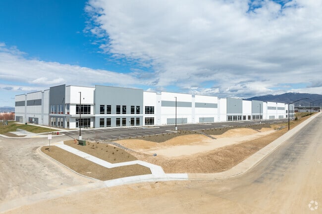
7017 S Eisenman Rd
Boise City, ID
PAR #0340 POR LTS 9 & 10 BLK 3 GOWEN BUSINESS PARK SUB NO 03 PARCEL E ROS 13480 #0302-S
R3220250340
ADA
Foundry
Idaho
M-1D
9,10
2025
10.14 AC
2025
Airport
010503
Boise City/Nampa
171,774 SF
NEARBY LISTINGS FOR SALE OR LEASE
DEMOGRAPHICS near 7017 S Eisenman Rd
1 mile
3 mile
5 mile
2025 Total Population
1,508
26,382
74,306
2030 Population
1,604
27,492
78,101
Pop Growth 2025-2030
+ 6.37%
+ 4.21%
+ 5.11%
Average Age
37
41
39
2025 Total Households
583
10,432
31,177
HH Growth 2025-2030
+ 7.03%
+ 4.60%
+ 5.64%
Median Household Inc
$89,958
$120,046
$94,613
Avg Household Size
2.50
2.50
2.30
2025 Avg HH Vehicles
2.00
2.00
2.00
Median Home Value
$468,867
$585,284
$593,711
Median Year Built
1997
1993
1990
Nearby Places
Map Layers
Map Styles
 Street
 Aerial
Layers
 Traffic
 Biking
Places
Listings with unknown addresses are not visible on the map
- Restaurants
- Banks
- Shops
- Fitness
- Groceries
PUBLIC TRANSPORTATION
AIRPORT
Boise Air Trml/Gowen Field
Drive
Walk
Distance
Boise Air Trml/Gowen Field
10 min
4.2 mi
SALE & LEASE HISTORY
LISTING DATE
SALE/LEASE

Jun 28, 2022
For Lease
Jun 28, 2022
For Lease
Nearby Properties
Address
Land Use
TOTAL SIZE
Lot Size
Zoning
Address
Land Use
TOTAL SIZE
Lot Size
Zoning
ZC-258
Address
Land Use
TOTAL SIZE
Lot Size
Zoning
851,556 SF
78.75 AC
M-2D
Address
Land Use
TOTAL SIZE
Lot Size
Zoning
900,981 SF
86.35 AC
ZC-263
Address
Land Use
TOTAL SIZE
Lot Size
Zoning
122,110 SF
12.66 AC
T-2D/DA
Address
Land Use
TOTAL SIZE
Lot Size
Zoning
356,969 SF
49.72 AC
M-1D
Address
Land Use
TOTAL SIZE
Lot Size
Zoning
245,240 SF
5.40 AC
R-2D
Address
Land Use
TOTAL SIZE
Lot Size
Zoning
259,565 SF
4.07 AC
SP-02
Address
Land Use
TOTAL SIZE
Lot Size
Zoning
364,998 SF
40.53 AC
M-1D
Address
Land Use
TOTAL SIZE
Lot Size
Zoning
277,827 SF
M-2D
Address
Land Use
TOTAL SIZE
Lot Size
Zoning
215,141 SF
5.25 AC
SP-01
Address
Land Use
TOTAL SIZE
Lot Size
Zoning
366,032 SF
10.79 AC
C-4D
Address
Land Use
TOTAL SIZE
Lot Size
Zoning
237,251 SF
20.90 AC
M-1D
Address
Land Use
TOTAL SIZE
Lot Size
Zoning
220,160 SF
12.70 AC
M-1D
Address
Land Use
TOTAL SIZE
Lot Size
Zoning
190,180 SF
14.43 AC
R-2D
Address
Land Use
TOTAL SIZE
Lot Size
Zoning
237,299 SF
20.32 AC
M-1D
Address
Land Use
TOTAL SIZE
Lot Size
Zoning
50,674 SF
49.82 AC
T-2D
Address
Land Use
TOTAL SIZE
Lot Size
Zoning
150,147 SF
3.94 AC
SP-01
Address
Land Use
TOTAL SIZE
Lot Size
Zoning
161,421 SF
10.05 AC
R-1C
Address
Land Use
TOTAL SIZE
Lot Size
Zoning
168,000 SF
M-2D
Address
Land Use
TOTAL SIZE
Lot Size
Zoning
3.41 AC
SP-02
Address
Land Use
TOTAL SIZE
Lot Size
Zoning
187,820 SF
11.39 AC
M-1D
Address
Land Use
TOTAL SIZE
Lot Size
Zoning
96.73 AC
T-2D
Address
Land Use
TOTAL SIZE
Lot Size
Zoning
165,000 SF
10.60 AC
M-1D
Address
Land Use
TOTAL SIZE
Lot Size
Zoning
158,767 SF
3 AC
M-1D
Address
Land Use
TOTAL SIZE
Lot Size
Zoning
19,359 SF
4.75 AC
C-1D
Address
Land Use
TOTAL SIZE
Lot Size
Zoning
133,300 SF
18.38 AC
M-1D
Address
Land Use
TOTAL SIZE
Lot Size
Zoning
81.26 AC
T-2D
Address
Land Use
TOTAL SIZE
Lot Size
Zoning
174,290 SF
14.12 AC
C-3D
Address
Land Use
TOTAL SIZE
Lot Size
Zoning
160 AC
RP
The World's #1 Commercial Real Estate Marketplace
Connect with us
© 2026 CoStar Group
The information above has been obtained from sources believed reliable. While we do not doubt its accuracy we have not verified it and make no guarantee, warranty or representation about it. It is your responsibility to independently confirm its accuracy and completeness. Any projections, opinions, assumptions, or estimates used are for example only and do not represent the current or future performance of the property. The value of this transaction to you depends on tax and other factors which should be evaluated by your tax, financial, and legal advisors. You and your advisors should conduct a careful, independent investigation of the property to determine to your satisfaction the suitability of the property for your needs.