Property Record
7019 N 53Rd Ave, Glendale, AZ 85301
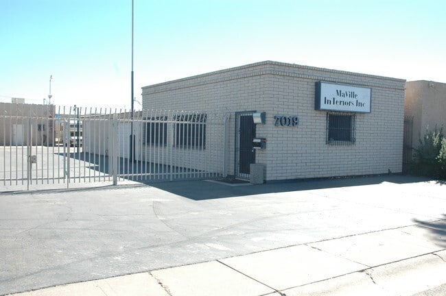


This Property Is For Sale
Property Detail
7019 N 53Rd Ave
147-16-064B
PARK PLACE BLKS 1,3,4 MCR 4-40
Warehouse
MARICOPA
C-C
Arizona
C and X Area of minimal flood hazard, usually depicted on FIRMs as above the 500-year flood level.
6
2025
0.21 AC
2025
Grand Avenue
092500
Phoenix
2,764 SF
Phoenix-Mesa-Chandler, AZ
NEARBY LISTINGS FOR SALE OR LEASE
DEMOGRAPHICS near 7019 N 53Rd Ave
1 mile
3 mile
5 mile
2025 Total Population
21,750
205,903
546,299
2030 Population
22,751
212,525
563,897
Pop Growth 2025-2030
+ 4.60%
+ 3.22%
+ 3.22%
Average Age
37
35
35
2025 Total Households
7,946
66,888
174,148
HH Growth 2025-2030
+ 4.92%
+ 3.34%
+ 3.39%
Median Household Inc
$44,912
$58,137
$62,817
Avg Household Size
2.70
2.90
2.90
2025 Avg HH Vehicles
1.00
2.00
2.00
Median Home Value
$294,673
$328,656
$340,571
Median Year Built
1978
1976
1977
Nearby Places
Map Layers
Map Styles
 Street
 Aerial
Layers
 Traffic
 Biking
Places
Listings with unknown addresses are not visible on the map
- Restaurants
- Banks
- Shops
- Fitness
- Groceries
PUBLIC TRANSPORTATION
AIRPORT
Phoenix Sky Harbor International
Drive
Walk
Distance
Phoenix Sky Harbor International
27 min
15.5 mi
Freight Ports
Port of San Diego
Drive
Walk
Distance
Port of San Diego
399 min
354.6 mi
Nearby Properties
Address
Land Use
TOTAL SIZE
Lot Size
Zoning
Address
Land Use
TOTAL SIZE
Lot Size
Zoning
Address
Land Use
TOTAL SIZE
Lot Size
Zoning
611,971 SF
36.16 AC
A1
Address
Land Use
TOTAL SIZE
Lot Size
Zoning
281,038 SF
7.71 AC
Address
Land Use
TOTAL SIZE
Lot Size
Zoning
337,487 SF
39 AC
R-6
Address
Land Use
TOTAL SIZE
Lot Size
Zoning
285,815 SF
37.17 AC
R-6
Address
Land Use
TOTAL SIZE
Lot Size
Zoning
629,928 SF
41.37 AC
Address
Land Use
TOTAL SIZE
Lot Size
Zoning
276,102 SF
39.72 AC
AG
Address
Land Use
TOTAL SIZE
Lot Size
Zoning
25.91 AC
A1
Address
Land Use
TOTAL SIZE
Lot Size
Zoning
4.43 AC
Address
Land Use
TOTAL SIZE
Lot Size
Zoning
310,295 SF
9.32 AC
Address
Land Use
TOTAL SIZE
Lot Size
Zoning
350,874 SF
28.66 AC
C-C
Address
Land Use
TOTAL SIZE
Lot Size
Zoning
211,015 SF
9.59 AC
R-6
Address
Land Use
TOTAL SIZE
Lot Size
Zoning
262,609 SF
18.96 AC
I-1
Address
Land Use
TOTAL SIZE
Lot Size
Zoning
200,998 SF
0.06 AC
C-C
Address
Land Use
TOTAL SIZE
Lot Size
Zoning
187,309 SF
19.99 AC
R-6
Address
Land Use
TOTAL SIZE
Lot Size
Zoning
88,059 SF
78.03 AC
AG
Address
Land Use
TOTAL SIZE
Lot Size
Zoning
217,214 SF
27.12 AC
R-6
Address
Land Use
TOTAL SIZE
Lot Size
Zoning
367,133 SF
17.88 AC
IND.PK.
Address
Land Use
TOTAL SIZE
Lot Size
Zoning
196,254 SF
17.36 AC
R2
Address
Land Use
TOTAL SIZE
Lot Size
Zoning
206,709 SF
11.76 AC
Address
Land Use
TOTAL SIZE
Lot Size
Zoning
2.23 AC
Address
Land Use
TOTAL SIZE
Lot Size
Zoning
139,343 SF
10.13 AC
R-6
Address
Land Use
TOTAL SIZE
Lot Size
Zoning
114,671 SF
13.28 AC
R-6
Address
Land Use
TOTAL SIZE
Lot Size
Zoning
287,199 SF
15.11 AC
M-H
Address
Land Use
TOTAL SIZE
Lot Size
Zoning
120,680 SF
19.15 AC
A-1
Address
Land Use
TOTAL SIZE
Lot Size
Zoning
134,215 SF
17.75 AC
R-6
Address
Land Use
TOTAL SIZE
Lot Size
Zoning
116,276 SF
11.58 AC
R-6
Address
Land Use
TOTAL SIZE
Lot Size
Zoning
208,448 SF
19.04 AC
C-C
Address
Land Use
TOTAL SIZE
Lot Size
Zoning
320,093 SF
14.56 AC
M-H
Address
Land Use
TOTAL SIZE
Lot Size
Zoning
94,663 SF
19.32 AC
R-6
The World's #1 Commercial Real Estate Marketplace
Connect with us
© 2026 CoStar Group
The information above has been obtained from sources believed reliable. While we do not doubt its accuracy we have not verified it and make no guarantee, warranty or representation about it. It is your responsibility to independently confirm its accuracy and completeness. Any projections, opinions, assumptions, or estimates used are for example only and do not represent the current or future performance of the property. The value of this transaction to you depends on tax and other factors which should be evaluated by your tax, financial, and legal advisors. You and your advisors should conduct a careful, independent investigation of the property to determine to your satisfaction the suitability of the property for your needs.