Property Record
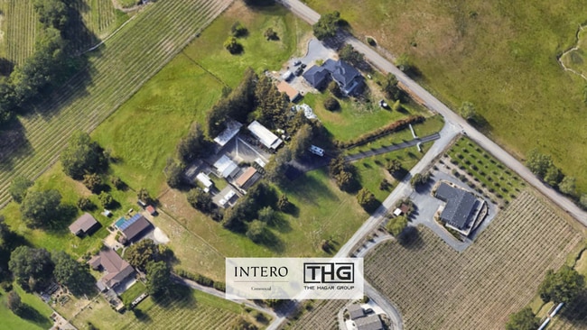
7050 Starr Rd, Windsor, CA 95492


NEARBY LISTINGS FOR SALE OR LEASE
Property Detail
7050 Starr Rd
Santa Rosa-Petaluma, CA
As Shown On Parcel Map No. 4456
066-220-022
75 FORM PT OF 66-220-12 LOT 2 PM 4456
Mobilemanufacturedhomeregardlessoflandownership
Sonoma
X
California
06097C0564F
2
2024
3.83 AC
2025
Healdsburg/Cloverdale
153811
North Bay/Santa Rosa
3,520 SF
DEMOGRAPHICS near 7050 Starr Rd
1 mile
3 mile
5 mile
2024 Total Population
339
24,221
41,936
2029 Population
325
23,721
40,927
Pop Growth 2024-2029
(4.13%)
(2.06%)
(2.41%)
Average Age
42
42
43
2024 Total Households
108
8,317
15,240
HH Growth 2024-2029
(4.63%)
(2.22%)
(2.59%)
Median Household Inc
$136,666
$127,525
$119,038
Avg Household Size
3.00
2.80
2.70
2024 Avg HH Vehicles
3.00
2.00
2.00
Median Home Value
$825,892
$738,950
$755,234
Median Year Built
1988
1991
1986
Nearby Places
Map Layers
Map Styles
 Street
 Aerial
Transit
 Traffic
 Biking
Places
Listings with unknown addresses are not visible on the map
- Restaurants
- Banks
- Shops
- Fitness
- Groceries
PUBLIC TRANSPORTATION
COMMUTER RAIL
Sonoma County Airport Smart (Main Line - Sonoma Marin Area Rail Transit)
Drive
Walk
Distance
Sonoma County Airport Smart (Main Line - Sonoma Marin Area Rail Transit)
16 min
6.0 mi
AIRPORT
Charles M Schulz - Sonoma County
Drive
Walk
Distance
Charles M Schulz - Sonoma County
16 min
5.0 mi
Freight Ports
Port of Richmond
Drive
Walk
Distance
Port of Richmond
82 min
59.8 mi
SALE & LEASE HISTORY
LISTING DATE
SALE/LEASE

Mar 13, 2025
For Sale
Nearby Properties
Address
Land Use
TOTAL SIZE
Lot Size
Zoning
Address
Land Use
TOTAL SIZE
Lot Size
Zoning
14.56 AC
Address
Land Use
TOTAL SIZE
Lot Size
Zoning
249,088 SF
10.75 AC
Address
Land Use
TOTAL SIZE
Lot Size
Zoning
46,737 SF
0.12 AC
DA60
Address
Land Use
TOTAL SIZE
Lot Size
Zoning
163,194 SF
15.09 AC
Address
Land Use
TOTAL SIZE
Lot Size
Zoning
35.05 AC
Address
Land Use
TOTAL SIZE
Lot Size
Zoning
93,886 SF
5.40 AC
MP2
Address
Land Use
TOTAL SIZE
Lot Size
Zoning
100,186 SF
4.31 AC
Address
Land Use
TOTAL SIZE
Lot Size
Zoning
14.29 AC
Address
Land Use
TOTAL SIZE
Lot Size
Zoning
232,262 SF
30.69 AC
Address
Land Use
TOTAL SIZE
Lot Size
Zoning
18.24 AC
Address
Land Use
TOTAL SIZE
Lot Size
Zoning
129,726 SF
12.47 AC
Address
Land Use
TOTAL SIZE
Lot Size
Zoning
55,388 SF
30.07 AC
Address
Land Use
TOTAL SIZE
Lot Size
Zoning
70,358 SF
4.51 AC
M1
Address
Land Use
TOTAL SIZE
Lot Size
Zoning
146,448 SF
84.59 AC
Address
Land Use
TOTAL SIZE
Lot Size
Zoning
282,600 SF
6.89 AC
Address
Land Use
TOTAL SIZE
Lot Size
Zoning
195,243 SF
12.31 AC
Address
Land Use
TOTAL SIZE
Lot Size
Zoning
134,209 SF
11.02 AC
Address
Land Use
TOTAL SIZE
Lot Size
Zoning
69,962 SF
4.49 AC
Address
Land Use
TOTAL SIZE
Lot Size
Zoning
70,511 SF
1.52 AC
Address
Land Use
TOTAL SIZE
Lot Size
Zoning
80,808 SF
6.92 AC
Address
Land Use
TOTAL SIZE
Lot Size
Zoning
98,033 SF
1.39 AC
Address
Land Use
TOTAL SIZE
Lot Size
Zoning
35,648 SF
2.26 AC
M1
Address
Land Use
TOTAL SIZE
Lot Size
Zoning
107,188 SF
7.59 AC
PC
Address
Land Use
TOTAL SIZE
Lot Size
Zoning
0.18 AC
Address
Land Use
TOTAL SIZE
Lot Size
Zoning
63,890 SF
3.72 AC
Address
Land Use
TOTAL SIZE
Lot Size
Zoning
63,890 SF
4.05 AC
Address
Land Use
TOTAL SIZE
Lot Size
Zoning
0.25 AC
LIA60
Address
Land Use
TOTAL SIZE
Lot Size
Zoning
42,040 SF
45.09 AC
Address
Land Use
TOTAL SIZE
Lot Size
Zoning
109,845 SF
6.05 AC
Address
Land Use
TOTAL SIZE
Lot Size
Zoning
5.22 AC
The World's #1 Commercial Real Estate Marketplace
Connect with us
© 2026 CoStar Group
The information above has been obtained from sources believed reliable. While we do not doubt its accuracy we have not verified it and make no guarantee, warranty or representation about it. It is your responsibility to independently confirm its accuracy and completeness. Any projections, opinions, assumptions, or estimates used are for example only and do not represent the current or future performance of the property. The value of this transaction to you depends on tax and other factors which should be evaluated by your tax, financial, and legal advisors. You and your advisors should conduct a careful, independent investigation of the property to determine to your satisfaction the suitability of the property for your needs.