Property Record
7055 3Rd St Se, Turner, OR 97392


Property Detail
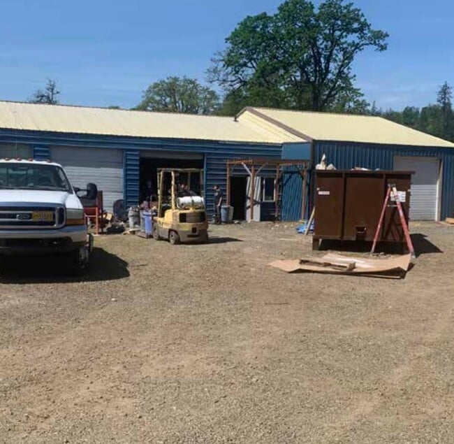
7055 3Rd St Se
530970
PP 2009-029 LOT 2 ACRES .24
Officebuilding
Marion
C-1
Oregon
AE The base floodplain where base flood elevations are provided. AE Zones are now used on new format FIRMs instead of A1-A30 Zones.
2
2024
0.24 AC
2025
Marion County
002701
Portland
3,525 SF
Salem, OR
NEARBY LISTINGS FOR SALE OR LEASE
DEMOGRAPHICS near 7055 3Rd St Se
1 mile
3 mile
5 mile
2025 Total Population
3,273
12,067
62,289
2030 Population
3,373
12,311
62,994
Pop Growth 2025-2030
+ 3.06%
+ 2.02%
+ 1.13%
Average Age
43
43
41
2025 Total Households
1,215
3,605
22,123
HH Growth 2025-2030
+ 3.21%
+ 2.27%
+ 1.24%
Median Household Inc
$104,482
$100,233
$87,877
Avg Household Size
2.70
2.60
2.60
2025 Avg HH Vehicles
2.00
2.00
2.00
Median Home Value
$663,117
$662,083
$460,893
Median Year Built
1990
1992
1990
Nearby Places
Map Layers
Map Styles
 Street
 Aerial
Layers
 Traffic
 Biking
Places
Listings with unknown addresses are not visible on the map
- Restaurants
- Banks
- Shops
- Fitness
- Groceries
PUBLIC TRANSPORTATION
COMMUTER RAIL
Salem (Amtrak Cascades - Amtrak, Coast Starlight - Amtrak)
Drive
Walk
Distance
Salem (Amtrak Cascades - Amtrak, Coast Starlight - Amtrak)
14 min
7.5 mi
Freight Ports
Port of Portland
Drive
Walk
Distance
Port of Portland
72 min
55.7 mi
SALE & LEASE HISTORY
LISTING DATE
SALE/LEASE

Jun 17, 2021
For Sale
Nearby Properties
Address
Land Use
TOTAL SIZE
Lot Size
Zoning
Address
Land Use
TOTAL SIZE
Lot Size
Zoning
412,248 SF
27.80 AC
Address
Land Use
TOTAL SIZE
Lot Size
Zoning
341,320 SF
17.85 AC
PH
Address
Land Use
TOTAL SIZE
Lot Size
Zoning
193,237 SF
9.98 AC
IG
Address
Land Use
TOTAL SIZE
Lot Size
Zoning
310,408 SF
203.73 AC
PH; PE
Address
Land Use
TOTAL SIZE
Lot Size
Zoning
Address
Land Use
TOTAL SIZE
Lot Size
Zoning
118,239 SF
10.69 AC
IG
Address
Land Use
TOTAL SIZE
Lot Size
Zoning
174,632 SF
4.58 AC
CO
Address
Land Use
TOTAL SIZE
Lot Size
Zoning
51,473 SF
5.01 AC
CO
Address
Land Use
TOTAL SIZE
Lot Size
Zoning
127,442 SF
8.69 AC
R-11
Address
Land Use
TOTAL SIZE
Lot Size
Zoning
161,616 SF
6.74 AC
EC
Address
Land Use
TOTAL SIZE
Lot Size
Zoning
59,705 SF
10.08 AC
UT-10
Address
Land Use
TOTAL SIZE
Lot Size
Zoning
48,762 SF
8.78 AC
P-1; R-11
Address
Land Use
TOTAL SIZE
Lot Size
Zoning
74,519 SF
36.38 AC
R-2
Address
Land Use
TOTAL SIZE
Lot Size
Zoning
Address
Land Use
TOTAL SIZE
Lot Size
Zoning
Address
Land Use
TOTAL SIZE
Lot Size
Zoning
3,975 SF
10 AC
Address
Land Use
TOTAL SIZE
Lot Size
Zoning
30,320 SF
3.06 AC
R-11
Address
Land Use
TOTAL SIZE
Lot Size
Zoning
18,745 SF
10.46 AC
IC
Address
Land Use
TOTAL SIZE
Lot Size
Zoning
Address
Land Use
TOTAL SIZE
Lot Size
Zoning
1,234 SF
0.69 AC
CO; RA
Address
Land Use
TOTAL SIZE
Lot Size
Zoning
35.04 AC
EC
Address
Land Use
TOTAL SIZE
Lot Size
Zoning
58,560 SF
3.87 AC
IG
Address
Land Use
TOTAL SIZE
Lot Size
Zoning
45,740 SF
4.74 AC
IG-LU
Address
Land Use
TOTAL SIZE
Lot Size
Zoning
36,213 SF
C
Address
Land Use
TOTAL SIZE
Lot Size
Zoning
19,623 SF
1.91 AC
CO
Address
Land Use
TOTAL SIZE
Lot Size
Zoning
26.17 AC
EC
Address
Land Use
TOTAL SIZE
Lot Size
Zoning
39,316 SF
5.08 AC
IG
Address
Land Use
TOTAL SIZE
Lot Size
Zoning
Address
Land Use
TOTAL SIZE
Lot Size
Zoning
49,225 SF
3.10 AC
RM2
The World's #1 Commercial Real Estate Marketplace
Connect with us
© 2026 CoStar Group
The information above has been obtained from sources believed reliable. While we do not doubt its accuracy we have not verified it and make no guarantee, warranty or representation about it. It is your responsibility to independently confirm its accuracy and completeness. Any projections, opinions, assumptions, or estimates used are for example only and do not represent the current or future performance of the property. The value of this transaction to you depends on tax and other factors which should be evaluated by your tax, financial, and legal advisors. You and your advisors should conduct a careful, independent investigation of the property to determine to your satisfaction the suitability of the property for your needs.