Property Record
707 Arrowest Rd, Grand Junction, CO 81505
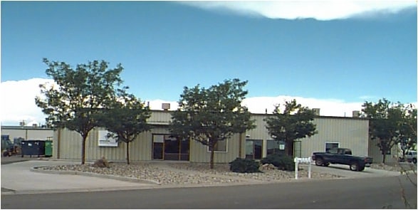


Property Detail
707 Arrowest Rd
2701-314-01-002
LOT 2 BLK 1 ARROWEST COMMERCIAL SUB SEC 31 1N 1W
Multipleuses
MESA
I-2
Colorado
B and X Area of moderate flood hazard, usually the area between the limits of the 100-year and 500-year floods.
2
2024
1.70 AC
2024
Colorado Northwest Area
000900
Other Market Areas
13,550 SF
Grand Junction, CO
NEARBY LISTINGS FOR SALE OR LEASE
DEMOGRAPHICS near 707 Arrowest Rd
1 mile
3 mile
5 mile
2025 Total Population
592
19,370
53,799
2030 Population
625
20,054
55,791
Pop Growth 2025-2030
+ 5.57%
+ 3.53%
+ 3.70%
Average Age
42
44
44
2025 Total Households
248
7,909
22,516
HH Growth 2025-2030
+ 5.65%
+ 3.76%
+ 3.98%
Median Household Inc
$87,500
$94,599
$72,441
Avg Household Size
2.40
2.40
2.20
2025 Avg HH Vehicles
2.00
2.00
2.00
Median Home Value
$464,444
$486,569
$471,754
Median Year Built
2007
1997
1988
Nearby Places
Map Layers
Map Styles
 Street
 Aerial
Transit
 Traffic
 Biking
Places
Listings with unknown addresses are not visible on the map
- Restaurants
- Banks
- Shops
- Fitness
- Groceries
PUBLIC TRANSPORTATION
COMMUTER RAIL
Grand Junction Amtrak Station (California Zephyr - Amtrak)
Drive
Walk
Distance
Grand Junction Amtrak Station (California Zephyr - Amtrak)
9 min
4.9 mi
AIRPORT
Grand Junction Regional
Drive
Walk
Distance
Grand Junction Regional
11 min
6.8 mi
Freight Ports
Port of Long Beach
Drive
Walk
Distance
Port of Long Beach
809 min
784.9 mi
SALE & LEASE HISTORY
LISTING DATE
SALE/LEASE

Sep 25, 2016
For Lease
Aug 05, 2019
For Lease
Apr 11, 2022
For Lease
Nearby Properties
Address
Land Use
TOTAL SIZE
Lot Size
Zoning
Address
Land Use
TOTAL SIZE
Lot Size
Zoning
278,357 SF
29.28 AC
MU
Address
Land Use
TOTAL SIZE
Lot Size
Zoning
90,528 SF
6.09 AC
MU
Address
Land Use
TOTAL SIZE
Lot Size
Zoning
206,585 SF
18.98 AC
C-2
Address
Land Use
TOTAL SIZE
Lot Size
Zoning
399,553 SF
C-1
Address
Land Use
TOTAL SIZE
Lot Size
Zoning
94,818 SF
19.78 AC
RSF-4
Address
Land Use
TOTAL SIZE
Lot Size
Zoning
129,062 SF
25.98 AC
RSF-R
Address
Land Use
TOTAL SIZE
Lot Size
Zoning
435,198 SF
7.55 AC
I-2
Address
Land Use
TOTAL SIZE
Lot Size
Zoning
2,856 SF
108.60 AC
CSR
Address
Land Use
TOTAL SIZE
Lot Size
Zoning
80,235 SF
7.68 AC
RSF-R
Address
Land Use
TOTAL SIZE
Lot Size
Zoning
88,904 SF
4.79 AC
C-1
Address
Land Use
TOTAL SIZE
Lot Size
Zoning
64,289 SF
6.38 AC
C-1
Address
Land Use
TOTAL SIZE
Lot Size
Zoning
43,022 SF
6.28 AC
I-O
Address
Land Use
TOTAL SIZE
Lot Size
Zoning
63,602 SF
3.93 AC
C-1
Address
Land Use
TOTAL SIZE
Lot Size
Zoning
25,399 SF
4.75 AC
I-O
Address
Land Use
TOTAL SIZE
Lot Size
Zoning
215,695 SF
13.41 AC
I-2
Address
Land Use
TOTAL SIZE
Lot Size
Zoning
80,543 SF
31.70 AC
AFT
Address
Land Use
TOTAL SIZE
Lot Size
Zoning
116,231 SF
10.34 AC
C-1
Address
Land Use
TOTAL SIZE
Lot Size
Zoning
86,470 SF
12 AC
PD
Address
Land Use
TOTAL SIZE
Lot Size
Zoning
94,480 SF
7.11 AC
C-1
Address
Land Use
TOTAL SIZE
Lot Size
Zoning
41,955 SF
2.05 AC
C-1
Address
Land Use
TOTAL SIZE
Lot Size
Zoning
117,652 SF
9.31 AC
C-1
Address
Land Use
TOTAL SIZE
Lot Size
Zoning
103,774 SF
10 AC
I-1
Address
Land Use
TOTAL SIZE
Lot Size
Zoning
104,541 SF
8.54 AC
C-1
Address
Land Use
TOTAL SIZE
Lot Size
Zoning
22,544 SF
10.87 AC
I-1
Address
Land Use
TOTAL SIZE
Lot Size
Zoning
53,719 SF
7 AC
I-2
Address
Land Use
TOTAL SIZE
Lot Size
Zoning
41,645 SF
17.89 AC
I-1
Address
Land Use
TOTAL SIZE
Lot Size
Zoning
30,381 SF
2 AC
C-1
Address
Land Use
TOTAL SIZE
Lot Size
Zoning
29,490 SF
21 AC
RSF-4
Address
Land Use
TOTAL SIZE
Lot Size
Zoning
103,247 SF
11.28 AC
C-1
Address
Land Use
TOTAL SIZE
Lot Size
Zoning
66,918 SF
6.39 AC
I-2
The World's #1 Commercial Real Estate Marketplace
Connect with us
© 2026 CoStar Group
The information above has been obtained from sources believed reliable. While we do not doubt its accuracy we have not verified it and make no guarantee, warranty or representation about it. It is your responsibility to independently confirm its accuracy and completeness. Any projections, opinions, assumptions, or estimates used are for example only and do not represent the current or future performance of the property. The value of this transaction to you depends on tax and other factors which should be evaluated by your tax, financial, and legal advisors. You and your advisors should conduct a careful, independent investigation of the property to determine to your satisfaction the suitability of the property for your needs.