Property Record
2256 N Orchard St, Chicago, IL 60614


NEARBY LISTINGS FOR SALE OR LEASE
Property Detail
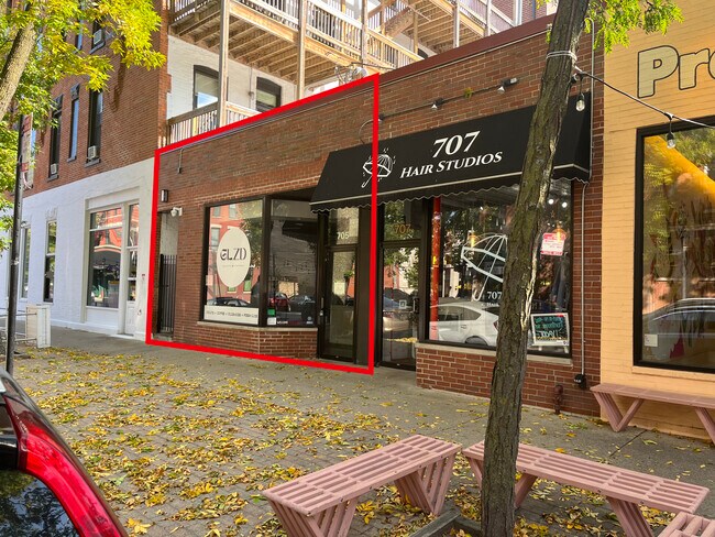
2256 N Orchard St
Chicago-Naperville-Elgin, IL-IN-WI
Canal Trustees Sub
14-33-108-020-0000
(SUBDIVISION) OF EH BLK9 IN CANAL TRUSTEES SUB OF NH & NH SE & EH SW SEC 33-40-14
Commercialbuilding
Cook
X
Illinois
17031C0417K
100,9
2023
0.14 AC
2024
Lincoln Park
071200
Chicago
2,060 SF
DEMOGRAPHICS near 2256 N Orchard St
1 Mile
3 Mile
5 Mile
2024 Total Population
84,720
508,935
976,104
2029 Population
82,869
498,362
944,723
Pop Growth 2024-2029
(2.18%)
(2.08%)
(3.21%)
Average Age
35
36
37
2024 Total Households
44,940
276,425
486,038
HH Growth 2024-2029
(2.42%)
(2.17%)
(3.11%)
Median Household Inc
$110,268
$111,821
$94,036
Avg Household Size
1.80
1.80
1.90
2024 Avg HH Vehicles
1.00
1.00
1.00
Median Home Value
$680,949
$555,967
$462,502
Median Year Built
1966
1973
1964
Nearby Places
Map Layers
Map Styles
 Street
 Aerial
- Restaurants
- Banks
- Shops
- Fitness
- Groceries
PUBLIC TRANSPORTATION
TRANSIT/SUBWAY
Fullerton Station (Brown Line - Chicago Transit Authority "L" Trains (The "L"), Purple Line - Chicago Transit Authority "L" Trains (The "L"), Red Line - Chicago Transit Authority "L" Trains (The "L"))
DRIVE
WALK
Distance
Fullerton Station (Brown Line - Chicago Transit Authority "L" Trains (The "L"), Purple Line - Chicago Transit Authority "L" Trains (The "L"), Red Line - Chicago Transit Authority "L" Trains (The "L"))
3 min
8 min
0.4 mi
Armitage Station (Brown Line - Chicago Transit Authority "L" Trains (The "L"), Purple Line - Chicago Transit Authority "L" Trains (The "L"))
DRIVE
WALK
Distance
Armitage Station (Brown Line - Chicago Transit Authority "L" Trains (The "L"), Purple Line - Chicago Transit Authority "L" Trains (The "L"))
2 min
14 min
0.7 mi
Diversey Station (Brown Line - Chicago Transit Authority "L" Trains (The "L"), Purple Line - Chicago Transit Authority "L" Trains (The "L"))
DRIVE
WALK
Distance
Diversey Station (Brown Line - Chicago Transit Authority "L" Trains (The "L"), Purple Line - Chicago Transit Authority "L" Trains (The "L"))
2 min
16 min
0.8 mi
North/Clybourn Station (Red Line - Chicago Transit Authority "L" Trains (The "L"))
DRIVE
WALK
Distance
North/Clybourn Station (Red Line - Chicago Transit Authority "L" Trains (The "L"))
3 min
20 min
1.0 mi
COMMUTER RAIL
Clybourn Station (Union Pacific North Line - Northeast Illinois Regional Commuter Railroad (Metra), Union Pacific Northwest Line - Northeast Illinois Regional Commuter Railroad (Metra))
DRIVE
WALK
Distance
Clybourn Station (Union Pacific North Line - Northeast Illinois Regional Commuter Railroad (Metra), Union Pacific Northwest Line - Northeast Illinois Regional Commuter Railroad (Metra))
5 min
1.8 mi
Chicago Millennium Station (South Shore Line - Northern Indiana Commuter Transportation District (South Shore Line))
DRIVE
WALK
Distance
Chicago Millennium Station (South Shore Line - Northern Indiana Commuter Transportation District (South Shore Line))
9 min
3.5 mi
AIRPORT
Chicago Midway International
DRIVE
WALK
Distance
Chicago Midway International
28 min
14.2 mi
Chicago O'Hare International
DRIVE
WALK
Distance
Chicago O'Hare International
49 min
18.4 mi
SALE & LEASE HISTORY
LISTING DATE
SALE/LEASE

Oct 02, 2023
For Lease
Jul 19, 2018
For Sale
Feb 12, 2020
For Lease
Feb 11, 2020
For Lease
Nearby Properties
Address
Land Use
TOTAL SIZE
Lot Size
Zoning
Address
Land Use
TOTAL SIZE
Lot Size
Zoning
3,457,865 SF
3.74 AC
PD 70
Address
Land Use
TOTAL SIZE
Lot Size
Zoning
1,362,475 SF
1.97 AC
PD 1226
Address
Land Use
TOTAL SIZE
Lot Size
Zoning
1,396,750 SF
4.09 AC
PD 98
Address
Land Use
TOTAL SIZE
Lot Size
Zoning
3,090,691 SF
3.30 AC
PD 377,PD
Address
Land Use
TOTAL SIZE
Lot Size
Zoning
0.82 AC
PD 1115
Address
Land Use
TOTAL SIZE
Lot Size
Zoning
0.88 AC
DC-16,PD 9
Address
Land Use
TOTAL SIZE
Lot Size
Zoning
1,888,207 SF
2.03 AC
PD 264
Address
Land Use
TOTAL SIZE
Lot Size
Zoning
2,456,900 SF
0.96 AC
PD 256
Address
Land Use
TOTAL SIZE
Lot Size
Zoning
2,612,517 SF
1.28 AC
PD 256
Address
Land Use
TOTAL SIZE
Lot Size
Zoning
4,296,046 SF
6.15 AC
DC-16
Address
Land Use
TOTAL SIZE
Lot Size
Zoning
3,914,400 SF
5.70 AC
DC-16
Address
Land Use
TOTAL SIZE
Lot Size
Zoning
1,559,966 SF
1.38 AC
DC-12
Address
Land Use
TOTAL SIZE
Lot Size
Zoning
831,084 SF
2.05 AC
PD 316
Address
Land Use
TOTAL SIZE
Lot Size
Zoning
1,316,385 SF
0.76 AC
PD 381
Address
Land Use
TOTAL SIZE
Lot Size
Zoning
1,051,000 SF
0.93 AC
PD 325
Address
Land Use
TOTAL SIZE
Lot Size
Zoning
0.61 AC
PD 824
Address
Land Use
TOTAL SIZE
Lot Size
Zoning
1,502,279 SF
3.79 AC
PD 98
Address
Land Use
TOTAL SIZE
Lot Size
Zoning
1,661,783 SF
0.56 AC
PD 500
Address
Land Use
TOTAL SIZE
Lot Size
Zoning
1,600,546 SF
1.04 AC
PD 191
Address
Land Use
TOTAL SIZE
Lot Size
Zoning
0.23 AC
PD 756
Address
Land Use
TOTAL SIZE
Lot Size
Zoning
1,272,928 SF
2.33 AC
PD 368
Address
Land Use
TOTAL SIZE
Lot Size
Zoning
1.09 AC
B1-3
Address
Land Use
TOTAL SIZE
Lot Size
Zoning
1,376,978 SF
0.59 AC
PD 1060
Address
Land Use
TOTAL SIZE
Lot Size
Zoning
959,129 SF
1.32 AC
DC-16
Address
Land Use
TOTAL SIZE
Lot Size
Zoning
1.02 AC
PD 325
Address
Land Use
TOTAL SIZE
Lot Size
Zoning
0.35 AC
PD 325
Address
Land Use
TOTAL SIZE
Lot Size
Zoning
559,589 SF
1.72 AC
C3-5
Address
Land Use
TOTAL SIZE
Lot Size
Zoning
821,186 SF
PD 368
Address
Land Use
TOTAL SIZE
Lot Size
Zoning
0.72 AC
PD 1403
Address
Land Use
TOTAL SIZE
Lot Size
Zoning
1,857,394 SF
3.13 AC
PD 447
The World's #1 Commercial Real Estate Marketplace
Connect with us
© 2025 CoStar Group
The information above has been obtained from sources believed reliable. While we do not doubt its accuracy we have not verified it and make no guarantee, warranty or representation about it. It is your responsibility to independently confirm its accuracy and completeness. Any projections, opinions, assumptions, or estimates used are for example only and do not represent the current or future performance of the property. The value of this transaction to you depends on tax and other factors which should be evaluated by your tax, financial, and legal advisors. You and your advisors should conduct a careful, independent investigation of the property to determine to your satisfaction the suitability of the property for your needs.