Property Record
711 N Interstate 35, San Marcos, TX 78666
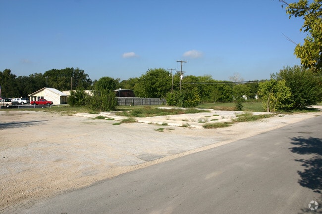

This Property Is For Sale
Property Detail
711 N Interstate 35
Austin-Round Rock-San Marcos, TX
RIO VISTA TERRACE, BLOCK 1, LOT 47A, ACRES 0.534
R136910
HAYS
Residentialacreage
Texas
C and X Area of minimal flood hazard, usually depicted on FIRMs as above the 500-year flood level.
47a
2024
0.53 AC
2025
Hays County
010302
Austin
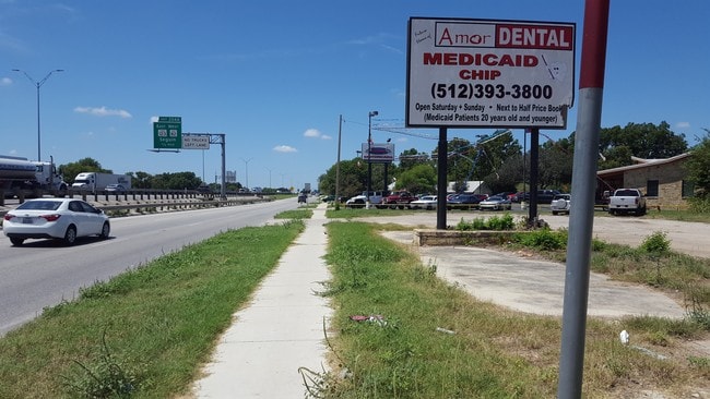
NEARBY LISTINGS FOR SALE OR LEASE
DEMOGRAPHICS near 711 N Interstate 35
1 mile
3 mile
5 mile
2024 Total Population
9,553
63,010
88,555
2029 Population
10,860
71,859
101,503
Pop Growth 2024-2029
+ 13.68%
+ 14.04%
+ 14.62%
Average Age
32
31
33
2024 Total Households
3,973
25,462
34,889
HH Growth 2024-2029
+ 14.62%
+ 15.40%
+ 15.92%
Median Household Inc
$43,929
$49,433
$54,792
Avg Household Size
2.30
2.20
2.30
2024 Avg HH Vehicles
2.00
2.00
2.00
Median Home Value
$157,571
$277,939
$305,912
Median Year Built
1986
1996
1999
Nearby Places
Map Layers
Map Styles
 Street
 Aerial
Transit
 Traffic
 Biking
Places
Listings with unknown addresses are not visible on the map
- Restaurants
- Banks
- Shops
- Fitness
- Groceries
PUBLIC TRANSPORTATION
COMMUTER RAIL
San Marcos Amtrak (Texas Eagle - Amtrak)
Drive
Walk
Distance
San Marcos Amtrak (Texas Eagle - Amtrak)
3 min
16 min
0.9 mi
AIRPORT
Austin-Bergstrom International
Drive
Walk
Distance
Austin-Bergstrom International
47 min
35.5 mi
Freight Ports
Calhoun Port
Drive
Walk
Distance
Calhoun Port
163 min
135.0 mi
Nearby Properties
Address
Land Use
TOTAL SIZE
Lot Size
Zoning
Address
Land Use
TOTAL SIZE
Lot Size
Zoning
623,823 SF
1.46 AC
Address
Land Use
TOTAL SIZE
Lot Size
Zoning
215,932 SF
3.67 AC
Address
Land Use
TOTAL SIZE
Lot Size
Zoning
419,973 SF
23.69 AC
Address
Land Use
TOTAL SIZE
Lot Size
Zoning
324,430 SF
23.60 AC
Address
Land Use
TOTAL SIZE
Lot Size
Zoning
479,270 SF
24.78 AC
Address
Land Use
TOTAL SIZE
Lot Size
Zoning
458,948 SF
35.43 AC
Address
Land Use
TOTAL SIZE
Lot Size
Zoning
3,600 SF
1,376 AC
Address
Land Use
TOTAL SIZE
Lot Size
Zoning
343,094 SF
39.30 AC
Address
Land Use
TOTAL SIZE
Lot Size
Zoning
545,643 SF
2.69 AC
Address
Land Use
TOTAL SIZE
Lot Size
Zoning
279,131 SF
22.46 AC
Address
Land Use
TOTAL SIZE
Lot Size
Zoning
466,968 SF
15.19 AC
Address
Land Use
TOTAL SIZE
Lot Size
Zoning
311,146 SF
5.11 AC
Address
Land Use
TOTAL SIZE
Lot Size
Zoning
264,570 SF
14.23 AC
Address
Land Use
TOTAL SIZE
Lot Size
Zoning
352,285 SF
12.75 AC
Address
Land Use
TOTAL SIZE
Lot Size
Zoning
283,033 SF
19.46 AC
Address
Land Use
TOTAL SIZE
Lot Size
Zoning
327,917 SF
10.54 AC
Address
Land Use
TOTAL SIZE
Lot Size
Zoning
266,157 SF
14.70 AC
Address
Land Use
TOTAL SIZE
Lot Size
Zoning
278,193 SF
17.44 AC
Address
Land Use
TOTAL SIZE
Lot Size
Zoning
365,750 SF
19.65 AC
Address
Land Use
TOTAL SIZE
Lot Size
Zoning
277,659 SF
10.77 AC
Address
Land Use
TOTAL SIZE
Lot Size
Zoning
306,818 SF
18.33 AC
Address
Land Use
TOTAL SIZE
Lot Size
Zoning
307,962 SF
14.23 AC
Address
Land Use
TOTAL SIZE
Lot Size
Zoning
215,696 SF
28.15 AC
Address
Land Use
TOTAL SIZE
Lot Size
Zoning
215,688 SF
10.36 AC
Address
Land Use
TOTAL SIZE
Lot Size
Zoning
24.14 AC
Address
Land Use
TOTAL SIZE
Lot Size
Zoning
179,764 SF
3.27 AC
Address
Land Use
TOTAL SIZE
Lot Size
Zoning
193,192 SF
18.45 AC
Address
Land Use
TOTAL SIZE
Lot Size
Zoning
248,868 SF
17.77 AC
Address
Land Use
TOTAL SIZE
Lot Size
Zoning
145,336 SF
0.87 AC
Address
Land Use
TOTAL SIZE
Lot Size
Zoning
195,018 SF
7.37 AC
The World's #1 Commercial Real Estate Marketplace
Connect with us
© 2026 CoStar Group
The information above has been obtained from sources believed reliable. While we do not doubt its accuracy we have not verified it and make no guarantee, warranty or representation about it. It is your responsibility to independently confirm its accuracy and completeness. Any projections, opinions, assumptions, or estimates used are for example only and do not represent the current or future performance of the property. The value of this transaction to you depends on tax and other factors which should be evaluated by your tax, financial, and legal advisors. You and your advisors should conduct a careful, independent investigation of the property to determine to your satisfaction the suitability of the property for your needs.