Property Record
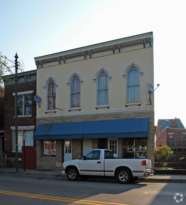
714 Main St, Covington, KY 41011


Property Detail
714 Main St
Cincinnati, OH-KY-IN
GREERS ADDN BLK 37 PT LOTS 1-2 30'X 89' IRREG
054-21-05-016.02
Kenton
Commercialofficeresidentialmixeduse
Kentucky
B and X Area of moderate flood hazard, usually the area between the limits of the 100-year and 500-year floods.
2,1
2025
0.06 AC
2025
Covington/Newport
060300
Cincinnati/Dayton
3,800 SF
NEARBY LISTINGS FOR SALE OR LEASE
DEMOGRAPHICS near 714 Main St
1 mile
3 mile
5 mile
2025 Total Population
16,394
123,845
285,806
2030 Population
17,170
128,286
294,208
Pop Growth 2025-2030
+ 4.73%
+ 3.59%
+ 2.94%
Average Age
40
39
38
2025 Total Households
8,167
58,943
124,889
HH Growth 2025-2030
+ 4.86%
+ 3.71%
+ 3.10%
Median Household Inc
$66,871
$64,958
$61,160
Avg Household Size
1.90
2.00
2.10
2025 Avg HH Vehicles
1.00
1.00
1.00
Median Home Value
$280,450
$249,885
$257,294
Median Year Built
1947
1949
1954
Nearby Places
Map Layers
Map Styles
 Street
 Aerial
Layers
 Traffic
 Biking
Places
Listings with unknown addresses are not visible on the map
- Restaurants
- Banks
- Shops
- Fitness
- Groceries
PUBLIC TRANSPORTATION
COMMUTER RAIL
Drive
Walk
Distance
8 min
2.7 mi
AIRPORT
Cincinnati/Northern Kentucky International
Drive
Walk
Distance
Cincinnati/Northern Kentucky International
21 min
10.6 mi
SALE & LEASE HISTORY
LISTING DATE
SALE/LEASE

Sep 25, 2016
For Lease
Sep 24, 2016
For Sale
Nearby Properties
Address
Land Use
TOTAL SIZE
Lot Size
Zoning
Address
Land Use
TOTAL SIZE
Lot Size
Zoning
39.99 AC
MG
Address
Land Use
TOTAL SIZE
Lot Size
Zoning
11.82 AC
Address
Land Use
TOTAL SIZE
Lot Size
Zoning
11.62 AC
Address
Land Use
TOTAL SIZE
Lot Size
Zoning
19.36 AC
Address
Land Use
TOTAL SIZE
Lot Size
Zoning
17.10 AC
DD
Address
Land Use
TOTAL SIZE
Lot Size
Zoning
1.97 AC
DD
Address
Land Use
TOTAL SIZE
Lot Size
Zoning
11.41 AC
IR
Address
Land Use
TOTAL SIZE
Lot Size
Zoning
411,750 SF
21.25 AC
Address
Land Use
TOTAL SIZE
Lot Size
Zoning
60,750 SF
1.52 AC
Address
Land Use
TOTAL SIZE
Lot Size
Zoning
2.60 AC
Address
Land Use
TOTAL SIZE
Lot Size
Zoning
9.55 AC
Address
Land Use
TOTAL SIZE
Lot Size
Zoning
19.43 AC
Address
Land Use
TOTAL SIZE
Lot Size
Zoning
89,500 SF
0.58 AC
Address
Land Use
TOTAL SIZE
Lot Size
Zoning
290,233 SF
Address
Land Use
TOTAL SIZE
Lot Size
Zoning
3.51 AC
DD
Address
Land Use
TOTAL SIZE
Lot Size
Zoning
9,962 SF
712 AC
Address
Land Use
TOTAL SIZE
Lot Size
Zoning
Address
Land Use
TOTAL SIZE
Lot Size
Zoning
153,312 SF
4 AC
Address
Land Use
TOTAL SIZE
Lot Size
Zoning
9.14 AC
Address
Land Use
TOTAL SIZE
Lot Size
Zoning
21.55 AC
Address
Land Use
TOTAL SIZE
Lot Size
Zoning
298,611 SF
Address
Land Use
TOTAL SIZE
Lot Size
Zoning
20.02 AC
Address
Land Use
TOTAL SIZE
Lot Size
Zoning
12.13 AC
Address
Land Use
TOTAL SIZE
Lot Size
Zoning
2.46 AC
Address
Land Use
TOTAL SIZE
Lot Size
Zoning
165,016 SF
15.23 AC
Address
Land Use
TOTAL SIZE
Lot Size
Zoning
20.49 AC
Address
Land Use
TOTAL SIZE
Lot Size
Zoning
256,000 SF
Address
Land Use
TOTAL SIZE
Lot Size
Zoning
1.95 AC
Address
Land Use
TOTAL SIZE
Lot Size
Zoning
12,150 SF
10.02 AC
Address
Land Use
TOTAL SIZE
Lot Size
Zoning
19,816 SF
26.42 AC
The World's #1 Commercial Real Estate Marketplace
Connect with us
© 2026 CoStar Group
The information above has been obtained from sources believed reliable. While we do not doubt its accuracy we have not verified it and make no guarantee, warranty or representation about it. It is your responsibility to independently confirm its accuracy and completeness. Any projections, opinions, assumptions, or estimates used are for example only and do not represent the current or future performance of the property. The value of this transaction to you depends on tax and other factors which should be evaluated by your tax, financial, and legal advisors. You and your advisors should conduct a careful, independent investigation of the property to determine to your satisfaction the suitability of the property for your needs.