Property Record
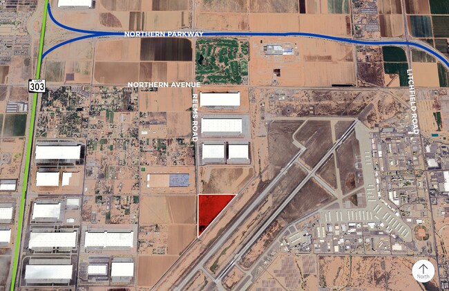
7151 N Reems Rd, Glendale, AZ 85309
Property Detail
7151 N Reems Rd
Phoenix-Mesa-Chandler, AZ
PT NW4 BEG NW COR TH E 1724.70F TH S 42M 48D W 2538.72F TO A PT ON W LN NW4 SD SEC TH N ALG W LN OF SEC 1890.91F TPOB TOG-WI NLY 33F ABAND R/W P/MCR 5-37 EX 55F RD LY WI NWLY COR P/F 2021-0479476
501-50-002M
MARICOPA
Commercialacreage
Arizona
2025
70.82 AC
2025
Loop 303/Surprise
061100
Phoenix
NEARBY LISTINGS FOR SALE OR LEASE
DEMOGRAPHICS near 7151 N Reems Rd
1 mile
3 mile
5 mile
2025 Total Population
295
25,954
136,643
2030 Population
306
27,652
145,824
Pop Growth 2025-2030
+ 3.73%
+ 6.54%
+ 6.72%
Average Age
42
36
39
2025 Total Households
97
8,629
45,842
HH Growth 2025-2030
+ 4.12%
+ 7.51%
+ 6.93%
Median Household Inc
$103,125
$101,182
$110,935
Avg Household Size
3.00
2.80
2.90
2025 Avg HH Vehicles
2.00
2.00
2.00
Median Home Value
$697,115
$542,225
$530,961
Median Year Built
2010
2006
2007
Nearby Places
Map Layers
Map Styles
 Street
 Aerial
Layers
 Traffic
 Biking
Places
Listings with unknown addresses are not visible on the map
- Restaurants
- Banks
- Shops
- Fitness
- Groceries
PUBLIC TRANSPORTATION
AIRPORT
Phoenix Sky Harbor International
Drive
Walk
Distance
Phoenix Sky Harbor International
45 min
31.7 mi
Freight Ports
Port of San Diego
Drive
Walk
Distance
Port of San Diego
381 min
341.2 mi
SALE & LEASE HISTORY
LISTING DATE
SALE/LEASE

Oct 30, 2025
For Sale
Mar 10, 2022
For Sale
Jan 23, 2024
For Sale
Jan 23, 2024
For Sale
Nearby Properties
Address
Land Use
TOTAL SIZE
Lot Size
Zoning
Address
Land Use
TOTAL SIZE
Lot Size
Zoning
71.40 AC
Address
Land Use
TOTAL SIZE
Lot Size
Zoning
Address
Land Use
TOTAL SIZE
Lot Size
Zoning
43.69 AC
Address
Land Use
TOTAL SIZE
Lot Size
Zoning
Address
Land Use
TOTAL SIZE
Lot Size
Zoning
27.38 AC
Address
Land Use
TOTAL SIZE
Lot Size
Zoning
1,188,764 SF
631.19 AC
AP
Address
Land Use
TOTAL SIZE
Lot Size
Zoning
1,433,378 SF
317.58 AC
AP
Address
Land Use
TOTAL SIZE
Lot Size
Zoning
73.09 AC
Address
Land Use
TOTAL SIZE
Lot Size
Zoning
1,201,280 SF
74.43 AC
PAD
Address
Land Use
TOTAL SIZE
Lot Size
Zoning
1,758,410 SF
98.58 AC
PAD
Address
Land Use
TOTAL SIZE
Lot Size
Zoning
1,192,719 SF
70.75 AC
Address
Land Use
TOTAL SIZE
Lot Size
Zoning
915,160 SF
53.89 AC
Address
Land Use
TOTAL SIZE
Lot Size
Zoning
1,155,404 SF
75.47 AC
Address
Land Use
TOTAL SIZE
Lot Size
Zoning
1,259,666 SF
71.73 AC
R-43
Address
Land Use
TOTAL SIZE
Lot Size
Zoning
1,200,140 SF
76.91 AC
Address
Land Use
TOTAL SIZE
Lot Size
Zoning
1,109,869 SF
67.32 AC
R-43
Address
Land Use
TOTAL SIZE
Lot Size
Zoning
510,342 SF
51.45 AC
LUKEAFB
Address
Land Use
TOTAL SIZE
Lot Size
Zoning
1,253,382 SF
74.13 AC
Address
Land Use
TOTAL SIZE
Lot Size
Zoning
802,439 SF
56.30 AC
PAD
Address
Land Use
TOTAL SIZE
Lot Size
Zoning
25.69 AC
Address
Land Use
TOTAL SIZE
Lot Size
Zoning
570,080 SF
36.76 AC
Address
Land Use
TOTAL SIZE
Lot Size
Zoning
844,524 SF
130.66 AC
LUKEAFB
Address
Land Use
TOTAL SIZE
Lot Size
Zoning
351,775 SF
53.72 AC
AP
Address
Land Use
TOTAL SIZE
Lot Size
Zoning
663,367 SF
38.83 AC
Address
Land Use
TOTAL SIZE
Lot Size
Zoning
1,178,814 SF
64.63 AC
Address
Land Use
TOTAL SIZE
Lot Size
Zoning
634,560 SF
36.84 AC
PAD
Address
Land Use
TOTAL SIZE
Lot Size
Zoning
599,070 SF
38.33 AC
Address
Land Use
TOTAL SIZE
Lot Size
Zoning
522,480 SF
31.89 AC
The World's #1 Commercial Real Estate Marketplace
Connect with us
© 2026 CoStar Group
The information above has been obtained from sources believed reliable. While we do not doubt its accuracy we have not verified it and make no guarantee, warranty or representation about it. It is your responsibility to independently confirm its accuracy and completeness. Any projections, opinions, assumptions, or estimates used are for example only and do not represent the current or future performance of the property. The value of this transaction to you depends on tax and other factors which should be evaluated by your tax, financial, and legal advisors. You and your advisors should conduct a careful, independent investigation of the property to determine to your satisfaction the suitability of the property for your needs.