Property Record
7183 Arapahoe Rd, Boulder, CO 80303

Property Detail
7183 Arapahoe Rd
Boulder, CO
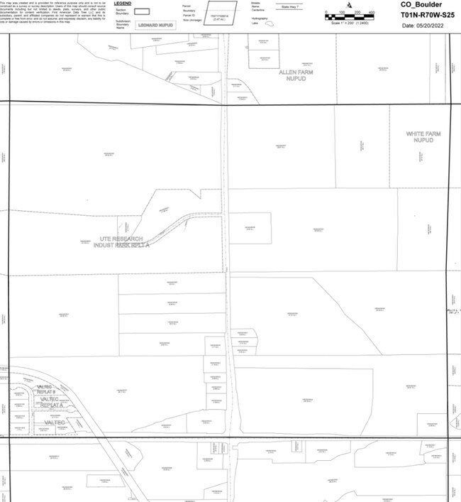
LOT 11 VALTEC LESS 0.031 ACS CDOT PER REC # 3225252
1463250-08-006
Boulder
Industrialgeneral
Colorado
B and X Area of moderate flood hazard, usually the area between the limits of the 100-year and 500-year floods.
11
2023
0.87 AC
2025
Boulder
012707
Denver
7,830 SF
NEARBY LISTINGS FOR SALE OR LEASE
DEMOGRAPHICS near 7183 Arapahoe Rd
1 mile
3 mile
5 mile
2025 Total Population
532
22,008
141,166
2030 Population
526
21,824
140,717
Pop Growth 2025-2030
(1.13%)
(0.84%)
(0.32%)
Average Age
47
43
39
2025 Total Households
208
9,039
56,802
HH Growth 2025-2030
(0.96%)
(0.90%)
(0.32%)
Median Household Inc
$173,214
$123,474
$94,670
Avg Household Size
2.40
2.30
2.20
2025 Avg HH Vehicles
2.00
2.00
2.00
Median Home Value
$1,085,200
$950,506
$881,574
Median Year Built
1974
1981
1982
Nearby Places
Map Layers
Map Styles
 Street
 Aerial
Layers
 Traffic
 Biking
Places
Listings with unknown addresses are not visible on the map
- Restaurants
- Banks
- Shops
- Fitness
- Groceries
PUBLIC TRANSPORTATION
AIRPORT
Denver International
Drive
Walk
Distance
Denver International
48 min
39.1 mi
Nearby Properties
Address
Land Use
TOTAL SIZE
Lot Size
Zoning
Address
Land Use
TOTAL SIZE
Lot Size
Zoning
30.08 AC
Address
Land Use
TOTAL SIZE
Lot Size
Zoning
14.66 AC
Address
Land Use
TOTAL SIZE
Lot Size
Zoning
244,999 SF
2.24 AC
Address
Land Use
TOTAL SIZE
Lot Size
Zoning
228.08 AC
A
Address
Land Use
TOTAL SIZE
Lot Size
Zoning
520,605 SF
42.57 AC
C
Address
Land Use
TOTAL SIZE
Lot Size
Zoning
385,761 SF
19.07 AC
Address
Land Use
TOTAL SIZE
Lot Size
Zoning
186.43 AC
RR
Address
Land Use
TOTAL SIZE
Lot Size
Zoning
576 SF
175.05 AC
A
Address
Land Use
TOTAL SIZE
Lot Size
Zoning
25.41 AC
GI
Address
Land Use
TOTAL SIZE
Lot Size
Zoning
38.79 AC
RR
Address
Land Use
TOTAL SIZE
Lot Size
Zoning
69.99 AC
ER
Address
Land Use
TOTAL SIZE
Lot Size
Zoning
161,711 SF
20.40 AC
MH
Address
Land Use
TOTAL SIZE
Lot Size
Zoning
27.92 AC
RR
Address
Land Use
TOTAL SIZE
Lot Size
Zoning
107.63 AC
A
Address
Land Use
TOTAL SIZE
Lot Size
Zoning
29.20 AC
RR
Address
Land Use
TOTAL SIZE
Lot Size
Zoning
234,050 SF
30.93 AC
Address
Land Use
TOTAL SIZE
Lot Size
Zoning
1,008 SF
16.27 AC
Address
Land Use
TOTAL SIZE
Lot Size
Zoning
103,400 SF
21.82 AC
Address
Land Use
TOTAL SIZE
Lot Size
Zoning
1,002 SF
16.71 AC
Address
Land Use
TOTAL SIZE
Lot Size
Zoning
165.77 AC
A
Address
Land Use
TOTAL SIZE
Lot Size
Zoning
86.39 AC
Address
Land Use
TOTAL SIZE
Lot Size
Zoning
42.12 AC
ER
Address
Land Use
TOTAL SIZE
Lot Size
Zoning
86.70 AC
A
Address
Land Use
TOTAL SIZE
Lot Size
Zoning
176,033 SF
15.23 AC
Address
Land Use
TOTAL SIZE
Lot Size
Zoning
20.51 AC
GI
Address
Land Use
TOTAL SIZE
Lot Size
Zoning
23.79 AC
RR
Address
Land Use
TOTAL SIZE
Lot Size
Zoning
76,484 SF
7.06 AC
Address
Land Use
TOTAL SIZE
Lot Size
Zoning
346,774 SF
11.75 AC
Address
Land Use
TOTAL SIZE
Lot Size
Zoning
118.35 AC
Address
Land Use
TOTAL SIZE
Lot Size
Zoning
10.78 AC
GI
The World's #1 Commercial Real Estate Marketplace
Connect with us
© 2026 CoStar Group
The information above has been obtained from sources believed reliable. While we do not doubt its accuracy we have not verified it and make no guarantee, warranty or representation about it. It is your responsibility to independently confirm its accuracy and completeness. Any projections, opinions, assumptions, or estimates used are for example only and do not represent the current or future performance of the property. The value of this transaction to you depends on tax and other factors which should be evaluated by your tax, financial, and legal advisors. You and your advisors should conduct a careful, independent investigation of the property to determine to your satisfaction the suitability of the property for your needs.