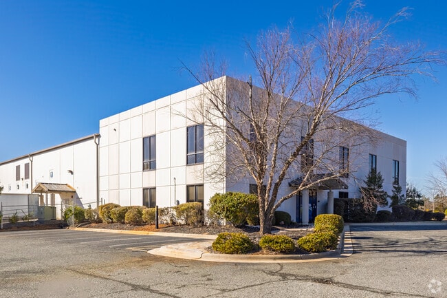
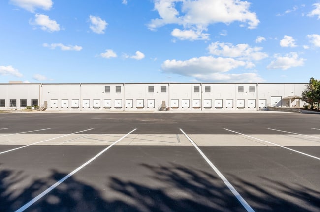
Property Record
719 N Regional Rd, Greensboro, NC 27409


Current Lease Availabilities
NEARBY LISTINGS FOR SALE OR LEASE
Property Detail
719 N Regional Rd
Greensboro-High Point, NC
John A Moore Jr & Us Wooven La
0097694
LOT 1-A MOORE&US WOVEN LABEL CORP PL:133-34
Industrialgeneral
Guilford
X
North Carolina
3710781600J
1-a
2024
6.84 AC
2025
Airport/W Guilford County
016008
Greensboro/Winston-Salem
120,000 SF
DEMOGRAPHICS near 719 N Regional Rd
1 Mile
3 Mile
5 Mile
2024 Total Population
2,752
16,081
62,881
2029 Population
2,840
16,142
63,028
Pop Growth 2024-2029
+ 3.20%
+ 0.38%
+ 0.23%
Average Age
39
39
40
2024 Total Households
1,078
6,164
26,806
HH Growth 2024-2029
+ 3.15%
+ 0.42%
+ 0.21%
Median Household Inc
$78,037
$91,883
$74,755
Avg Household Size
2.50
2.60
2.30
2024 Avg HH Vehicles
2.00
2.00
2.00
Median Home Value
$251,046
$262,646
$257,481
Median Year Built
2004
1994
1993
Nearby Places
Map Layers
Map Styles
 Street
 Aerial
- Restaurants
- Banks
- Shops
- Fitness
- Groceries
PUBLIC TRANSPORTATION
AIRPORT
Piedmont Triad International
DRIVE
WALK
Distance
Piedmont Triad International
15 min
5.8 mi
Freight Ports
Virginia Port Authority - Richmond
DRIVE
WALK
Distance
Virginia Port Authority - Richmond
244 min
211.3 mi
Nearby Properties
Address
Land Use
TOTAL SIZE
Lot Size
Zoning
Address
Land Use
TOTAL SIZE
Lot Size
Zoning
404,766 SF
153.35 AC
AR
Address
Land Use
TOTAL SIZE
Lot Size
Zoning
543,043 SF
62.40 AC
BP
Address
Land Use
TOTAL SIZE
Lot Size
Zoning
905,735 SF
39.66 AC
AR
Address
Land Use
TOTAL SIZE
Lot Size
Zoning
186,200 SF
10.58 AC
LI
Address
Land Use
TOTAL SIZE
Lot Size
Zoning
324,931 SF
16.32 AC
PUD
Address
Land Use
TOTAL SIZE
Lot Size
Zoning
340,508 SF
15.45 AC
RM-26
Address
Land Use
TOTAL SIZE
Lot Size
Zoning
509,216 SF
40.85 AC
LI
Address
Land Use
TOTAL SIZE
Lot Size
Zoning
285,123 SF
22.44 AC
PUD
Address
Land Use
TOTAL SIZE
Lot Size
Zoning
428,867 SF
76.65 AC
LI
Address
Land Use
TOTAL SIZE
Lot Size
Zoning
362,708 SF
56.81 AC
LI
Address
Land Use
TOTAL SIZE
Lot Size
Zoning
325.42 AC
HI
Address
Land Use
TOTAL SIZE
Lot Size
Zoning
180,568 SF
0.01 AC
AR
Address
Land Use
TOTAL SIZE
Lot Size
Zoning
341,000 SF
29.55 AC
LI
Address
Land Use
TOTAL SIZE
Lot Size
Zoning
543,123 SF
24.66 AC
LI
Address
Land Use
TOTAL SIZE
Lot Size
Zoning
217,000 SF
16.58 AC
LI
Address
Land Use
TOTAL SIZE
Lot Size
Zoning
267,381 SF
18.98 AC
RM-12
Address
Land Use
TOTAL SIZE
Lot Size
Zoning
161,975 SF
20.66 AC
BP
Address
Land Use
TOTAL SIZE
Lot Size
Zoning
246,306 SF
44.26 AC
RM-8
Address
Land Use
TOTAL SIZE
Lot Size
Zoning
208,936 SF
22.88 AC
LI
Address
Land Use
TOTAL SIZE
Lot Size
Zoning
134,781 SF
140.63 AC
AR
Address
Land Use
TOTAL SIZE
Lot Size
Zoning
209,128 SF
17.45 AC
RM-18
Address
Land Use
TOTAL SIZE
Lot Size
Zoning
112,728 SF
9.18 AC
BP
Address
Land Use
TOTAL SIZE
Lot Size
Zoning
121,932 SF
38.04 AC
BP
Address
Land Use
TOTAL SIZE
Lot Size
Zoning
66,780 SF
16.64 AC
LI
Address
Land Use
TOTAL SIZE
Lot Size
Zoning
192,200 SF
21.68 AC
LI
Address
Land Use
TOTAL SIZE
Lot Size
Zoning
171,955 SF
6.16 AC
BP
Address
Land Use
TOTAL SIZE
Lot Size
Zoning
237,518 SF
35.22 AC
RM-8
Address
Land Use
TOTAL SIZE
Lot Size
Zoning
254,857 SF
82.98 AC
PI
Address
Land Use
TOTAL SIZE
Lot Size
Zoning
100,733 SF
7.63 AC
BP
Address
Land Use
TOTAL SIZE
Lot Size
Zoning
292,513 SF
23.84 AC
HI
The World's #1 Commercial Real Estate Marketplace
Connect with us
© 2025 CoStar Group
The information above has been obtained from sources believed reliable. While we do not doubt its accuracy we have not verified it and make no guarantee, warranty or representation about it. It is your responsibility to independently confirm its accuracy and completeness. Any projections, opinions, assumptions, or estimates used are for example only and do not represent the current or future performance of the property. The value of this transaction to you depends on tax and other factors which should be evaluated by your tax, financial, and legal advisors. You and your advisors should conduct a careful, independent investigation of the property to determine to your satisfaction the suitability of the property for your needs.