Property Record
720 Goodlette-Frank Rd N, Naples, FL 34102


Save to a Folder
{{folder.Name}}
{{folder.ListingIds.length}} Properties
{{folder.ListingIds.length}} Property
Create a New Folder
Property Detail
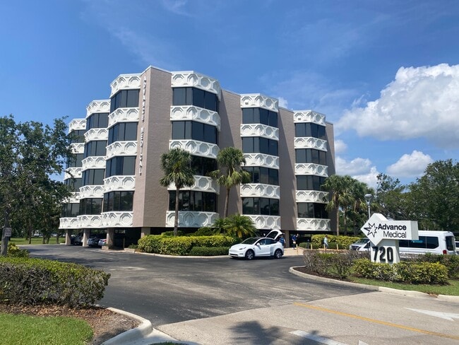
720 Goodlette-Frank Rd N
06050000627
COMMONS PROFESSIONAL PARK, THE N 230 FT OF LOT 1
Officebuilding
Collier
NAPLES
Florida
AE The base floodplain where base flood elevations are provided. AE Zones are now used on new format FIRMs instead of A1-A30 Zones.
1
2024
2.53 AC
2025
East Naples
010210
Southwest Florida
8,293 SF
Naples-Marco Island, FL
NEARBY LISTINGS FOR SALE OR LEASE
DEMOGRAPHICS near 720 Goodlette-Frank Rd N
1 mile
3 mile
5 mile
2025 Total Population
5,215
48,148
116,418
2030 Population
5,715
53,517
127,991
Pop Growth 2025-2030
+ 9.59%
+ 11.15%
+ 9.94%
Average Age
48
53
52
2025 Total Households
2,347
22,698
53,882
HH Growth 2025-2030
+ 8.82%
+ 11.00%
+ 9.74%
Median Household Inc
$75,153
$91,942
$86,210
Avg Household Size
2.10
2.00
2.00
2025 Avg HH Vehicles
2.00
2.00
2.00
Median Home Value
$1,003,647
$845,469
$642,883
Median Year Built
1984
1983
1989
Nearby Places
Map Layers
Map Styles
 Street
 Aerial
Layers
 Traffic
 Biking
Places
Listings with unknown addresses are not visible on the map
- Restaurants
- Banks
- Shops
- Fitness
- Groceries
PUBLIC TRANSPORTATION
AIRPORT
Southwest Florida International
Drive
Walk
Distance
Southwest Florida International
46 min
34.6 mi
SALE & LEASE HISTORY
LISTING DATE
SALE/LEASE

Sep 24, 2016
For Lease
Nov 16, 2016
For Lease
May 11, 2017
For Lease
May 05, 2017
For Lease
Jun 08, 2021
For Lease
Dec 30, 2025
For Sale
Aug 30, 2021
For Lease
Apr 28, 2023
For Sale
Nearby Properties
Address
Land Use
TOTAL SIZE
Lot Size
Zoning
Address
Land Use
TOTAL SIZE
Lot Size
Zoning
1,429,641 SF
45.28 AC
P
Address
Land Use
TOTAL SIZE
Lot Size
Zoning
556,070 SF
13.72 AC
NAPLES
Address
Land Use
TOTAL SIZE
Lot Size
Zoning
Address
Land Use
TOTAL SIZE
Lot Size
Zoning
1,850 SF
5.20 AC
Address
Land Use
TOTAL SIZE
Lot Size
Zoning
560,854 SF
592.62 AC
NAPLES
Address
Land Use
TOTAL SIZE
Lot Size
Zoning
2,440 SF
3.99 AC
NAPLES
Address
Land Use
TOTAL SIZE
Lot Size
Zoning
77,529 SF
1.15 AC
NAPLES
Address
Land Use
TOTAL SIZE
Lot Size
Zoning
250,674 SF
33.61 AC
NAPLES
Address
Land Use
TOTAL SIZE
Lot Size
Zoning
362,032 SF
15.97 AC
PUD
Address
Land Use
TOTAL SIZE
Lot Size
Zoning
936 SF
2.47 AC
Address
Land Use
TOTAL SIZE
Lot Size
Zoning
140,512 SF
12.10 AC
PUD
Address
Land Use
TOTAL SIZE
Lot Size
Zoning
26,296 SF
2.10 AC
Address
Land Use
TOTAL SIZE
Lot Size
Zoning
344,520 SF
21.91 AC
PUD
Address
Land Use
TOTAL SIZE
Lot Size
Zoning
291,699 SF
18.17 AC
PUD
Address
Land Use
TOTAL SIZE
Lot Size
Zoning
932,389 SF
36.28 AC
NAPLES
Address
Land Use
TOTAL SIZE
Lot Size
Zoning
131,210 SF
3.62 AC
Address
Land Use
TOTAL SIZE
Lot Size
Zoning
137,799 SF
5.78 AC
Address
Land Use
TOTAL SIZE
Lot Size
Zoning
159,901 SF
10.08 AC
RMF-16
Address
Land Use
TOTAL SIZE
Lot Size
Zoning
93,542 SF
4.09 AC
NAPLES
Address
Land Use
TOTAL SIZE
Lot Size
Zoning
39,546 SF
1.62 AC
Address
Land Use
TOTAL SIZE
Lot Size
Zoning
71,516 SF
2.88 AC
NAPLES
Address
Land Use
TOTAL SIZE
Lot Size
Zoning
255,522 SF
21.83 AC
NAPLES
Address
Land Use
TOTAL SIZE
Lot Size
Zoning
217,119 SF
4.20 AC
NAPLES
Address
Land Use
TOTAL SIZE
Lot Size
Zoning
61,910 SF
45.05 AC
A
Address
Land Use
TOTAL SIZE
Lot Size
Zoning
69,767 SF
1.89 AC
NAPLES
Address
Land Use
TOTAL SIZE
Lot Size
Zoning
70,944 SF
9.51 AC
P
Address
Land Use
TOTAL SIZE
Lot Size
Zoning
203,171 SF
16.64 AC
NAPLES
Address
Land Use
TOTAL SIZE
Lot Size
Zoning
168,247 SF
25.60 AC
RMF-6
Address
Land Use
TOTAL SIZE
Lot Size
Zoning
19,641 SF
2.93 AC
NAPLES
Address
Land Use
TOTAL SIZE
Lot Size
Zoning
1,388 SF
6.89 AC
NAPLES
The World's #1 Commercial Real Estate Marketplace
Connect with us
© 2026 CoStar Group
The information above has been obtained from sources believed reliable. While we do not doubt its accuracy we have not verified it and make no guarantee, warranty or representation about it. It is your responsibility to independently confirm its accuracy and completeness. Any projections, opinions, assumptions, or estimates used are for example only and do not represent the current or future performance of the property. The value of this transaction to you depends on tax and other factors which should be evaluated by your tax, financial, and legal advisors. You and your advisors should conduct a careful, independent investigation of the property to determine to your satisfaction the suitability of the property for your needs.