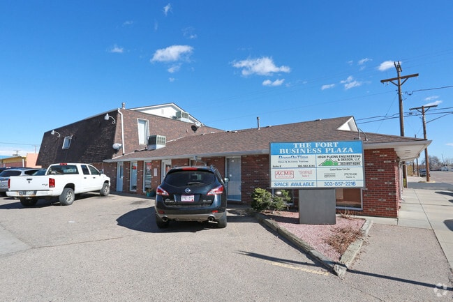
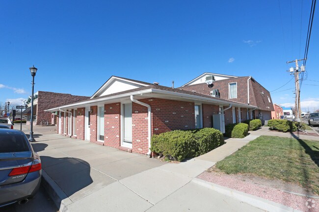
Property Record
721 4Th St, Fort Lupton, CO 80621

Property Detail
721 4Th St
Greeley, CO
FTL 15409 L10 THRU L12 BLK11
R0071387
Weld
Apartment
Colorado
B and X Area of moderate flood hazard, usually the area between the limits of the 100-year and 500-year floods.
10
2024
0.24 AC
2025
Weld County
001905
Denver
8,664 SF
NEARBY LISTINGS FOR SALE OR LEASE
DEMOGRAPHICS near 721 4Th St
1 mile
3 mile
5 mile
2025 Total Population
8,787
11,764
15,054
2030 Population
9,848
13,174
16,762
Pop Growth 2025-2030
+ 12.07%
+ 11.99%
+ 11.35%
Average Age
38
39
39
2025 Total Households
2,959
3,958
5,063
HH Growth 2025-2030
+ 12.34%
+ 12.30%
+ 11.67%
Median Household Inc
$68,571
$77,823
$82,379
Avg Household Size
2.90
2.90
2.90
2025 Avg HH Vehicles
2.00
2.00
2.00
Median Home Value
$371,418
$402,146
$429,766
Median Year Built
1986
1990
1989
Nearby Places
Map Layers
Map Styles
 Street
 Aerial
Transit
 Traffic
 Biking
Places
Listings with unknown addresses are not visible on the map
- Restaurants
- Banks
- Shops
- Fitness
- Groceries
PUBLIC TRANSPORTATION
AIRPORT
Denver International
Drive
Walk
Distance
Denver International
38 min
28.4 mi
Freight Ports
Tulsa Port Of Catoosa
Drive
Walk
Distance
Tulsa Port Of Catoosa
745 min
722.5 mi
SALE & LEASE HISTORY
LISTING DATE
SALE/LEASE

Jun 26, 2023
For Sale
Jan 27, 2017
For Lease
Nearby Properties
Address
Land Use
TOTAL SIZE
Lot Size
Zoning
Address
Land Use
TOTAL SIZE
Lot Size
Zoning
Address
Land Use
TOTAL SIZE
Lot Size
Zoning
198,777 SF
59.19 AC
Address
Land Use
TOTAL SIZE
Lot Size
Zoning
217,236 SF
55.97 AC
Address
Land Use
TOTAL SIZE
Lot Size
Zoning
276,393 SF
40 AC
Address
Land Use
TOTAL SIZE
Lot Size
Zoning
70,131 SF
11.43 AC
Address
Land Use
TOTAL SIZE
Lot Size
Zoning
55,286 SF
59.13 AC
Address
Land Use
TOTAL SIZE
Lot Size
Zoning
37,126 SF
33.04 AC
Address
Land Use
TOTAL SIZE
Lot Size
Zoning
153,874 SF
8.92 AC
Address
Land Use
TOTAL SIZE
Lot Size
Zoning
103,400 SF
15.15 AC
Address
Land Use
TOTAL SIZE
Lot Size
Zoning
36,200 SF
25 AC
Address
Land Use
TOTAL SIZE
Lot Size
Zoning
78,700 SF
23.10 AC
Address
Land Use
TOTAL SIZE
Lot Size
Zoning
96,798 SF
16.14 AC
Address
Land Use
TOTAL SIZE
Lot Size
Zoning
238,735 SF
21.18 AC
Address
Land Use
TOTAL SIZE
Lot Size
Zoning
58,165 SF
5.45 AC
Address
Land Use
TOTAL SIZE
Lot Size
Zoning
48,393 SF
15 AC
Address
Land Use
TOTAL SIZE
Lot Size
Zoning
30,000 SF
5.86 AC
Address
Land Use
TOTAL SIZE
Lot Size
Zoning
42,500 SF
7.73 AC
Address
Land Use
TOTAL SIZE
Lot Size
Zoning
26,065 SF
20 AC
Address
Land Use
TOTAL SIZE
Lot Size
Zoning
23,763 SF
5.86 AC
Address
Land Use
TOTAL SIZE
Lot Size
Zoning
81,122 SF
13 AC
Address
Land Use
TOTAL SIZE
Lot Size
Zoning
38,880 SF
3.90 AC
Address
Land Use
TOTAL SIZE
Lot Size
Zoning
899,000 SF
31.42 AC
Address
Land Use
TOTAL SIZE
Lot Size
Zoning
38,071 SF
4.06 AC
Address
Land Use
TOTAL SIZE
Lot Size
Zoning
24,227 SF
8 AC
Address
Land Use
TOTAL SIZE
Lot Size
Zoning
32,837 SF
30.33 AC
Address
Land Use
TOTAL SIZE
Lot Size
Zoning
13,375 SF
2 AC
Address
Land Use
TOTAL SIZE
Lot Size
Zoning
51,315 SF
10.66 AC
Address
Land Use
TOTAL SIZE
Lot Size
Zoning
63,694 SF
2.89 AC
Address
Land Use
TOTAL SIZE
Lot Size
Zoning
15,426 SF
3.01 AC
Address
Land Use
TOTAL SIZE
Lot Size
Zoning
26,700 SF
20.11 AC
The World's #1 Commercial Real Estate Marketplace
Connect with us
© 2026 CoStar Group
The information above has been obtained from sources believed reliable. While we do not doubt its accuracy we have not verified it and make no guarantee, warranty or representation about it. It is your responsibility to independently confirm its accuracy and completeness. Any projections, opinions, assumptions, or estimates used are for example only and do not represent the current or future performance of the property. The value of this transaction to you depends on tax and other factors which should be evaluated by your tax, financial, and legal advisors. You and your advisors should conduct a careful, independent investigation of the property to determine to your satisfaction the suitability of the property for your needs.