Property Record
721 E Chestnut Hill Rd, Newark, DE 19713


Property Detail
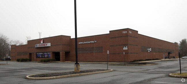
721 E Chestnut Hill Rd
09-022.40-228
BEG AT POINT ON SELY SIDE OF CHESTNUT HILL RD 150 FT WIDE SAID POINT BEING NELY END OF 25 FT RADIUS JUNCTION CURVE JOINING NELY SIDE OF STANLEY PLAZA BLVD
Officebuilding
New Castle
CN
Delaware
B and X Area of moderate flood hazard, usually the area between the limits of the 100-year and 500-year floods.
4.83 AC
0
South New Castle County
2025
Philadelphia
014705
Philadelphia-Camden-Wilmington, PA-NJ-DE-MD
12,383 SF
NEARBY LISTINGS FOR SALE OR LEASE
DEMOGRAPHICS near 721 E Chestnut Hill Rd
1 mile
3 mile
5 mile
2025 Total Population
12,338
86,278
215,048
2030 Population
12,585
89,292
223,145
Pop Growth 2025-2030
+ 2.00%
+ 3.49%
+ 3.77%
Average Age
40
38
39
2025 Total Households
4,728
32,047
82,810
HH Growth 2025-2030
+ 2.22%
+ 3.68%
+ 3.95%
Median Household Inc
$73,294
$75,585
$82,082
Avg Household Size
2.50
2.50
2.50
2025 Avg HH Vehicles
2.00
2.00
2.00
Median Home Value
$291,428
$311,717
$325,019
Median Year Built
1969
1980
1982
Nearby Places
Map Layers
Map Styles
 Street
 Aerial
Transit
 Traffic
 Biking
Places
Listings with unknown addresses are not visible on the map
- Restaurants
- Banks
- Shops
- Fitness
- Groceries
PUBLIC TRANSPORTATION
COMMUTER RAIL
Churchmans Crossing (R2 - Southeastern Pennsylvania Transportation Authority Regional Rail (SEPTA Regional Rail))
Drive
Walk
Distance
Churchmans Crossing (R2 - Southeastern Pennsylvania Transportation Authority Regional Rail (SEPTA Regional Rail))
4 min
2.5 mi
Newark (R2 - Southeastern Pennsylvania Transportation Authority Regional Rail (SEPTA Regional Rail))
Drive
Walk
Distance
Newark (R2 - Southeastern Pennsylvania Transportation Authority Regional Rail (SEPTA Regional Rail))
6 min
4.3 mi
AIRPORT
Philadelphia International
Drive
Walk
Distance
Philadelphia International
43 min
31.4 mi
Freight Ports
Port of Wilmington, RI
Drive
Walk
Distance
Port of Wilmington, RI
18 min
11.3 mi
Nearby Properties
Address
Land Use
TOTAL SIZE
Lot Size
Zoning
Address
Land Use
TOTAL SIZE
Lot Size
Zoning
525,757 SF
189.70 AC
NCPUD
Address
Land Use
TOTAL SIZE
Lot Size
Zoning
467,262 SF
28.74 AC
CR
Address
Land Use
TOTAL SIZE
Lot Size
Zoning
354.61 AC
18UN
Address
Land Use
TOTAL SIZE
Lot Size
Zoning
Address
Land Use
TOTAL SIZE
Lot Size
Zoning
488,637 SF
229.83 AC
NCPUD
Address
Land Use
TOTAL SIZE
Lot Size
Zoning
Address
Land Use
TOTAL SIZE
Lot Size
Zoning
735,703 SF
49.15 AC
NCAP
Address
Land Use
TOTAL SIZE
Lot Size
Zoning
43,943 SF
8.95 AC
18BB
Address
Land Use
TOTAL SIZE
Lot Size
Zoning
80,834 SF
4.60 AC
18BB
Address
Land Use
TOTAL SIZE
Lot Size
Zoning
92,081 SF
30.99 AC
18RM
Address
Land Use
TOTAL SIZE
Lot Size
Zoning
Address
Land Use
TOTAL SIZE
Lot Size
Zoning
351,528 SF
24.88 AC
NCAP
Address
Land Use
TOTAL SIZE
Lot Size
Zoning
33,790 SF
45.17 AC
S
Address
Land Use
TOTAL SIZE
Lot Size
Zoning
216,689 SF
16.44 AC
CR
Address
Land Use
TOTAL SIZE
Lot Size
Zoning
76,357 SF
145.10 AC
CR
Address
Land Use
TOTAL SIZE
Lot Size
Zoning
54,907 SF
21.74 AC
18RA
Address
Land Use
TOTAL SIZE
Lot Size
Zoning
294,518 SF
29.44 AC
ST
Address
Land Use
TOTAL SIZE
Lot Size
Zoning
203,570 SF
83.85 AC
OR
Address
Land Use
TOTAL SIZE
Lot Size
Zoning
333,334 SF
20.57 AC
NCPUD
Address
Land Use
TOTAL SIZE
Lot Size
Zoning
135,764 SF
18.59 AC
NCAP
Address
Land Use
TOTAL SIZE
Lot Size
Zoning
Address
Land Use
TOTAL SIZE
Lot Size
Zoning
234,941 SF
19.54 AC
NCPUD
Address
Land Use
TOTAL SIZE
Lot Size
Zoning
Address
Land Use
TOTAL SIZE
Lot Size
Zoning
57,214 SF
1.10 AC
18BB
Address
Land Use
TOTAL SIZE
Lot Size
Zoning
62,498 SF
132.23 AC
I
Address
Land Use
TOTAL SIZE
Lot Size
Zoning
276,191 SF
54.91 AC
BP
Address
Land Use
TOTAL SIZE
Lot Size
Zoning
2,463 SF
5.98 AC
18STC
Address
Land Use
TOTAL SIZE
Lot Size
Zoning
242,811 SF
38.77 AC
CR
Address
Land Use
TOTAL SIZE
Lot Size
Zoning
119,820 SF
19.86 AC
18UN
Address
Land Use
TOTAL SIZE
Lot Size
Zoning
102,955 SF
9.57 AC
I
The World's #1 Commercial Real Estate Marketplace
Connect with us
© 2026 CoStar Group
The information above has been obtained from sources believed reliable. While we do not doubt its accuracy we have not verified it and make no guarantee, warranty or representation about it. It is your responsibility to independently confirm its accuracy and completeness. Any projections, opinions, assumptions, or estimates used are for example only and do not represent the current or future performance of the property. The value of this transaction to you depends on tax and other factors which should be evaluated by your tax, financial, and legal advisors. You and your advisors should conduct a careful, independent investigation of the property to determine to your satisfaction the suitability of the property for your needs.