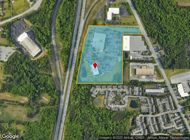
Property Record
721 N Regional Rd, Greensboro, NC 27409

NEARBY LISTINGS FOR SALE OR LEASE
Property Detail
721 N Regional Rd
Greensboro-High Point, NC
Warner
0097690
TIME WARNER OPERATIONS CENTER LO:2A PL:133-34
Industrialgeneral
Guilford
X
North Carolina
3710781600J
2a
2024
23.67 AC
2025
Airport/W Guilford County
016008
Greensboro/Winston-Salem
121,396 SF
DEMOGRAPHICS near 721 N Regional Rd
1 Mile
3 Mile
5 Mile
2024 Total Population
2,848
15,607
61,419
2029 Population
2,941
15,669
61,595
Pop Growth 2024-2029
+ 3.27%
+ 0.40%
+ 0.29%
Average Age
39
39
40
2024 Total Households
1,116
5,926
26,089
HH Growth 2024-2029
+ 3.14%
+ 0.44%
+ 0.26%
Median Household Inc
$78,311
$93,547
$75,358
Avg Household Size
2.50
2.60
2.30
2024 Avg HH Vehicles
2.00
2.00
2.00
Median Home Value
$251,844
$264,619
$259,281
Median Year Built
2005
1995
1994
Nearby Places
Map Layers
Map Styles
 Street
 Aerial
- Restaurants
- Banks
- Shops
- Fitness
- Groceries
PUBLIC TRANSPORTATION
AIRPORT
Piedmont Triad International
DRIVE
WALK
Distance
Piedmont Triad International
17 min
6.2 mi
Freight Ports
Virginia Port Authority - Richmond
DRIVE
WALK
Distance
Virginia Port Authority - Richmond
246 min
211.6 mi
Nearby Properties
Address
Land Use
TOTAL SIZE
Lot Size
Zoning
Address
Land Use
TOTAL SIZE
Lot Size
Zoning
404,766 SF
153.35 AC
AR
Address
Land Use
TOTAL SIZE
Lot Size
Zoning
543,043 SF
62.40 AC
BP
Address
Land Use
TOTAL SIZE
Lot Size
Zoning
905,735 SF
39.66 AC
AR
Address
Land Use
TOTAL SIZE
Lot Size
Zoning
186,200 SF
10.58 AC
LI
Address
Land Use
TOTAL SIZE
Lot Size
Zoning
324,931 SF
16.32 AC
PUD
Address
Land Use
TOTAL SIZE
Lot Size
Zoning
340,508 SF
15.45 AC
RM-26
Address
Land Use
TOTAL SIZE
Lot Size
Zoning
509,216 SF
40.85 AC
LI
Address
Land Use
TOTAL SIZE
Lot Size
Zoning
285,123 SF
22.44 AC
PUD
Address
Land Use
TOTAL SIZE
Lot Size
Zoning
428,867 SF
76.65 AC
LI
Address
Land Use
TOTAL SIZE
Lot Size
Zoning
362,708 SF
56.81 AC
LI
Address
Land Use
TOTAL SIZE
Lot Size
Zoning
325.42 AC
HI
Address
Land Use
TOTAL SIZE
Lot Size
Zoning
180,568 SF
0.01 AC
AR
Address
Land Use
TOTAL SIZE
Lot Size
Zoning
341,000 SF
29.55 AC
LI
Address
Land Use
TOTAL SIZE
Lot Size
Zoning
543,123 SF
24.66 AC
LI
Address
Land Use
TOTAL SIZE
Lot Size
Zoning
217,000 SF
16.58 AC
LI
Address
Land Use
TOTAL SIZE
Lot Size
Zoning
267,381 SF
18.98 AC
RM-12
Address
Land Use
TOTAL SIZE
Lot Size
Zoning
161,975 SF
20.66 AC
BP
Address
Land Use
TOTAL SIZE
Lot Size
Zoning
208,936 SF
22.88 AC
LI
Address
Land Use
TOTAL SIZE
Lot Size
Zoning
134,781 SF
140.63 AC
AR
Address
Land Use
TOTAL SIZE
Lot Size
Zoning
209,128 SF
17.45 AC
RM-18
Address
Land Use
TOTAL SIZE
Lot Size
Zoning
112,728 SF
9.18 AC
BP
Address
Land Use
TOTAL SIZE
Lot Size
Zoning
121,932 SF
38.04 AC
BP
Address
Land Use
TOTAL SIZE
Lot Size
Zoning
66,780 SF
16.64 AC
LI
Address
Land Use
TOTAL SIZE
Lot Size
Zoning
192,200 SF
21.68 AC
LI
Address
Land Use
TOTAL SIZE
Lot Size
Zoning
171,955 SF
6.16 AC
BP
Address
Land Use
TOTAL SIZE
Lot Size
Zoning
254,857 SF
82.98 AC
PI
Address
Land Use
TOTAL SIZE
Lot Size
Zoning
100,733 SF
7.63 AC
BP
Address
Land Use
TOTAL SIZE
Lot Size
Zoning
292,513 SF
23.84 AC
HI
Address
Land Use
TOTAL SIZE
Lot Size
Zoning
218,724 SF
33.96 AC
CU-LI
Address
Land Use
TOTAL SIZE
Lot Size
Zoning
316,092 SF
16.10 AC
LI
The World's #1 Commercial Real Estate Marketplace
Connect with us
© 2026 CoStar Group
The information above has been obtained from sources believed reliable. While we do not doubt its accuracy we have not verified it and make no guarantee, warranty or representation about it. It is your responsibility to independently confirm its accuracy and completeness. Any projections, opinions, assumptions, or estimates used are for example only and do not represent the current or future performance of the property. The value of this transaction to you depends on tax and other factors which should be evaluated by your tax, financial, and legal advisors. You and your advisors should conduct a careful, independent investigation of the property to determine to your satisfaction the suitability of the property for your needs.