Property Record
722 E Pulaski Hwy, Elkton, MD 21921

NEARBY LISTINGS FOR SALE OR LEASE
Property Detail
722 E Pulaski Hwy
03-033333
Mcheal Vaniska To Acorn Investment Compa
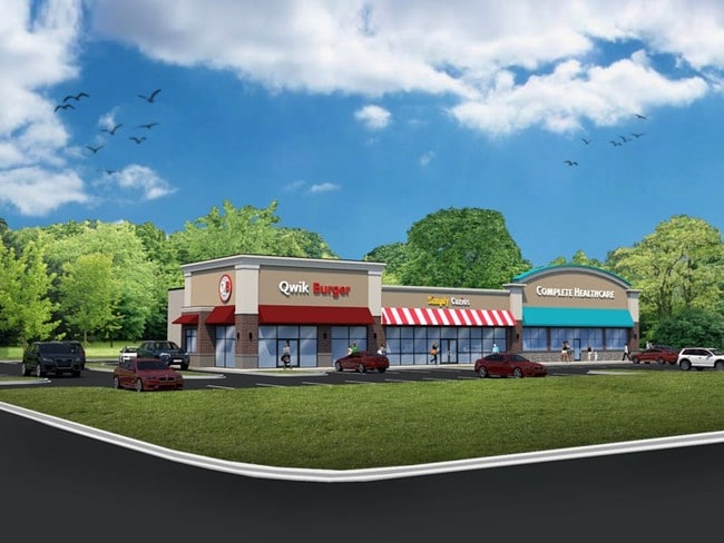
Stripcommercialcenter
1.209 ACRES 722 EAST PULASKI HIGHWAY E OF ELKTON
X
Cecil
10003C0225L
Maryland
2025
1.21 AC
2025
Cecil County
030505
Baltimore
8,713 SF
Philadelphia-Camden-Wilmington, PA-NJ-DE-MD
DEMOGRAPHICS near 722 E Pulaski Hwy
1 mile
3 mile
5 mile
2024 Total Population
5,009
28,597
67,139
2029 Population
5,085
29,169
68,419
Pop Growth 2024-2029
+ 1.52%
+ 2.00%
+ 1.91%
Average Age
39
39
40
2024 Total Households
1,789
10,388
25,105
HH Growth 2024-2029
+ 1.45%
+ 2.02%
+ 1.96%
Median Household Inc
$63,200
$71,342
$78,979
Avg Household Size
2.70
2.60
2.60
2024 Avg HH Vehicles
2.00
2.00
2.00
Median Home Value
$211,692
$280,273
$305,885
Median Year Built
1977
1990
1990
Nearby Places
Map Layers
Map Styles
 Street
 Aerial
Transit
 Traffic
 Biking
Places
Listings with unknown addresses are not visible on the map
- Restaurants
- Banks
- Shops
- Fitness
- Groceries
PUBLIC TRANSPORTATION
COMMUTER RAIL
Newark (R2 - Southeastern Pennsylvania Transportation Authority Regional Rail (SEPTA Regional Rail))
Drive
Walk
Distance
Newark (R2 - Southeastern Pennsylvania Transportation Authority Regional Rail (SEPTA Regional Rail))
12 min
8.1 mi
Freight Ports
Port of Wilmington, RI
Drive
Walk
Distance
Port of Wilmington, RI
29 min
20.0 mi
SALE & LEASE HISTORY
LISTING DATE
SALE/LEASE

Sep 25, 2016
For Lease
Sep 23, 2016
For Sale
Nearby Properties
Address
Land Use
TOTAL SIZE
Lot Size
Zoning
Address
Land Use
TOTAL SIZE
Lot Size
Zoning
766,520 SF
69.52 AC
BI
Address
Land Use
TOTAL SIZE
Lot Size
Zoning
193,004 SF
3.67 AC
C1
Address
Land Use
TOTAL SIZE
Lot Size
Zoning
200,880 SF
49.83 AC
R3
Address
Land Use
TOTAL SIZE
Lot Size
Zoning
263,500 SF
15.28 AC
BI
Address
Land Use
TOTAL SIZE
Lot Size
Zoning
20,973 SF
75.14 AC
M1
Address
Land Use
TOTAL SIZE
Lot Size
Zoning
82,688 SF
11.30 AC
BI
Address
Land Use
TOTAL SIZE
Lot Size
Zoning
65,668 SF
4.52 AC
C2
Address
Land Use
TOTAL SIZE
Lot Size
Zoning
267,840 SF
20.35 AC
BI
Address
Land Use
TOTAL SIZE
Lot Size
Zoning
31,350 SF
8.89 AC
R2
Address
Land Use
TOTAL SIZE
Lot Size
Zoning
205,955 SF
24.91 AC
BI
Address
Land Use
TOTAL SIZE
Lot Size
Zoning
17.50 AC
R3
Address
Land Use
TOTAL SIZE
Lot Size
Zoning
2,189 SF
37.37 AC
BI
Address
Land Use
TOTAL SIZE
Lot Size
Zoning
85,924 SF
2.95 AC
C1
Address
Land Use
TOTAL SIZE
Lot Size
Zoning
159,038 SF
22.52 AC
R3
Address
Land Use
TOTAL SIZE
Lot Size
Zoning
56,815 SF
2.40 AC
C1
Address
Land Use
TOTAL SIZE
Lot Size
Zoning
64,800 SF
14.01 AC
C3
Address
Land Use
TOTAL SIZE
Lot Size
Zoning
32,997 SF
6.77 AC
R3 C2
Address
Land Use
TOTAL SIZE
Lot Size
Zoning
277,806 SF
31.82 AC
C2
Address
Land Use
TOTAL SIZE
Lot Size
Zoning
11,200 SF
64.19 AC
BI
Address
Land Use
TOTAL SIZE
Lot Size
Zoning
8,000 SF
11.51 AC
C2
Address
Land Use
TOTAL SIZE
Lot Size
Zoning
65,332 SF
10.56 AC
R3 RP
Address
Land Use
TOTAL SIZE
Lot Size
Zoning
35,617 SF
4.15 AC
C2
Address
Land Use
TOTAL SIZE
Lot Size
Zoning
82,079 SF
13.60 AC
R2
Address
Land Use
TOTAL SIZE
Lot Size
Zoning
8,864 SF
28.61 AC
BI
Address
Land Use
TOTAL SIZE
Lot Size
Zoning
62,609 SF
15 AC
R2
Address
Land Use
TOTAL SIZE
Lot Size
Zoning
77,156 SF
34.36 AC
BI
Address
Land Use
TOTAL SIZE
Lot Size
Zoning
15.86 AC
R3
Address
Land Use
TOTAL SIZE
Lot Size
Zoning
163,650 SF
2.98 AC
C1
Address
Land Use
TOTAL SIZE
Lot Size
Zoning
137,330 SF
14.11 AC
C2
Address
Land Use
TOTAL SIZE
Lot Size
Zoning
51,560 SF
4.57 AC
OR
The World's #1 Commercial Real Estate Marketplace
Connect with us
© 2026 CoStar Group
The information above has been obtained from sources believed reliable. While we do not doubt its accuracy we have not verified it and make no guarantee, warranty or representation about it. It is your responsibility to independently confirm its accuracy and completeness. Any projections, opinions, assumptions, or estimates used are for example only and do not represent the current or future performance of the property. The value of this transaction to you depends on tax and other factors which should be evaluated by your tax, financial, and legal advisors. You and your advisors should conduct a careful, independent investigation of the property to determine to your satisfaction the suitability of the property for your needs.