Property Record
7224 Beech Ave, Orangevale, CA 95662


Save to a Folder
{{folder.Name}}
{{folder.ListingIds.length}} Properties
{{folder.ListingIds.length}} Property
Create a New Folder
Property Detail
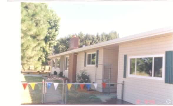
7224 Beech Ave
213-0331-014
N 144 FT OF W 181 FT OF LOT 27 OF ORANGEVALE COL
Daycare
Sacramento
AR-1
California
B and X Area of moderate flood hazard, usually the area between the limits of the 100-year and 500-year floods.
27
2025
0.60 AC
2026
Orangevale/Citrus Hts
008203
Sacramento
1,822 SF
Sacramento-Roseville-Folsom, CA
NEARBY LISTINGS FOR SALE OR LEASE
DEMOGRAPHICS near 7224 Beech Ave
1 mile
3 mile
5 mile
2025 Total Population
5,683
106,184
262,781
2030 Population
5,657
107,991
267,598
Pop Growth 2025-2030
(0.46%)
+ 1.70%
+ 1.83%
Average Age
46
43
43
2025 Total Households
2,125
40,901
101,451
HH Growth 2025-2030
(0.33%)
+ 1.72%
+ 1.88%
Median Household Inc
$99,450
$99,257
$97,401
Avg Household Size
2.60
2.50
2.50
2025 Avg HH Vehicles
2.00
2.00
2.00
Median Home Value
$638,889
$652,925
$631,941
Median Year Built
1974
1980
1979
Nearby Places
Map Layers
Map Styles
 Street
 Aerial
Layers
 Traffic
 Biking
Places
Listings with unknown addresses are not visible on the map
- Restaurants
- Banks
- Shops
- Fitness
- Groceries
PUBLIC TRANSPORTATION
COMMUTER RAIL
Roseville Amtrak (California Zephyr - Capitol Corridor Joint Powers Authority, Capitol Corridor - Capitol Corridor Joint Powers Authority)
Drive
Walk
Distance
Roseville Amtrak (California Zephyr - Capitol Corridor Joint Powers Authority, Capitol Corridor - Capitol Corridor Joint Powers Authority)
15 min
7.6 mi
Rocklin (Capitol Corridor - Capitol Corridor Joint Powers Authority)
Drive
Walk
Distance
Rocklin (Capitol Corridor - Capitol Corridor Joint Powers Authority)
14 min
8.1 mi
AIRPORT
Sacramento International
Drive
Walk
Distance
Sacramento International
37 min
26.3 mi
Freight Ports
Port of Stockton
Drive
Walk
Distance
Port of Stockton
80 min
66.5 mi
Nearby Properties
Address
Land Use
TOTAL SIZE
Lot Size
Zoning
Address
Land Use
TOTAL SIZE
Lot Size
Zoning
638,040 SF
38.70 AC
Address
Land Use
TOTAL SIZE
Lot Size
Zoning
251,225 SF
23.54 AC
SC
Address
Land Use
TOTAL SIZE
Lot Size
Zoning
289,557 SF
28.31 AC
R-M (PD)
Address
Land Use
TOTAL SIZE
Lot Size
Zoning
120,983 SF
17.60 AC
Address
Land Use
TOTAL SIZE
Lot Size
Zoning
157,580 SF
16.93 AC
R-M
Address
Land Use
TOTAL SIZE
Lot Size
Zoning
142,063 SF
8.70 AC
Address
Land Use
TOTAL SIZE
Lot Size
Zoning
241,672 SF
18.54 AC
SC
Address
Land Use
TOTAL SIZE
Lot Size
Zoning
78,730 SF
8.03 AC
RD20 BP
Address
Land Use
TOTAL SIZE
Lot Size
Zoning
118,155 SF
3.80 AC
Address
Land Use
TOTAL SIZE
Lot Size
Zoning
128,480 SF
7.95 AC
RD30 BP
Address
Land Use
TOTAL SIZE
Lot Size
Zoning
84,387 SF
3.52 AC
LC
Address
Land Use
TOTAL SIZE
Lot Size
Zoning
166,268 SF
9.50 AC
RD30
Address
Land Use
TOTAL SIZE
Lot Size
Zoning
91,983 SF
3.27 AC
SPA
Address
Land Use
TOTAL SIZE
Lot Size
Zoning
137,732 SF
12.87 AC
SC
Address
Land Use
TOTAL SIZE
Lot Size
Zoning
78,379 SF
4.91 AC
RD20
Address
Land Use
TOTAL SIZE
Lot Size
Zoning
254,982 SF
19.60 AC
Address
Land Use
TOTAL SIZE
Lot Size
Zoning
82,499 SF
4.74 AC
RD-30
Address
Land Use
TOTAL SIZE
Lot Size
Zoning
104,750 SF
5.66 AC
RD-20
Address
Land Use
TOTAL SIZE
Lot Size
Zoning
87,942 SF
9.03 AC
SPA
Address
Land Use
TOTAL SIZE
Lot Size
Zoning
2,940 SF
4.97 AC
RD10
Address
Land Use
TOTAL SIZE
Lot Size
Zoning
134,216 SF
7.79 AC
SPA
Address
Land Use
TOTAL SIZE
Lot Size
Zoning
139,734 SF
8.03 AC
SPA
Address
Land Use
TOTAL SIZE
Lot Size
Zoning
124,339 SF
10.28 AC
RD-20
Address
Land Use
TOTAL SIZE
Lot Size
Zoning
112,068 SF
10.22 AC
SC
Address
Land Use
TOTAL SIZE
Lot Size
Zoning
107,047 SF
6.12 AC
SPA
Address
Land Use
TOTAL SIZE
Lot Size
Zoning
72,245 SF
4.11 AC
RD-30
Address
Land Use
TOTAL SIZE
Lot Size
Zoning
64,140 SF
4.82 AC
RD-20
Address
Land Use
TOTAL SIZE
Lot Size
Zoning
139,440 SF
8.90 AC
Address
Land Use
TOTAL SIZE
Lot Size
Zoning
47,482 SF
8.11 AC
SPA
Address
Land Use
TOTAL SIZE
Lot Size
Zoning
31,722 SF
151.30 AC
RSAGB40
The World's #1 Commercial Real Estate Marketplace
Connect with us
© 2026 CoStar Group
The information above has been obtained from sources believed reliable. While we do not doubt its accuracy we have not verified it and make no guarantee, warranty or representation about it. It is your responsibility to independently confirm its accuracy and completeness. Any projections, opinions, assumptions, or estimates used are for example only and do not represent the current or future performance of the property. The value of this transaction to you depends on tax and other factors which should be evaluated by your tax, financial, and legal advisors. You and your advisors should conduct a careful, independent investigation of the property to determine to your satisfaction the suitability of the property for your needs.