Property Record
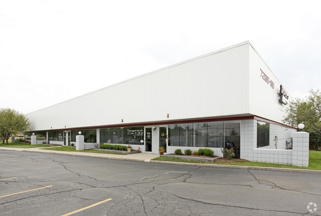
7280 N Haggerty Rd, Canton, MI 48187


NEARBY LISTINGS FOR SALE OR LEASE
Property Detail
7280 N Haggerty Rd
Detroit-Warren-Dearborn, MI
Mid Point Industrial Park
71-003-01-0002-002
01D2B 3 PT OF LOT 2 ALSO LOT 3 DESC AS BEG AT NW COR LOT 3 TH N88DEG 40M 04S E 332.58FT TH ON A CURVE TO LEFT RAD 11656.16FT
Loftbuilding
Wayne
AE
Michigan
26163C0204E
2-3
2025
1.29 AC
2025
Southern I-275
563300
Detroit
14,000 SF
DEMOGRAPHICS near 7280 N Haggerty Rd
1 Mile
3 Mile
5 Mile
2024 Total Population
8,812
89,813
210,251
2029 Population
8,459
86,156
201,589
Pop Growth 2024-2029
(4.01%)
(4.07%)
(4.12%)
Average Age
40
41
42
2024 Total Households
3,976
38,536
86,886
HH Growth 2024-2029
(3.95%)
(4.06%)
(4.08%)
Median Household Inc
$70,355
$78,555
$84,486
Avg Household Size
2.20
2.30
2.40
2024 Avg HH Vehicles
2.00
2.00
2.00
Median Home Value
$243,580
$259,649
$255,006
Median Year Built
1976
1976
1975
Nearby Places
Map Layers
Map Styles
 Street
 Aerial
- Restaurants
- Banks
- Shops
- Fitness
- Groceries
PUBLIC TRANSPORTATION
AIRPORT
Detroit Metro Wayne County
DRIVE
WALK
Distance
Detroit Metro Wayne County
17 min
14.9 mi
Detroit City
DRIVE
WALK
Distance
Detroit City
36 min
29.8 mi
Freight Ports
Port of Baltimore
DRIVE
WALK
Distance
Port of Baltimore
1 min
416.2 mi
Nearby Properties
Address
Land Use
TOTAL SIZE
Lot Size
Zoning
Address
Land Use
TOTAL SIZE
Lot Size
Zoning
741,173 SF
63.81 AC
Address
Land Use
TOTAL SIZE
Lot Size
Zoning
1,005,040 SF
Address
Land Use
TOTAL SIZE
Lot Size
Zoning
17.50 AC
R-2
Address
Land Use
TOTAL SIZE
Lot Size
Zoning
400,857 SF
27.44 AC
RP
Address
Land Use
TOTAL SIZE
Lot Size
Zoning
37.30 AC
MR
Address
Land Use
TOTAL SIZE
Lot Size
Zoning
517,265 SF
116.72 AC
Address
Land Use
TOTAL SIZE
Lot Size
Zoning
39.50 AC
MR
Address
Land Use
TOTAL SIZE
Lot Size
Zoning
176,796 SF
17.08 AC
C-2
Address
Land Use
TOTAL SIZE
Lot Size
Zoning
167,491 SF
18.59 AC
Address
Land Use
TOTAL SIZE
Lot Size
Zoning
408,122 SF
23.31 AC
MR
Address
Land Use
TOTAL SIZE
Lot Size
Zoning
21.71 AC
MR
Address
Land Use
TOTAL SIZE
Lot Size
Zoning
311,556 SF
23.17 AC
C-3
Address
Land Use
TOTAL SIZE
Lot Size
Zoning
114,894 SF
4.94 AC
ARC
Address
Land Use
TOTAL SIZE
Lot Size
Zoning
352,514 SF
26.40 AC
Address
Land Use
TOTAL SIZE
Lot Size
Zoning
480,910 SF
26.32 AC
Address
Land Use
TOTAL SIZE
Lot Size
Zoning
24.63 AC
MR
Address
Land Use
TOTAL SIZE
Lot Size
Zoning
20.91 AC
Address
Land Use
TOTAL SIZE
Lot Size
Zoning
361,807 SF
18.77 AC
M-2
Address
Land Use
TOTAL SIZE
Lot Size
Zoning
395,148 SF
9.67 AC
Address
Land Use
TOTAL SIZE
Lot Size
Zoning
169,489 SF
14.51 AC
R-6
Address
Land Use
TOTAL SIZE
Lot Size
Zoning
221,508 SF
26.03 AC
IND
Address
Land Use
TOTAL SIZE
Lot Size
Zoning
113,292 SF
15.79 AC
IND
Address
Land Use
TOTAL SIZE
Lot Size
Zoning
123,225 SF
9 AC
CJ/ARC
Address
Land Use
TOTAL SIZE
Lot Size
Zoning
Address
Land Use
TOTAL SIZE
Lot Size
Zoning
954,882 SF
47.92 AC
LI-2
Address
Land Use
TOTAL SIZE
Lot Size
Zoning
169,968 SF
12.46 AC
MR
Address
Land Use
TOTAL SIZE
Lot Size
Zoning
249,795 SF
21.17 AC
Address
Land Use
TOTAL SIZE
Lot Size
Zoning
186,967 SF
9.75 AC
Address
Land Use
TOTAL SIZE
Lot Size
Zoning
286,188 SF
40.21 AC
Address
Land Use
TOTAL SIZE
Lot Size
Zoning
285,136 SF
15.28 AC
The World's #1 Commercial Real Estate Marketplace
Connect with us
© 2026 CoStar Group
The information above has been obtained from sources believed reliable. While we do not doubt its accuracy we have not verified it and make no guarantee, warranty or representation about it. It is your responsibility to independently confirm its accuracy and completeness. Any projections, opinions, assumptions, or estimates used are for example only and do not represent the current or future performance of the property. The value of this transaction to you depends on tax and other factors which should be evaluated by your tax, financial, and legal advisors. You and your advisors should conduct a careful, independent investigation of the property to determine to your satisfaction the suitability of the property for your needs.