Property Record
7311 E 29Th Dr, Denver, CO 80238


NEARBY LISTINGS FOR SALE OR LEASE
Property Detail
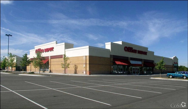
7311 E 29Th Dr
Denver-Aurora-Centennial, CO
Stapleton Flg #9
1283-30-004
STAPLETON FLG #9 B16 PT OF L1 RESUB OF STAPLETON FLG #2 BLK 16 PT OF L1 DAF BEG SW COR L1 N20.4144E 287.5FT E 236.87FT S 268.94FT W 338.47FT TO POB
Storebuilding
Denver
X
Colorado
0800460094H
1
2024
1.78 AC
2024
Central
004112
Denver
14,654 SF
DEMOGRAPHICS near 7311 E 29Th Dr
1 Mile
3 Mile
5 Mile
2024 Total Population
20,450
135,749
425,997
2029 Population
20,618
137,527
433,078
Pop Growth 2024-2029
+ 0.82%
+ 1.31%
+ 1.66%
Average Age
37
37
37
2024 Total Households
8,100
53,730
185,090
HH Growth 2024-2029
+ 0.57%
+ 1.12%
+ 1.66%
Median Household Inc
$112,650
$85,833
$74,771
Avg Household Size
2.40
2.40
2.20
2024 Avg HH Vehicles
2.00
2.00
2.00
Median Home Value
$600,960
$650,453
$544,447
Median Year Built
1999
1964
1974
Nearby Places
Map Layers
Map Styles
 Street
 Aerial
- Restaurants
- Banks
- Shops
- Fitness
- Groceries
PUBLIC TRANSPORTATION
COMMUTER RAIL
DRIVE
WALK
Distance
5 min
1.9 mi
DRIVE
WALK
Distance
5 min
1.9 mi
AIRPORT
Denver International
DRIVE
WALK
Distance
Denver International
25 min
18.9 mi
Nearby Properties
Address
Land Use
TOTAL SIZE
Lot Size
Zoning
Address
Land Use
TOTAL SIZE
Lot Size
Zoning
719,357 SF
21.47 AC
M-MX-5
Address
Land Use
TOTAL SIZE
Lot Size
Zoning
880,442 SF
67.95 AC
I-B
Address
Land Use
TOTAL SIZE
Lot Size
Zoning
579,102 SF
7.47 AC
H-1-A
Address
Land Use
TOTAL SIZE
Lot Size
Zoning
603,377 SF
9.25 AC
H-1-A
Address
Land Use
TOTAL SIZE
Lot Size
Zoning
269,025 SF
18.86 AC
M-RX-5
Address
Land Use
TOTAL SIZE
Lot Size
Zoning
254,509 SF
16.29 AC
E-SU-DX
Address
Land Use
TOTAL SIZE
Lot Size
Zoning
599,680 SF
43.94 AC
Address
Land Use
TOTAL SIZE
Lot Size
Zoning
390,822 SF
13.47 AC
O-1
Address
Land Use
TOTAL SIZE
Lot Size
Zoning
57,392 SF
0.72 AC
Address
Land Use
TOTAL SIZE
Lot Size
Zoning
477,508 SF
79.66 AC
OS-A
Address
Land Use
TOTAL SIZE
Lot Size
Zoning
651,423 SF
82.50 AC
I-2
Address
Land Use
TOTAL SIZE
Lot Size
Zoning
185,206 SF
9.94 AC
C-MX
Address
Land Use
TOTAL SIZE
Lot Size
Zoning
646,975 SF
32.60 AC
M-IMX-8
Address
Land Use
TOTAL SIZE
Lot Size
Zoning
33.01 AC
M-IMX-12
Address
Land Use
TOTAL SIZE
Lot Size
Zoning
98,333 SF
3.59 AC
H-1-A
Address
Land Use
TOTAL SIZE
Lot Size
Zoning
269,622 SF
12.90 AC
Address
Land Use
TOTAL SIZE
Lot Size
Zoning
138,799 SF
16.28 AC
I-A
Address
Land Use
TOTAL SIZE
Lot Size
Zoning
253,099 SF
7.15 AC
E-SU-DX
Address
Land Use
TOTAL SIZE
Lot Size
Zoning
343,997 SF
6.36 AC
S-MX-5
Address
Land Use
TOTAL SIZE
Lot Size
Zoning
723,053 SF
32.44 AC
M-IMX-12
Address
Land Use
TOTAL SIZE
Lot Size
Zoning
268,268 SF
29.99 AC
I-B
Address
Land Use
TOTAL SIZE
Lot Size
Zoning
677,018 SF
5.05 AC
C-MX
Address
Land Use
TOTAL SIZE
Lot Size
Zoning
295,885 SF
6.05 AC
R-MU-30
Address
Land Use
TOTAL SIZE
Lot Size
Zoning
384,124 SF
3.25 AC
S-MX-12
Address
Land Use
TOTAL SIZE
Lot Size
Zoning
51,075 SF
0.72 AC
Address
Land Use
TOTAL SIZE
Lot Size
Zoning
329,903 SF
21.97 AC
Address
Land Use
TOTAL SIZE
Lot Size
Zoning
492,387 SF
50.21 AC
C-MU-30
Address
Land Use
TOTAL SIZE
Lot Size
Zoning
466,055 SF
24.82 AC
M-IMX-5
Address
Land Use
TOTAL SIZE
Lot Size
Zoning
1,048,207 SF
57.91 AC
I-B
Address
Land Use
TOTAL SIZE
Lot Size
Zoning
102,833 SF
14.27 AC
R-MU-20
The World's #1 Commercial Real Estate Marketplace
Connect with us
© 2026 CoStar Group
The information above has been obtained from sources believed reliable. While we do not doubt its accuracy we have not verified it and make no guarantee, warranty or representation about it. It is your responsibility to independently confirm its accuracy and completeness. Any projections, opinions, assumptions, or estimates used are for example only and do not represent the current or future performance of the property. The value of this transaction to you depends on tax and other factors which should be evaluated by your tax, financial, and legal advisors. You and your advisors should conduct a careful, independent investigation of the property to determine to your satisfaction the suitability of the property for your needs.