Property Record
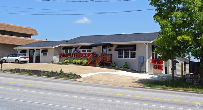
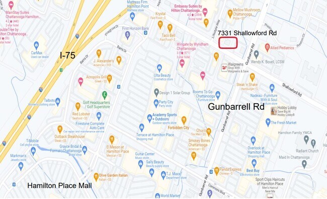
7331 Shallowford Rd, Chattanooga, TN 37421

Save to a Folder
{{folder.Name}}
{{folder.ListingIds.length}} Properties
{{folder.ListingIds.length}} Property
Create a New Folder
Property Detail
7331 Shallowford Rd
149H-G-021
PT LT 12 TIMBERLAND SUB PB20 PG73 3229 07 17
Animalhospitalvet
Hamilton
R4
Tennessee
B and X Area of moderate flood hazard, usually the area between the limits of the 100-year and 500-year floods.
12
2025
0.45 AC
2025
Outlying Chattanooga
011323
Chattanooga
3,815 SF
Chattanooga, TN-GA
NEARBY LISTINGS FOR SALE OR LEASE
DEMOGRAPHICS near 7331 Shallowford Rd
1 mile
3 mile
5 mile
2025 Total Population
7,380
44,824
105,596
2030 Population
7,798
46,920
110,546
Pop Growth 2025-2030
+ 5.66%
+ 4.68%
+ 4.69%
Average Age
42
41
42
2025 Total Households
3,525
18,667
42,819
HH Growth 2025-2030
+ 5.84%
+ 4.90%
+ 4.90%
Median Household Inc
$74,316
$77,148
$76,065
Avg Household Size
2.00
2.30
2.40
2025 Avg HH Vehicles
2.00
2.00
2.00
Median Home Value
$339,743
$325,978
$319,884
Median Year Built
2001
1991
1986
Nearby Places
Map Layers
Map Styles
 Street
 Aerial
Layers
 Traffic
 Biking
Places
Listings with unknown addresses are not visible on the map
- Restaurants
- Banks
- Shops
- Fitness
- Groceries
PUBLIC TRANSPORTATION
AIRPORT
Lovell Field
Drive
Walk
Distance
Lovell Field
12 min
5.3 mi
Nearby Properties
Address
Land Use
TOTAL SIZE
Lot Size
Zoning
Address
Land Use
TOTAL SIZE
Lot Size
Zoning
831.19 AC
M1
Address
Land Use
TOTAL SIZE
Lot Size
Zoning
0.06 AC
M1
Address
Land Use
TOTAL SIZE
Lot Size
Zoning
523,520 SF
12.03 AC
M1
Address
Land Use
TOTAL SIZE
Lot Size
Zoning
440,611 SF
27.46 AC
C2
Address
Land Use
TOTAL SIZE
Lot Size
Zoning
292,309 SF
45.28 AC
M1
Address
Land Use
TOTAL SIZE
Lot Size
Zoning
1,015,740 SF
83.82 AC
M1
Address
Land Use
TOTAL SIZE
Lot Size
Zoning
117,007 SF
23.87 AC
R4
Address
Land Use
TOTAL SIZE
Lot Size
Zoning
242,788 SF
27 AC
Address
Land Use
TOTAL SIZE
Lot Size
Zoning
4,418 SF
18.01 AC
R3
Address
Land Use
TOTAL SIZE
Lot Size
Zoning
320,068 SF
42.83 AC
R4
Address
Land Use
TOTAL SIZE
Lot Size
Zoning
402,862 SF
26.14 AC
R1
Address
Land Use
TOTAL SIZE
Lot Size
Zoning
43,488 SF
27.72 AC
R3
Address
Land Use
TOTAL SIZE
Lot Size
Zoning
25,436 SF
21.34 AC
R3
Address
Land Use
TOTAL SIZE
Lot Size
Zoning
23,078 SF
14.41 AC
R4
Address
Land Use
TOTAL SIZE
Lot Size
Zoning
333,768 SF
15.38 AC
C4
Address
Land Use
TOTAL SIZE
Lot Size
Zoning
43,576 SF
6.66 AC
C2
Address
Land Use
TOTAL SIZE
Lot Size
Zoning
25,462 SF
16.20 AC
R1
Address
Land Use
TOTAL SIZE
Lot Size
Zoning
3,472 SF
14.01 AC
Address
Land Use
TOTAL SIZE
Lot Size
Zoning
20,964 SF
17.72 AC
R1
Address
Land Use
TOTAL SIZE
Lot Size
Zoning
97,000 SF
18.78 AC
Address
Land Use
TOTAL SIZE
Lot Size
Zoning
23,124 SF
27.23 AC
A
Address
Land Use
TOTAL SIZE
Lot Size
Zoning
25,165 SF
21.90 AC
Address
Land Use
TOTAL SIZE
Lot Size
Zoning
102,382 SF
29.80 AC
M2
Address
Land Use
TOTAL SIZE
Lot Size
Zoning
99,202 SF
17.32 AC
Address
Land Use
TOTAL SIZE
Lot Size
Zoning
129,710 SF
4.55 AC
R1
Address
Land Use
TOTAL SIZE
Lot Size
Zoning
291,314 SF
29.69 AC
M1
Address
Land Use
TOTAL SIZE
Lot Size
Zoning
82,000 SF
22.45 AC
M1
Address
Land Use
TOTAL SIZE
Lot Size
Zoning
201,276 SF
15.30 AC
R3
Address
Land Use
TOTAL SIZE
Lot Size
Zoning
15,808 SF
19.50 AC
R2
Address
Land Use
TOTAL SIZE
Lot Size
Zoning
49,857 SF
1.93 AC
R1
The World's #1 Commercial Real Estate Marketplace
Connect with us
© 2026 CoStar Group
The information above has been obtained from sources believed reliable. While we do not doubt its accuracy we have not verified it and make no guarantee, warranty or representation about it. It is your responsibility to independently confirm its accuracy and completeness. Any projections, opinions, assumptions, or estimates used are for example only and do not represent the current or future performance of the property. The value of this transaction to you depends on tax and other factors which should be evaluated by your tax, financial, and legal advisors. You and your advisors should conduct a careful, independent investigation of the property to determine to your satisfaction the suitability of the property for your needs.