Property Record
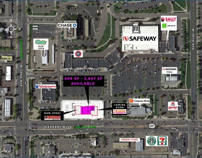
7353 Federal Blvd, Westminster, CO 80030


Property Detail
7353 Federal Blvd
Denver-Aurora-Centennial, CO
SUB:WESTMINSTER PLAZA LOT:10
1719-32-3-17-012
ADAMS
Storebuilding
Colorado
2024
10
2025
5.81 AC
009604
Northwest
57,416 SF
Denver
NEARBY LISTINGS FOR SALE OR LEASE
DEMOGRAPHICS near 7353 Federal Blvd
1 mile
3 mile
5 mile
2025 Total Population
21,024
137,192
356,364
2030 Population
21,848
140,856
364,428
Pop Growth 2025-2030
+ 3.92%
+ 2.67%
+ 2.26%
Average Age
37
38
38
2025 Total Households
7,744
50,153
141,706
HH Growth 2025-2030
+ 4.24%
+ 2.80%
+ 2.31%
Median Household Inc
$75,911
$80,016
$93,651
Avg Household Size
2.60
2.60
2.40
2025 Avg HH Vehicles
2.00
2.00
2.00
Median Home Value
$468,624
$466,411
$532,260
Median Year Built
1962
1974
1976
Nearby Places
Map Layers
Map Styles
 Street
 Aerial
Layers
 Traffic
 Biking
Places
Listings with unknown addresses are not visible on the map
- Restaurants
- Banks
- Shops
- Fitness
- Groceries
PUBLIC TRANSPORTATION
COMMUTER RAIL
Westminster Station N-Bound (Union Station to Westminster Station - Regional Transportation District)
Drive
Walk
Distance
Westminster Station N-Bound (Union Station to Westminster Station - Regional Transportation District)
4 min
11 min
0.6 mi
Westminster Station S-Bound (Union Station to Westminster Station - Regional Transportation District)
Drive
Walk
Distance
Westminster Station S-Bound (Union Station to Westminster Station - Regional Transportation District)
2 min
12 min
0.6 mi
AIRPORT
Denver International
Drive
Walk
Distance
Denver International
34 min
25.9 mi
Freight Ports
Tulsa Port Of Catoosa
Drive
Walk
Distance
Tulsa Port Of Catoosa
731 min
711.4 mi
SALE & LEASE HISTORY
LISTING DATE
SALE/LEASE

Apr 03, 2017
For Lease
Nearby Properties
Address
Land Use
TOTAL SIZE
Lot Size
Zoning
Address
Land Use
TOTAL SIZE
Lot Size
Zoning
21,306 SF
2.43 AC
Address
Land Use
TOTAL SIZE
Lot Size
Zoning
559,786 SF
26.52 AC
Address
Land Use
TOTAL SIZE
Lot Size
Zoning
271,631 SF
12.84 AC
Address
Land Use
TOTAL SIZE
Lot Size
Zoning
860,132 SF
68.50 AC
R-5
Address
Land Use
TOTAL SIZE
Lot Size
Zoning
208,500 SF
8.42 AC
Address
Land Use
TOTAL SIZE
Lot Size
Zoning
176,583 SF
Address
Land Use
TOTAL SIZE
Lot Size
Zoning
138,770 SF
4.64 AC
Address
Land Use
TOTAL SIZE
Lot Size
Zoning
117,774 SF
8.60 AC
Address
Land Use
TOTAL SIZE
Lot Size
Zoning
140,430 SF
8.39 AC
Address
Land Use
TOTAL SIZE
Lot Size
Zoning
138,912 SF
8.71 AC
Address
Land Use
TOTAL SIZE
Lot Size
Zoning
81,065 SF
4.51 AC
Address
Land Use
TOTAL SIZE
Lot Size
Zoning
113,385 SF
6.77 AC
Address
Land Use
TOTAL SIZE
Lot Size
Zoning
398,180 SF
33.31 AC
R1C
Address
Land Use
TOTAL SIZE
Lot Size
Zoning
58,750 SF
1.52 AC
Address
Land Use
TOTAL SIZE
Lot Size
Zoning
86,816 SF
4.95 AC
Address
Land Use
TOTAL SIZE
Lot Size
Zoning
79,636 SF
4.91 AC
Address
Land Use
TOTAL SIZE
Lot Size
Zoning
305,110 SF
16.87 AC
Address
Land Use
TOTAL SIZE
Lot Size
Zoning
52,194 SF
5.33 AC
Address
Land Use
TOTAL SIZE
Lot Size
Zoning
470,539 SF
23.59 AC
Address
Land Use
TOTAL SIZE
Lot Size
Zoning
110,878 SF
4.65 AC
Address
Land Use
TOTAL SIZE
Lot Size
Zoning
105,600 SF
1.31 AC
Address
Land Use
TOTAL SIZE
Lot Size
Zoning
419,745 SF
24.75 AC
Address
Land Use
TOTAL SIZE
Lot Size
Zoning
390,764 SF
20.19 AC
Address
Land Use
TOTAL SIZE
Lot Size
Zoning
65,336 SF
2.86 AC
Address
Land Use
TOTAL SIZE
Lot Size
Zoning
64,106 SF
4.10 AC
Address
Land Use
TOTAL SIZE
Lot Size
Zoning
74,432 SF
4.47 AC
Address
Land Use
TOTAL SIZE
Lot Size
Zoning
283,572 SF
17.76 AC
Address
Land Use
TOTAL SIZE
Lot Size
Zoning
147,009 SF
36.94 AC
I3
Address
Land Use
TOTAL SIZE
Lot Size
Zoning
69,537 SF
4.49 AC
Address
Land Use
TOTAL SIZE
Lot Size
Zoning
75,062 SF
5.28 AC
A1
The World's #1 Commercial Real Estate Marketplace
Connect with us
© 2026 CoStar Group
The information above has been obtained from sources believed reliable. While we do not doubt its accuracy we have not verified it and make no guarantee, warranty or representation about it. It is your responsibility to independently confirm its accuracy and completeness. Any projections, opinions, assumptions, or estimates used are for example only and do not represent the current or future performance of the property. The value of this transaction to you depends on tax and other factors which should be evaluated by your tax, financial, and legal advisors. You and your advisors should conduct a careful, independent investigation of the property to determine to your satisfaction the suitability of the property for your needs.