Property Record
7355 W Vickery Blvd, Benbrook, TX 76116
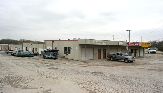

Property Detail
7355 W Vickery Blvd
04721829
ROGERS, JAMES SURVEY ABSTRACT 1265 TRACT 1C02
Commercialnec
TARRANT
B and X Area of moderate flood hazard, usually the area between the limits of the 100-year and 500-year floods.
Texas
2025
0.85 AC
2025
Southwest Tarrant
110905
Dallas/Ft Worth
16,000 SF
Dallas-Fort Worth-Arlington, TX
NEARBY LISTINGS FOR SALE OR LEASE
DEMOGRAPHICS near 7355 W Vickery Blvd
1 mile
3 mile
5 mile
2025 Total Population
9,336
86,792
217,901
2030 Population
9,787
91,695
231,063
Pop Growth 2025-2030
+ 4.83%
+ 5.65%
+ 6.04%
Average Age
40
39
39
2025 Total Households
3,792
39,254
91,412
HH Growth 2025-2030
+ 4.98%
+ 5.86%
+ 6.23%
Median Household Inc
$74,413
$65,322
$72,434
Avg Household Size
2.40
2.20
2.30
2025 Avg HH Vehicles
2.00
2.00
2.00
Median Home Value
$361,945
$356,173
$351,497
Median Year Built
1965
1983
1982
Nearby Places
Map Layers
Map Styles
 Street
 Aerial
Layers
 Traffic
 Biking
Places
Listings with unknown addresses are not visible on the map
- Restaurants
- Banks
- Shops
- Fitness
- Groceries
PUBLIC TRANSPORTATION
COMMUTER RAIL
Texas And Pacific (T&P) (Trinity Railway Express - Dallas Area Rapid Transit (DART))
Drive
Walk
Distance
Texas And Pacific (T&P) (Trinity Railway Express - Dallas Area Rapid Transit (DART))
16 min
8.1 mi
Fort Worth (Heartland Flyer - Amtrak, Texas Eagle - Amtrak)
Drive
Walk
Distance
Fort Worth (Heartland Flyer - Amtrak, Texas Eagle - Amtrak)
17 min
8.5 mi
AIRPORT
Dallas-Fort Worth International
Drive
Walk
Distance
Dallas-Fort Worth International
47 min
32.9 mi
Freight Ports
Port of Shreveport
Drive
Walk
Distance
Port of Shreveport
252 min
235.0 mi
Nearby Properties
Address
Land Use
TOTAL SIZE
Lot Size
Zoning
Address
Land Use
TOTAL SIZE
Lot Size
Zoning
505,069 SF
6.49 AC
Address
Land Use
TOTAL SIZE
Lot Size
Zoning
438,943 SF
3.77 AC
Address
Land Use
TOTAL SIZE
Lot Size
Zoning
477,907 SF
11.83 AC
Address
Land Use
TOTAL SIZE
Lot Size
Zoning
346,920 SF
9.88 AC
Address
Land Use
TOTAL SIZE
Lot Size
Zoning
323,685 SF
19.61 AC
Address
Land Use
TOTAL SIZE
Lot Size
Zoning
492,130 SF
6.55 AC
Address
Land Use
TOTAL SIZE
Lot Size
Zoning
373,138 SF
15 AC
Address
Land Use
TOTAL SIZE
Lot Size
Zoning
364,647 SF
17.90 AC
Address
Land Use
TOTAL SIZE
Lot Size
Zoning
344,054 SF
21.30 AC
Address
Land Use
TOTAL SIZE
Lot Size
Zoning
355,125 SF
21.29 AC
Address
Land Use
TOTAL SIZE
Lot Size
Zoning
388,957 SF
20 AC
Address
Land Use
TOTAL SIZE
Lot Size
Zoning
350,654 SF
21.29 AC
Address
Land Use
TOTAL SIZE
Lot Size
Zoning
296,664 SF
14.71 AC
Address
Land Use
TOTAL SIZE
Lot Size
Zoning
347,423 SF
7.32 AC
Address
Land Use
TOTAL SIZE
Lot Size
Zoning
100,000 SF
1.60 AC
Address
Land Use
TOTAL SIZE
Lot Size
Zoning
242,244 SF
27.01 AC
Address
Land Use
TOTAL SIZE
Lot Size
Zoning
310,935 SF
14.74 AC
Address
Land Use
TOTAL SIZE
Lot Size
Zoning
312,709 SF
16.26 AC
Address
Land Use
TOTAL SIZE
Lot Size
Zoning
244,918 SF
15.52 AC
Address
Land Use
TOTAL SIZE
Lot Size
Zoning
292,450 SF
8.17 AC
Address
Land Use
TOTAL SIZE
Lot Size
Zoning
297,813 SF
13.81 AC
Address
Land Use
TOTAL SIZE
Lot Size
Zoning
267,098 SF
14.06 AC
Address
Land Use
TOTAL SIZE
Lot Size
Zoning
166,474 SF
12.60 AC
Address
Land Use
TOTAL SIZE
Lot Size
Zoning
209,329 SF
90.74 AC
Address
Land Use
TOTAL SIZE
Lot Size
Zoning
300,006 SF
15 AC
Address
Land Use
TOTAL SIZE
Lot Size
Zoning
146,395 SF
13.11 AC
Address
Land Use
TOTAL SIZE
Lot Size
Zoning
372,523 SF
3.46 AC
Address
Land Use
TOTAL SIZE
Lot Size
Zoning
271,065 SF
9.03 AC
Address
Land Use
TOTAL SIZE
Lot Size
Zoning
301,571 SF
14.03 AC
Address
Land Use
TOTAL SIZE
Lot Size
Zoning
252,703 SF
14.35 AC
The World's #1 Commercial Real Estate Marketplace
Connect with us
© 2026 CoStar Group
The information above has been obtained from sources believed reliable. While we do not doubt its accuracy we have not verified it and make no guarantee, warranty or representation about it. It is your responsibility to independently confirm its accuracy and completeness. Any projections, opinions, assumptions, or estimates used are for example only and do not represent the current or future performance of the property. The value of this transaction to you depends on tax and other factors which should be evaluated by your tax, financial, and legal advisors. You and your advisors should conduct a careful, independent investigation of the property to determine to your satisfaction the suitability of the property for your needs.